Property Record
Sandalwood Dr, Mobile, AL 36618
Property Detail
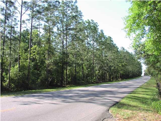
Sandalwood Dr
Mobile, AL
LOT 1 THE LOCALE PHASE TWO INSTRUMENT NUMBER 2022028307
28-01-02-2-000-053
MOBILE
Vacantlandnec
Alabama
B and X Area of moderate flood hazard, usually the area between the limits of the 100-year and 500-year floods.
1
2025
40.24 AC
2025
West Mobile
003408
Mobile
NEARBY LISTINGS FOR SALE OR LEASE
DEMOGRAPHICS near Sandalwood Dr
1 mile
3 mile
5 mile
2024 Total Population
2,249
31,723
111,353
2029 Population
2,203
31,338
111,185
Pop Growth 2024-2029
(2.05%)
(1.21%)
(0.15%)
Average Age
39
40
39
2024 Total Households
829
11,971
44,341
HH Growth 2024-2029
(2.17%)
(1.27%)
(0.23%)
Median Household Inc
$49,473
$52,636
$47,867
Avg Household Size
2.60
2.50
2.30
2024 Avg HH Vehicles
2.00
2.00
2.00
Median Home Value
$157,994
$163,810
$155,237
Median Year Built
1973
1974
1974
Nearby Places
Map Layers
Map Styles
 Street
 Aerial
Transit
 Traffic
 Biking
Places
Listings with unknown addresses are not visible on the map
- Restaurants
- Banks
- Shops
- Fitness
- Groceries
PUBLIC TRANSPORTATION
AIRPORT
Mobile Regional
Drive
Walk
Distance
Mobile Regional
22 min
8.7 mi
Mobile International
Drive
Walk
Distance
Mobile International
20 min
12.7 mi
Freight Ports
Port of Mobile
Drive
Walk
Distance
Port of Mobile
18 min
12.2 mi
Nearby Properties
Address
Land Use
TOTAL SIZE
Lot Size
Zoning
Address
Land Use
TOTAL SIZE
Lot Size
Zoning
170,500 SF
154.49 AC
Address
Land Use
TOTAL SIZE
Lot Size
Zoning
216,528 SF
159 AC
Address
Land Use
TOTAL SIZE
Lot Size
Zoning
148,656 SF
112.97 AC
Address
Land Use
TOTAL SIZE
Lot Size
Zoning
15,960 SF
11.06 AC
Address
Land Use
TOTAL SIZE
Lot Size
Zoning
30,395 SF
44.92 AC
Address
Land Use
TOTAL SIZE
Lot Size
Zoning
7,986 SF
156.65 AC
Address
Land Use
TOTAL SIZE
Lot Size
Zoning
24,400 SF
160 AC
Address
Land Use
TOTAL SIZE
Lot Size
Zoning
12,800 SF
160.22 AC
Address
Land Use
TOTAL SIZE
Lot Size
Zoning
96,114 SF
54.26 AC
Address
Land Use
TOTAL SIZE
Lot Size
Zoning
14,623 SF
19 AC
Address
Land Use
TOTAL SIZE
Lot Size
Zoning
37,209 SF
8.75 AC
Address
Land Use
TOTAL SIZE
Lot Size
Zoning
73,500 SF
Address
Land Use
TOTAL SIZE
Lot Size
Zoning
50,887 SF
10.10 AC
Address
Land Use
TOTAL SIZE
Lot Size
Zoning
53,850 SF
12 AC
Address
Land Use
TOTAL SIZE
Lot Size
Zoning
3,200 SF
119 AC
Address
Land Use
TOTAL SIZE
Lot Size
Zoning
87,716 SF
5.02 AC
Address
Land Use
TOTAL SIZE
Lot Size
Zoning
54,156 SF
5.15 AC
Address
Land Use
TOTAL SIZE
Lot Size
Zoning
5,703 SF
141.31 AC
Address
Land Use
TOTAL SIZE
Lot Size
Zoning
53,611 SF
8.77 AC
Address
Land Use
TOTAL SIZE
Lot Size
Zoning
94,787 SF
18 AC
Address
Land Use
TOTAL SIZE
Lot Size
Zoning
69,338 SF
8.23 AC
Address
Land Use
TOTAL SIZE
Lot Size
Zoning
13,690 SF
6.39 AC
Address
Land Use
TOTAL SIZE
Lot Size
Zoning
1,976 SF
77 AC
Address
Land Use
TOTAL SIZE
Lot Size
Zoning
141,514 SF
19 AC
Address
Land Use
TOTAL SIZE
Lot Size
Zoning
41,928 SF
29.40 AC
Address
Land Use
TOTAL SIZE
Lot Size
Zoning
89,556 SF
18 AC
Address
Land Use
TOTAL SIZE
Lot Size
Zoning
85,486 SF
6.18 AC
Address
Land Use
TOTAL SIZE
Lot Size
Zoning
35,110 SF
Address
Land Use
TOTAL SIZE
Lot Size
Zoning
12,848 SF
8.20 AC
Address
Land Use
TOTAL SIZE
Lot Size
Zoning
58,828 SF
15.08 AC
The World's #1 Commercial Real Estate Marketplace
Connect with us
© 2026 CoStar Group
The information above has been obtained from sources believed reliable. While we do not doubt its accuracy we have not verified it and make no guarantee, warranty or representation about it. It is your responsibility to independently confirm its accuracy and completeness. Any projections, opinions, assumptions, or estimates used are for example only and do not represent the current or future performance of the property. The value of this transaction to you depends on tax and other factors which should be evaluated by your tax, financial, and legal advisors. You and your advisors should conduct a careful, independent investigation of the property to determine to your satisfaction the suitability of the property for your needs.