Property Record
Sanderson St, Throop, PA 18512
NEARBY LISTINGS FOR SALE OR LEASE
-
-
View all Throop listings for sale on LoopNet.com
Property Detail
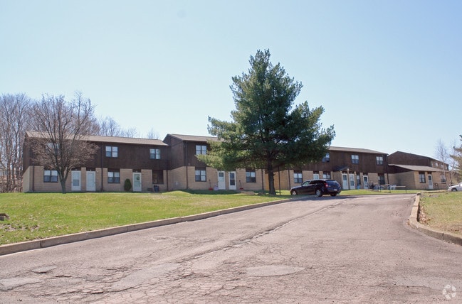
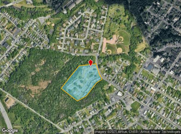
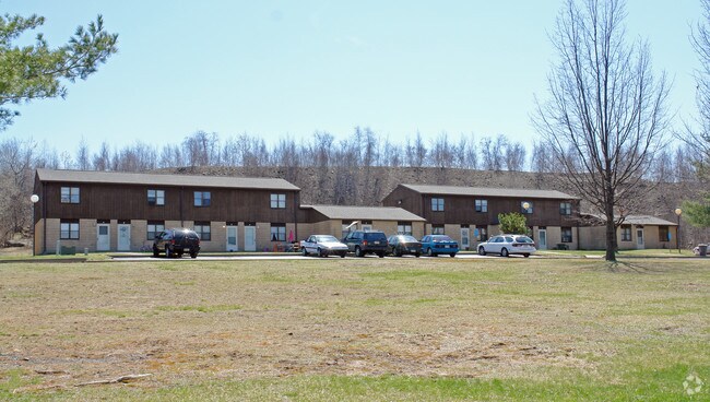
Sanderson St
1242001000101
7.7A BLDG & LAND
Municipalproperty
Lackawanna
X
Pennsylvania
42069C0228D
7.70 AC
2025
Throop
2025
Philadelphia
112000
Scranton--Wilkes-Barre--Hazelton, PA
DEMOGRAPHICS near Sanderson St
1 Mile
3 Mile
5 Mile
2024 Total Population
6,319
57,625
123,725
2029 Population
6,210
56,953
122,544
Pop Growth 2024-2029
(1.72%)
(1.17%)
(0.95%)
Average Age
43
42
41
2024 Total Households
2,737
23,978
50,608
HH Growth 2024-2029
(1.79%)
(1.25%)
(0.99%)
Median Household Inc
$54,026
$57,062
$56,344
Avg Household Size
2.20
2.20
2.20
2024 Avg HH Vehicles
2.00
2.00
2.00
Median Home Value
$162,353
$153,831
$155,843
Median Year Built
1948
1948
1948
Nearby Places
Map Layers
Map Styles
 Street
 Aerial
- Restaurants
- Banks
- Shops
- Fitness
- Groceries
PUBLIC TRANSPORTATION
AIRPORT
Wilkes-Barre/Scranton International
DRIVE
WALK
Distance
Wilkes-Barre/Scranton International
21 min
13.1 mi
Nearby Properties
Address
Land Use
TOTAL SIZE
Lot Size
Zoning
Address
Land Use
TOTAL SIZE
Lot Size
Zoning
2.62 AC
Address
Land Use
TOTAL SIZE
Lot Size
Zoning
43.66 AC
Address
Land Use
TOTAL SIZE
Lot Size
Zoning
112.27 AC
Address
Land Use
TOTAL SIZE
Lot Size
Zoning
3.86 AC
Address
Land Use
TOTAL SIZE
Lot Size
Zoning
7.81 AC
Address
Land Use
TOTAL SIZE
Lot Size
Zoning
Address
Land Use
TOTAL SIZE
Lot Size
Zoning
43.52 AC
Address
Land Use
TOTAL SIZE
Lot Size
Zoning
25.62 AC
Address
Land Use
TOTAL SIZE
Lot Size
Zoning
2.65 AC
Address
Land Use
TOTAL SIZE
Lot Size
Zoning
Address
Land Use
TOTAL SIZE
Lot Size
Zoning
97.16 AC
Address
Land Use
TOTAL SIZE
Lot Size
Zoning
5.35 AC
Address
Land Use
TOTAL SIZE
Lot Size
Zoning
3.86 AC
Address
Land Use
TOTAL SIZE
Lot Size
Zoning
Address
Land Use
TOTAL SIZE
Lot Size
Zoning
Address
Land Use
TOTAL SIZE
Lot Size
Zoning
43.89 AC
Address
Land Use
TOTAL SIZE
Lot Size
Zoning
28.89 AC
Address
Land Use
TOTAL SIZE
Lot Size
Zoning
3.12 AC
Address
Land Use
TOTAL SIZE
Lot Size
Zoning
Address
Land Use
TOTAL SIZE
Lot Size
Zoning
38.12 AC
Address
Land Use
TOTAL SIZE
Lot Size
Zoning
5.65 AC
Address
Land Use
TOTAL SIZE
Lot Size
Zoning
3.73 AC
Address
Land Use
TOTAL SIZE
Lot Size
Zoning
14.20 AC
Address
Land Use
TOTAL SIZE
Lot Size
Zoning
Address
Land Use
TOTAL SIZE
Lot Size
Zoning
43.10 AC
Address
Land Use
TOTAL SIZE
Lot Size
Zoning
1.87 AC
Address
Land Use
TOTAL SIZE
Lot Size
Zoning
7.04 AC
Address
Land Use
TOTAL SIZE
Lot Size
Zoning
21.11 AC
Address
Land Use
TOTAL SIZE
Lot Size
Zoning
11.14 AC
Address
Land Use
TOTAL SIZE
Lot Size
Zoning
12.30 AC
The World's #1 Commercial Real Estate Marketplace
Connect with us
© 2026 CoStar Group
The information above has been obtained from sources believed reliable. While we do not doubt its accuracy we have not verified it and make no guarantee, warranty or representation about it. It is your responsibility to independently confirm its accuracy and completeness. Any projections, opinions, assumptions, or estimates used are for example only and do not represent the current or future performance of the property. The value of this transaction to you depends on tax and other factors which should be evaluated by your tax, financial, and legal advisors. You and your advisors should conduct a careful, independent investigation of the property to determine to your satisfaction the suitability of the property for your needs.