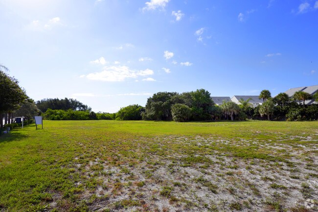
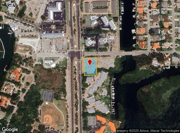
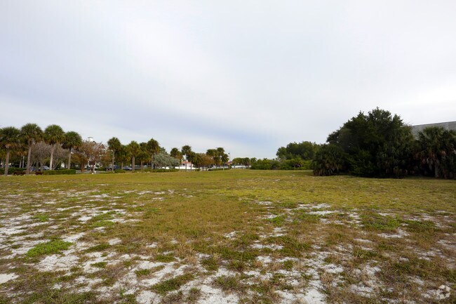
Property Record
Sands Point Dr, Tierra Verde, FL 33715

NEARBY LISTINGS FOR SALE OR LEASE
Property Detail
Sands Point Dr
Tampa-St. Petersburg-Clearwater, FL
Tierra Verde Unit 1
17-32-16-90828-031-0010
TIERRA VERDE UNIT 1 BLK 31, LOT 1 SEE MAP 29-32-16
Commercialacreage
Pinellas
AE
Florida
12103C0286H
1
2024
0.69 AC
2025
South Pinellas
020108
Tampa/St Petersburg
DEMOGRAPHICS near Sands Point Dr
1 Mile
3 Mile
5 Mile
2024 Total Population
3,327
12,238
43,341
2029 Population
3,444
12,919
44,874
Pop Growth 2024-2029
+ 3.52%
+ 5.56%
+ 3.54%
Average Age
58
60
53
2024 Total Households
1,652
6,594
22,016
HH Growth 2024-2029
+ 3.39%
+ 5.73%
+ 3.76%
Median Household Inc
$120,896
$94,840
$80,553
Avg Household Size
2.00
1.80
1.90
2024 Avg HH Vehicles
2.00
2.00
2.00
Median Home Value
$694,903
$470,023
$437,702
Median Year Built
1990
1983
1977
Nearby Places
- Restaurants
- Banks
- Shops
- Fitness
- Groceries
PUBLIC TRANSPORTATION
AIRPORT
St Pete-Clearwater International
DRIVE
WALK
Distance
St Pete-Clearwater International
30 min
20.8 mi
Tampa International
DRIVE
WALK
Distance
Tampa International
42 min
30.1 mi
Sarasota/Bradenton International
DRIVE
WALK
Distance
Sarasota/Bradenton International
50 min
32.7 mi
Freight Ports
Port Manatee
DRIVE
WALK
Distance
Port Manatee
36 min
25.0 mi
SALE & LEASE HISTORY
LISTING DATE
SALE/LEASE

Jul 26, 2017
For Sale
Jul 13, 2017
For Sale
Jan 18, 2019
For Sale
Nearby Properties
Address
Land Use
TOTAL SIZE
Lot Size
Zoning
Address
Land Use
TOTAL SIZE
Lot Size
Zoning
266,341 SF
4.31 AC
Address
Land Use
TOTAL SIZE
Lot Size
Zoning
18,065 SF
1,068.36 AC
UZ
Address
Land Use
TOTAL SIZE
Lot Size
Zoning
98,417 SF
1.26 AC
Address
Land Use
TOTAL SIZE
Lot Size
Zoning
102,940 SF
0.54 AC
Address
Land Use
TOTAL SIZE
Lot Size
Zoning
3,165 SF
2.63 AC
Address
Land Use
TOTAL SIZE
Lot Size
Zoning
85,798 SF
1.38 AC
Address
Land Use
TOTAL SIZE
Lot Size
Zoning
33,587 SF
1.84 AC
Address
Land Use
TOTAL SIZE
Lot Size
Zoning
87,647 SF
2.02 AC
Address
Land Use
TOTAL SIZE
Lot Size
Zoning
2.54 AC
Address
Land Use
TOTAL SIZE
Lot Size
Zoning
50,765 SF
1.03 AC
Address
Land Use
TOTAL SIZE
Lot Size
Zoning
5,112 SF
45.93 AC
AE
Address
Land Use
TOTAL SIZE
Lot Size
Zoning
7,727 SF
1.27 AC
Address
Land Use
TOTAL SIZE
Lot Size
Zoning
429 SF
1.20 AC
Address
Land Use
TOTAL SIZE
Lot Size
Zoning
65,008 SF
3.78 AC
Address
Land Use
TOTAL SIZE
Lot Size
Zoning
8,404 SF
0.30 AC
Address
Land Use
TOTAL SIZE
Lot Size
Zoning
1.59 AC
Address
Land Use
TOTAL SIZE
Lot Size
Zoning
27,270 SF
0.57 AC
Address
Land Use
TOTAL SIZE
Lot Size
Zoning
7,123 SF
0.56 AC
Address
Land Use
TOTAL SIZE
Lot Size
Zoning
13,304 SF
0.91 AC
Address
Land Use
TOTAL SIZE
Lot Size
Zoning
6,934 SF
0.52 AC
Address
Land Use
TOTAL SIZE
Lot Size
Zoning
57,500 SF
2.82 AC
R1
Address
Land Use
TOTAL SIZE
Lot Size
Zoning
10,072 SF
0.38 AC
Address
Land Use
TOTAL SIZE
Lot Size
Zoning
28,727 SF
4.26 AC
C2
Address
Land Use
TOTAL SIZE
Lot Size
Zoning
5,106 SF
0.27 AC
Address
Land Use
TOTAL SIZE
Lot Size
Zoning
1,600 SF
0.57 AC
Address
Land Use
TOTAL SIZE
Lot Size
Zoning
6,727 SF
0.15 AC
Address
Land Use
TOTAL SIZE
Lot Size
Zoning
11,815 SF
0.24 AC
Address
Land Use
TOTAL SIZE
Lot Size
Zoning
23,403 SF
3.49 AC
P1
Address
Land Use
TOTAL SIZE
Lot Size
Zoning
1,681 SF
0.34 AC
Address
Land Use
TOTAL SIZE
Lot Size
Zoning
3,290 SF
0.13 AC
The World's #1 Commercial Real Estate Marketplace
Connect with us
© 2025 CoStar Group
The information above has been obtained from sources believed reliable. While we do not doubt its accuracy we have not verified it and make no guarantee, warranty or representation about it. It is your responsibility to independently confirm its accuracy and completeness. Any projections, opinions, assumptions, or estimates used are for example only and do not represent the current or future performance of the property. The value of this transaction to you depends on tax and other factors which should be evaluated by your tax, financial, and legal advisors. You and your advisors should conduct a careful, independent investigation of the property to determine to your satisfaction the suitability of the property for your needs.