Property Record
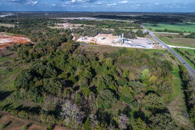
Sandy Point Rd, , TX


Property Detail
Sandy Point Rd
College Station-Bryan, TX
H Jones (Ocl)
15336
A014500, H JONES (OCL), TRACT 1.1, 10.14 ACRES
Agriculturalland
Brazos
X
Texas
48041C0195E
1.1
2024
10.14 AC
2025
Bryan & College Station
000000
Other Market Areas
NEARBY LISTINGS FOR SALE OR LEASE
DEMOGRAPHICS near Sandy Point Rd
1 mile
3 mile
5 mile
2024 Total Population
1,503
22,854
66,299
2029 Population
1,750
24,980
72,588
Pop Growth 2024-2029
+ 16.43%
+ 9.30%
+ 9.49%
Average Age
38
35
35
2024 Total Households
479
6,705
23,231
HH Growth 2024-2029
+ 17.12%
+ 9.89%
+ 10.09%
Median Household Inc
$58,548
$44,449
$45,477
Avg Household Size
2.80
3.00
2.60
2024 Avg HH Vehicles
2.00
2.00
2.00
Median Home Value
$252,173
$126,398
$155,269
Median Year Built
2010
1985
1987
Nearby Places
Map Layers
Map Styles
 Street
 Aerial
Transit
 Traffic
 Biking
Places
Listings with unknown addresses are not visible on the map
- Restaurants
- Banks
- Shops
- Fitness
- Groceries
PUBLIC TRANSPORTATION
AIRPORT
Easterwood Field
Drive
Walk
Distance
Easterwood Field
19 min
10.4 mi
Freight Ports
Port of Houston
Drive
Walk
Distance
Port of Houston
131 min
107.0 mi
SALE & LEASE HISTORY
LISTING DATE
SALE/LEASE

Sep 09, 2019
For Sale
Nearby Properties
Address
Land Use
TOTAL SIZE
Lot Size
Zoning
Address
Land Use
TOTAL SIZE
Lot Size
Zoning
187,336 SF
10.54 AC
Address
Land Use
TOTAL SIZE
Lot Size
Zoning
349.63 AC
Address
Land Use
TOTAL SIZE
Lot Size
Zoning
227,891 SF
350 AC
Address
Land Use
TOTAL SIZE
Lot Size
Zoning
30.36 AC
Address
Land Use
TOTAL SIZE
Lot Size
Zoning
80,776 SF
96.26 AC
Address
Land Use
TOTAL SIZE
Lot Size
Zoning
3,010 SF
65.44 AC
Address
Land Use
TOTAL SIZE
Lot Size
Zoning
196,836 SF
18.84 AC
Address
Land Use
TOTAL SIZE
Lot Size
Zoning
3,072 SF
50.38 AC
Address
Land Use
TOTAL SIZE
Lot Size
Zoning
15.99 AC
Address
Land Use
TOTAL SIZE
Lot Size
Zoning
22.25 AC
Address
Land Use
TOTAL SIZE
Lot Size
Zoning
64,130 SF
7.08 AC
Address
Land Use
TOTAL SIZE
Lot Size
Zoning
64,095 SF
11.62 AC
Address
Land Use
TOTAL SIZE
Lot Size
Zoning
15,342 SF
7.87 AC
Address
Land Use
TOTAL SIZE
Lot Size
Zoning
36,878 SF
48.13 AC
Address
Land Use
TOTAL SIZE
Lot Size
Zoning
236,200 SF
12.96 AC
Address
Land Use
TOTAL SIZE
Lot Size
Zoning
49,488 SF
30.01 AC
Address
Land Use
TOTAL SIZE
Lot Size
Zoning
112,200 SF
19.74 AC
Address
Land Use
TOTAL SIZE
Lot Size
Zoning
20.18 AC
Address
Land Use
TOTAL SIZE
Lot Size
Zoning
65,615 SF
22.05 AC
Address
Land Use
TOTAL SIZE
Lot Size
Zoning
9.98 AC
Address
Land Use
TOTAL SIZE
Lot Size
Zoning
114,400 SF
10.53 AC
Address
Land Use
TOTAL SIZE
Lot Size
Zoning
208,272 SF
76.76 AC
Address
Land Use
TOTAL SIZE
Lot Size
Zoning
174,861 SF
25.09 AC
Address
Land Use
TOTAL SIZE
Lot Size
Zoning
54,624 SF
16.29 AC
Address
Land Use
TOTAL SIZE
Lot Size
Zoning
79,200 SF
5.19 AC
Address
Land Use
TOTAL SIZE
Lot Size
Zoning
78,536 SF
5.76 AC
Address
Land Use
TOTAL SIZE
Lot Size
Zoning
55,815 SF
5 AC
Address
Land Use
TOTAL SIZE
Lot Size
Zoning
48,744 SF
9.03 AC
Address
Land Use
TOTAL SIZE
Lot Size
Zoning
24,918 SF
6.50 AC
Address
Land Use
TOTAL SIZE
Lot Size
Zoning
33,909 SF
1.54 AC
The World's #1 Commercial Real Estate Marketplace
Connect with us
© 2026 CoStar Group
The information above has been obtained from sources believed reliable. While we do not doubt its accuracy we have not verified it and make no guarantee, warranty or representation about it. It is your responsibility to independently confirm its accuracy and completeness. Any projections, opinions, assumptions, or estimates used are for example only and do not represent the current or future performance of the property. The value of this transaction to you depends on tax and other factors which should be evaluated by your tax, financial, and legal advisors. You and your advisors should conduct a careful, independent investigation of the property to determine to your satisfaction the suitability of the property for your needs.