Property Record
Scenic Ct, Manhattan, KS 66503
Property Detail
Scenic Ct
Manhattan, KS
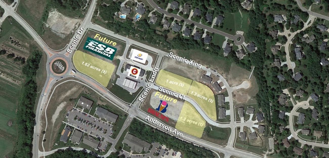
SCENIC CROSSING UNIT 4, S10, T10, R07E, LOT 2, 45573 SQUARE FEET, K-899
212-10-0-30-10-016.01-0
RILEY
Commercialofficeresidentialmixeduse
Kansas
B and X Area of moderate flood hazard, usually the area between the limits of the 100-year and 500-year floods.
2
2025
1.05 AC
2025
I-70 Corridor
001301
Other Market Areas
NEARBY LISTINGS FOR SALE OR LEASE
DEMOGRAPHICS near Scenic Ct
1 mile
3 mile
5 mile
2025 Total Population
5,222
33,060
58,137
2030 Population
5,260
33,358
58,684
Pop Growth 2025-2030
+ 0.73%
+ 0.90%
+ 0.94%
Average Age
37
35
33
2025 Total Households
2,089
12,667
23,099
HH Growth 2025-2030
+ 0.67%
+ 0.97%
+ 1.03%
Median Household Inc
$84,976
$73,934
$61,814
Avg Household Size
2.40
2.20
2.20
2025 Avg HH Vehicles
2.00
2.00
2.00
Median Home Value
$385,691
$303,656
$256,844
Median Year Built
2000
1986
1983
Nearby Places
Map Layers
Map Styles
 Street
 Aerial
Layers
 Traffic
 Biking
Places
Listings with unknown addresses are not visible on the map
- Restaurants
- Banks
- Shops
- Fitness
- Groceries
PUBLIC TRANSPORTATION
AIRPORT
Manhattan Regional
Drive
Walk
Distance
Manhattan Regional
14 min
6.4 mi
SALE & LEASE HISTORY
LISTING DATE
SALE/LEASE

May 03, 2023
For Sale
Mar 01, 2020
For Sale
Aug 08, 2017
For Sale
Nearby Properties
Address
Land Use
TOTAL SIZE
Lot Size
Zoning
Address
Land Use
TOTAL SIZE
Lot Size
Zoning
4,748,887 SF
261.83 AC
U
Address
Land Use
TOTAL SIZE
Lot Size
Zoning
125.53 AC
U
Address
Land Use
TOTAL SIZE
Lot Size
Zoning
1,084,753 SF
69.85 AC
U
Address
Land Use
TOTAL SIZE
Lot Size
Zoning
518,756 SF
11.88 AC
U
Address
Land Use
TOTAL SIZE
Lot Size
Zoning
69,440 SF
27.76 AC
U
Address
Land Use
TOTAL SIZE
Lot Size
Zoning
41,664 SF
22.69 AC
U
Address
Land Use
TOTAL SIZE
Lot Size
Zoning
132.41 AC
U
Address
Land Use
TOTAL SIZE
Lot Size
Zoning
347,291 SF
21.20 AC
R
Address
Land Use
TOTAL SIZE
Lot Size
Zoning
114,793 SF
9.46 AC
U
Address
Land Use
TOTAL SIZE
Lot Size
Zoning
126,616 SF
33.30 AC
R1
Address
Land Use
TOTAL SIZE
Lot Size
Zoning
1,920 SF
4.47 AC
Address
Land Use
TOTAL SIZE
Lot Size
Zoning
71,182 SF
11.80 AC
R
Address
Land Use
TOTAL SIZE
Lot Size
Zoning
89,898 SF
5.48 AC
R3
Address
Land Use
TOTAL SIZE
Lot Size
Zoning
46,653 SF
0.85 AC
U
Address
Land Use
TOTAL SIZE
Lot Size
Zoning
91,968 SF
5.69 AC
PUD
Address
Land Use
TOTAL SIZE
Lot Size
Zoning
71,899 SF
5.50 AC
R
Address
Land Use
TOTAL SIZE
Lot Size
Zoning
32,402 SF
5.76 AC
R
Address
Land Use
TOTAL SIZE
Lot Size
Zoning
67,276 SF
9 AC
R
Address
Land Use
TOTAL SIZE
Lot Size
Zoning
56,522 SF
17.60 AC
ROW
Address
Land Use
TOTAL SIZE
Lot Size
Zoning
44,800 SF
4.49 AC
Address
Land Use
TOTAL SIZE
Lot Size
Zoning
25,505 SF
2.46 AC
U
Address
Land Use
TOTAL SIZE
Lot Size
Zoning
64,310 SF
9.64 AC
R
Address
Land Use
TOTAL SIZE
Lot Size
Zoning
46,607 SF
3 AC
Address
Land Use
TOTAL SIZE
Lot Size
Zoning
37,416 SF
0.29 AC
R1
Address
Land Use
TOTAL SIZE
Lot Size
Zoning
15.72 AC
Address
Land Use
TOTAL SIZE
Lot Size
Zoning
7,914 SF
5.70 AC
R3
Address
Land Use
TOTAL SIZE
Lot Size
Zoning
58,446 SF
8.45 AC
R
Address
Land Use
TOTAL SIZE
Lot Size
Zoning
1,387 SF
19 AC
R
Address
Land Use
TOTAL SIZE
Lot Size
Zoning
7,320 SF
55.90 AC
R
Address
Land Use
TOTAL SIZE
Lot Size
Zoning
29,851 SF
2.59 AC
R1
The World's #1 Commercial Real Estate Marketplace
Connect with us
© 2026 CoStar Group
The information above has been obtained from sources believed reliable. While we do not doubt its accuracy we have not verified it and make no guarantee, warranty or representation about it. It is your responsibility to independently confirm its accuracy and completeness. Any projections, opinions, assumptions, or estimates used are for example only and do not represent the current or future performance of the property. The value of this transaction to you depends on tax and other factors which should be evaluated by your tax, financial, and legal advisors. You and your advisors should conduct a careful, independent investigation of the property to determine to your satisfaction the suitability of the property for your needs.