Property Record
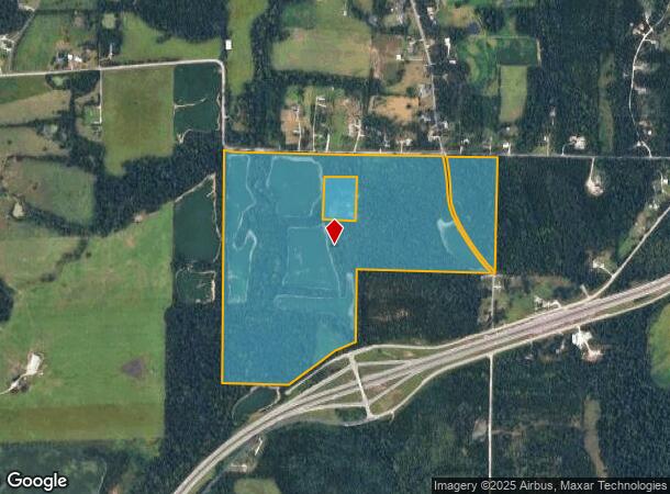
Schuchart Rd, Union, MO 63084

NEARBY LISTINGS FOR SALE OR LEASE
Property Detail
Schuchart Rd
21-4-180-0-000-009000
PT N1/2 NW,PT SW NW SPLIT BY PRAIRIE DELL RD
Agriculturalland
Franklin
A
Missouri
29071C0315D
125 AC
2025
Franklin County
2025
St. Louis
800605
St. Louis, MO-IL
DEMOGRAPHICS near Schuchart Rd
1 mile
3 mile
5 mile
2024 Total Population
351
6,742
21,385
2029 Population
365
6,993
22,115
Pop Growth 2024-2029
+ 3.99%
+ 3.72%
+ 3.41%
Average Age
41
41
40
2024 Total Households
141
2,671
8,349
HH Growth 2024-2029
+ 4.26%
+ 3.71%
+ 3.39%
Median Household Inc
$57,499
$61,399
$62,579
Avg Household Size
2.40
2.50
2.50
2024 Avg HH Vehicles
2.00
2.00
2.00
Median Home Value
$207,692
$192,731
$177,512
Median Year Built
1994
1993
1989
Nearby Places
Map Layers
Map Styles
 Street
 Aerial
Transit
 Traffic
 Biking
Places
Listings with unknown addresses are not visible on the map
- Restaurants
- Banks
- Shops
- Fitness
- Groceries
Nearby Properties
Address
Land Use
TOTAL SIZE
Lot Size
Zoning
Address
Land Use
TOTAL SIZE
Lot Size
Zoning
70,871 SF
13.90 AC
Address
Land Use
TOTAL SIZE
Lot Size
Zoning
70,687 SF
30 AC
Address
Land Use
TOTAL SIZE
Lot Size
Zoning
28,045 SF
4.30 AC
Address
Land Use
TOTAL SIZE
Lot Size
Zoning
101,929 SF
13.30 AC
Address
Land Use
TOTAL SIZE
Lot Size
Zoning
69,500 SF
11.80 AC
Address
Land Use
TOTAL SIZE
Lot Size
Zoning
2,401 SF
4.10 AC
Address
Land Use
TOTAL SIZE
Lot Size
Zoning
1,110 SF
43.90 AC
Address
Land Use
TOTAL SIZE
Lot Size
Zoning
15,053 SF
48.10 AC
Address
Land Use
TOTAL SIZE
Lot Size
Zoning
5,408 SF
2.40 AC
Address
Land Use
TOTAL SIZE
Lot Size
Zoning
7,600 SF
4.20 AC
Address
Land Use
TOTAL SIZE
Lot Size
Zoning
3,376 SF
11 AC
RD
Address
Land Use
TOTAL SIZE
Lot Size
Zoning
1,600 SF
3.40 AC
Address
Land Use
TOTAL SIZE
Lot Size
Zoning
87,860 SF
6 AC
Address
Land Use
TOTAL SIZE
Lot Size
Zoning
124,500 SF
12.50 AC
Address
Land Use
TOTAL SIZE
Lot Size
Zoning
76,745 SF
5 AC
Address
Land Use
TOTAL SIZE
Lot Size
Zoning
768 SF
7.10 AC
CA3
Address
Land Use
TOTAL SIZE
Lot Size
Zoning
12,240 SF
2 AC
Address
Land Use
TOTAL SIZE
Lot Size
Zoning
15,334 SF
0.80 AC
Address
Land Use
TOTAL SIZE
Lot Size
Zoning
23,000 SF
5 AC
Address
Land Use
TOTAL SIZE
Lot Size
Zoning
1,408 SF
8.90 AC
Address
Land Use
TOTAL SIZE
Lot Size
Zoning
2,622 SF
2.20 AC
Address
Land Use
TOTAL SIZE
Lot Size
Zoning
20,720 SF
2 AC
Address
Land Use
TOTAL SIZE
Lot Size
Zoning
15,114 SF
2.20 AC
Address
Land Use
TOTAL SIZE
Lot Size
Zoning
7,028 SF
11.80 AC
Address
Land Use
TOTAL SIZE
Lot Size
Zoning
36,960 SF
3 AC
Address
Land Use
TOTAL SIZE
Lot Size
Zoning
40,500 SF
3.50 AC
Address
Land Use
TOTAL SIZE
Lot Size
Zoning
20,000 SF
2.90 AC
Address
Land Use
TOTAL SIZE
Lot Size
Zoning
9,534 SF
2.30 AC
Address
Land Use
TOTAL SIZE
Lot Size
Zoning
8,040 SF
3 AC
Address
Land Use
TOTAL SIZE
Lot Size
Zoning
63,230 SF
3.40 AC
The World's #1 Commercial Real Estate Marketplace
Connect with us
© 2026 CoStar Group
The information above has been obtained from sources believed reliable. While we do not doubt its accuracy we have not verified it and make no guarantee, warranty or representation about it. It is your responsibility to independently confirm its accuracy and completeness. Any projections, opinions, assumptions, or estimates used are for example only and do not represent the current or future performance of the property. The value of this transaction to you depends on tax and other factors which should be evaluated by your tax, financial, and legal advisors. You and your advisors should conduct a careful, independent investigation of the property to determine to your satisfaction the suitability of the property for your needs.