Property Record
Schutt Rd Ext, T O Wallkill, NY 10940

Save to a Folder
{{folder.Name}}
{{folder.ListingIds.length}} Properties
{{folder.ListingIds.length}} Property
Create a New Folder
Property Detail
Schutt Rd Ext
Kiryas Joel-Poughkeepsie-Newburgh, NY
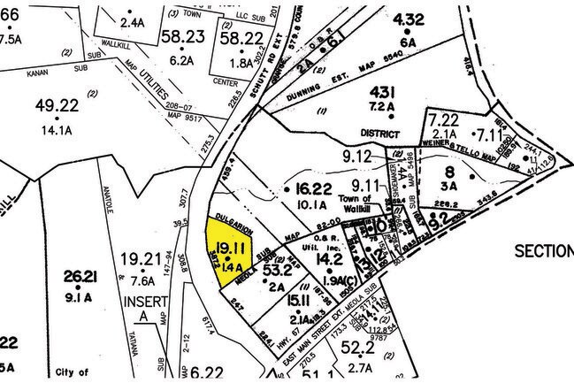
DULGARIAN SUB MAP 82-00
335200-050-000-0002-019.110-0000
ORANGE
Commercialacreage
New York
HC
19.11
C and X Area of minimal flood hazard, usually depicted on FIRMs as above the 500-year flood level.
1.40 AC
2024
Middletown
2025
Northern New Jersey
015100
NEARBY LISTINGS FOR SALE OR LEASE
DEMOGRAPHICS near Schutt Rd Ext
1 mile
3 mile
5 mile
2025 Total Population
5,995
51,259
71,109
2030 Population
6,135
52,124
72,425
Pop Growth 2025-2030
+ 2.34%
+ 1.69%
+ 1.85%
Average Age
41
39
40
2025 Total Households
2,400
18,746
26,129
HH Growth 2025-2030
+ 2.38%
+ 1.81%
+ 2.01%
Median Household Inc
$86,493
$83,499
$87,618
Avg Household Size
2.40
2.60
2.60
2025 Avg HH Vehicles
2.00
2.00
2.00
Median Home Value
$317,402
$330,378
$353,011
Median Year Built
1981
1973
1975
Nearby Places
Map Layers
Map Styles
 Street
 Aerial
Layers
 Traffic
 Biking
Places
Listings with unknown addresses are not visible on the map
- Restaurants
- Banks
- Shops
- Fitness
- Groceries
PUBLIC TRANSPORTATION
COMMUTER RAIL
Middletown Ny (Port Jervis Line - NJ TRANSIT RAIL)
Drive
Walk
Distance
Middletown Ny (Port Jervis Line - NJ TRANSIT RAIL)
6 min
2.0 mi
Campbell Hall (Port Jervis Line - NJ TRANSIT RAIL)
Drive
Walk
Distance
Campbell Hall (Port Jervis Line - NJ TRANSIT RAIL)
17 min
8.2 mi
AIRPORT
New York Stewart International
Drive
Walk
Distance
New York Stewart International
29 min
19.5 mi
Freight Ports
Port Newark Container Terminal
Drive
Walk
Distance
Port Newark Container Terminal
92 min
70.1 mi
SALE & LEASE HISTORY
LISTING DATE
SALE/LEASE

Sep 24, 2016
For Sale
Nearby Properties
Address
Land Use
TOTAL SIZE
Lot Size
Zoning
Address
Land Use
TOTAL SIZE
Lot Size
Zoning
275,216 SF
58.40 AC
O/R
Address
Land Use
TOTAL SIZE
Lot Size
Zoning
159,120 SF
90.20 AC
SR-RH
Address
Land Use
TOTAL SIZE
Lot Size
Zoning
40.40 AC
I-2
Address
Land Use
TOTAL SIZE
Lot Size
Zoning
47.80 AC
01092
Address
Land Use
TOTAL SIZE
Lot Size
Zoning
698,289 SF
52.20 AC
Address
Land Use
TOTAL SIZE
Lot Size
Zoning
180,840 SF
37.50 AC
TC
Address
Land Use
TOTAL SIZE
Lot Size
Zoning
24.40 AC
R-1
Address
Land Use
TOTAL SIZE
Lot Size
Zoning
58.10 AC
R1
Address
Land Use
TOTAL SIZE
Lot Size
Zoning
376,002 SF
34.40 AC
TC
Address
Land Use
TOTAL SIZE
Lot Size
Zoning
26,659 SF
15.80 AC
MC 2
Address
Land Use
TOTAL SIZE
Lot Size
Zoning
17.60 AC
R-1
Address
Land Use
TOTAL SIZE
Lot Size
Zoning
Address
Land Use
TOTAL SIZE
Lot Size
Zoning
14.70 AC
MC 1
Address
Land Use
TOTAL SIZE
Lot Size
Zoning
29,950 SF
3 AC
TC-1
Address
Land Use
TOTAL SIZE
Lot Size
Zoning
637,520 SF
44.70 AC
ENT-L
Address
Land Use
TOTAL SIZE
Lot Size
Zoning
50,700 SF
7.70 AC
TC-1
Address
Land Use
TOTAL SIZE
Lot Size
Zoning
142,416 SF
13.90 AC
R1
Address
Land Use
TOTAL SIZE
Lot Size
Zoning
289,910 SF
19.90 AC
TC
Address
Land Use
TOTAL SIZE
Lot Size
Zoning
26,156 SF
0.01 AC
TC-1
Address
Land Use
TOTAL SIZE
Lot Size
Zoning
1,360 SF
6.30 AC
Address
Land Use
TOTAL SIZE
Lot Size
Zoning
5,832 SF
2.30 AC
TC-1
Address
Land Use
TOTAL SIZE
Lot Size
Zoning
270,471 SF
78.40 AC
R1
Address
Land Use
TOTAL SIZE
Lot Size
Zoning
136,784 SF
6 AC
O/R
Address
Land Use
TOTAL SIZE
Lot Size
Zoning
430,275 SF
35.60 AC
O/R
Address
Land Use
TOTAL SIZE
Lot Size
Zoning
5,753 SF
18 AC
TC
Address
Land Use
TOTAL SIZE
Lot Size
Zoning
125,616 SF
11.50 AC
O/R
Address
Land Use
TOTAL SIZE
Lot Size
Zoning
208,464 SF
24.90 AC
HC
Address
Land Use
TOTAL SIZE
Lot Size
Zoning
12,142 SF
2.40 AC
SR-MC2
Address
Land Use
TOTAL SIZE
Lot Size
Zoning
141,454 SF
12 AC
TC
Address
Land Use
TOTAL SIZE
Lot Size
Zoning
57.40 AC
MC 1
The World's #1 Commercial Real Estate Marketplace
Connect with us
© 2026 CoStar Group
The information above has been obtained from sources believed reliable. While we do not doubt its accuracy we have not verified it and make no guarantee, warranty or representation about it. It is your responsibility to independently confirm its accuracy and completeness. Any projections, opinions, assumptions, or estimates used are for example only and do not represent the current or future performance of the property. The value of this transaction to you depends on tax and other factors which should be evaluated by your tax, financial, and legal advisors. You and your advisors should conduct a careful, independent investigation of the property to determine to your satisfaction the suitability of the property for your needs.