Property Record
Science Park Rd, State College, PA 16803
NEARBY LISTINGS FOR SALE OR LEASE
Property Detail
Science Park Rd
24-004-021-0000
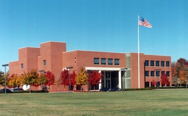
Property Survey Of Science Park Road
Taxexempt
Centre
X
Pennsylvania
42027C0619F
13.58 AC
2025
Other Market Areas
2025
State College, PA
011905
DEMOGRAPHICS near Science Park Rd
1 Mile
3 Mile
5 Mile
2024 Total Population
4,892
66,063
83,386
2029 Population
4,862
66,146
83,343
Pop Growth 2024-2029
(0.61%)
+ 0.13%
(0.05%)
Average Age
38
32
34
2024 Total Households
1,816
23,035
30,065
HH Growth 2024-2029
(0.66%)
+ 0.10%
(0.14%)
Median Household Inc
$112,096
$50,431
$59,496
Avg Household Size
2.60
2.20
2.20
2024 Avg HH Vehicles
2.00
1.00
2.00
Median Home Value
$400,359
$359,199
$363,761
Median Year Built
2001
1982
1983
Nearby Places
Map Layers
Map Styles
 Street
 Aerial
- Restaurants
- Banks
- Shops
- Fitness
- Groceries
PUBLIC TRANSPORTATION
AIRPORT
State College Regional
DRIVE
WALK
Distance
State College Regional
20 min
8.6 mi
Freight Ports
Port of Baltimore
DRIVE
WALK
Distance
Port of Baltimore
229 min
170.9 mi
Nearby Properties
Address
Land Use
TOTAL SIZE
Lot Size
Zoning
Address
Land Use
TOTAL SIZE
Lot Size
Zoning
60.26 AC
Address
Land Use
TOTAL SIZE
Lot Size
Zoning
Address
Land Use
TOTAL SIZE
Lot Size
Zoning
Address
Land Use
TOTAL SIZE
Lot Size
Zoning
Address
Land Use
TOTAL SIZE
Lot Size
Zoning
Address
Land Use
TOTAL SIZE
Lot Size
Zoning
Address
Land Use
TOTAL SIZE
Lot Size
Zoning
Address
Land Use
TOTAL SIZE
Lot Size
Zoning
56.73 AC
Address
Land Use
TOTAL SIZE
Lot Size
Zoning
44.46 AC
Address
Land Use
TOTAL SIZE
Lot Size
Zoning
Address
Land Use
TOTAL SIZE
Lot Size
Zoning
Address
Land Use
TOTAL SIZE
Lot Size
Zoning
Address
Land Use
TOTAL SIZE
Lot Size
Zoning
1.94 AC
The World's #1 Commercial Real Estate Marketplace
Connect with us
© 2026 CoStar Group
The information above has been obtained from sources believed reliable. While we do not doubt its accuracy we have not verified it and make no guarantee, warranty or representation about it. It is your responsibility to independently confirm its accuracy and completeness. Any projections, opinions, assumptions, or estimates used are for example only and do not represent the current or future performance of the property. The value of this transaction to you depends on tax and other factors which should be evaluated by your tax, financial, and legal advisors. You and your advisors should conduct a careful, independent investigation of the property to determine to your satisfaction the suitability of the property for your needs.