Property Record
Se 77Th St, Wakarusa, KS 66546
NEARBY LISTINGS FOR SALE OR LEASE
-
-
-
7215 SW Topeka Blvd., Bldg. 2703, Topeka, KS 66619
Topeka, KS 66619
$2.60 SF/YR
38,800 SF
Industrial
-
-
View all Wakarusa listings for sale on LoopNet.com
Property Detail
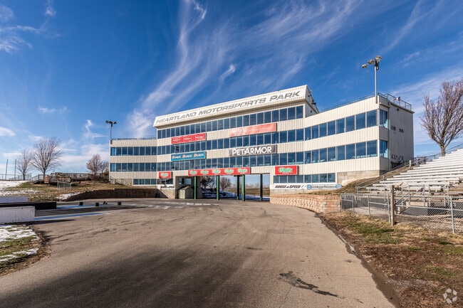
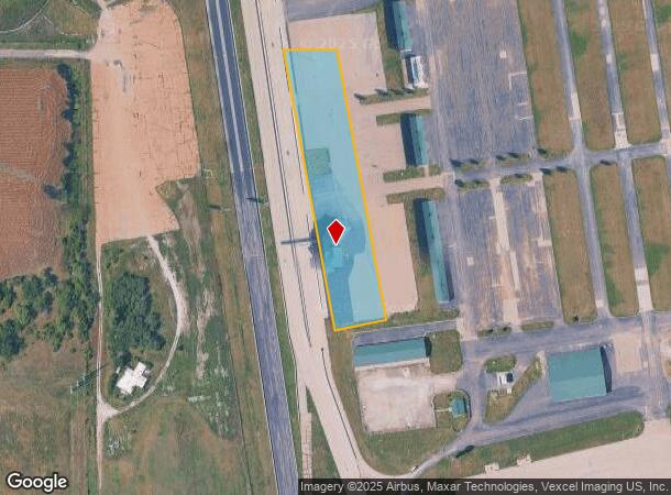
Se 77Th St
Topeka, KS
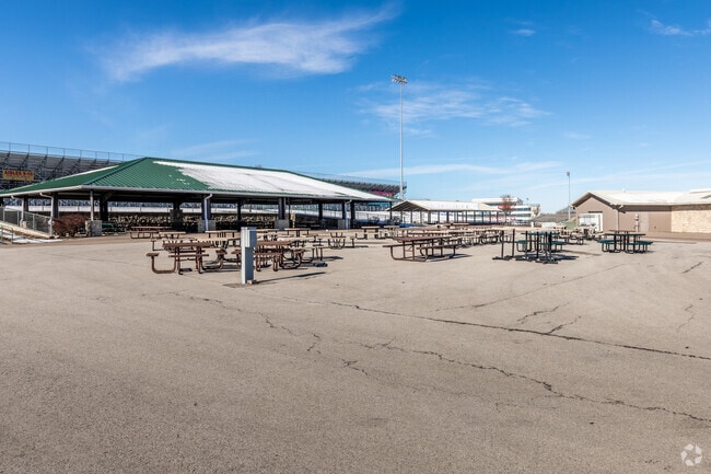
Heartland Park Topeka
204-18-0-00-01-001-030
HEARTLAND PARK TOPEKA, S18, T13, R16, BLOCK A, LOT 3, THAT PT OF FOL DESC TR THAT LIES WITHIN LT 3 BLK A HEARTLAND PARK SUB BEG 540.82 E OF NW COR SD LT TH NLY 123.22 ELY 147.12 SLY 910; WLY 144 SECTION 18 TOWNSHIP 13 RANGE 16
Racetrack
Shawnee
X
Kansas
20177C0320E
3
2024
2.59 AC
2025
Topeka
003902
Kansas City
11,608 SF
DEMOGRAPHICS near Se 77Th St
1 Mile
3 Mile
5 Mile
2024 Total Population
30
4,107
12,873
2029 Population
30
4,074
12,703
Pop Growth 2024-2029
0.00%
(0.80%)
(1.32%)
Average Age
46
34
39
2024 Total Households
12
1,387
4,800
HH Growth 2024-2029
0.00%
(0.87%)
(1.40%)
Median Household Inc
$74,999
$60,878
$67,724
Avg Household Size
2.30
2.90
2.60
2024 Avg HH Vehicles
3.00
2.00
2.00
Median Home Value
$199,999
$158,602
$170,435
Median Year Built
1977
1968
1985
Nearby Places
Map Layers
Map Styles
 Street
 Aerial
- Restaurants
- Banks
- Shops
- Fitness
- Groceries
SALE & LEASE HISTORY
LISTING DATE
SALE/LEASE

Nov 20, 2023
For Sale
Nearby Properties
Address
Land Use
TOTAL SIZE
Lot Size
Zoning
Address
Land Use
TOTAL SIZE
Lot Size
Zoning
194.03 AC
I2
Address
Land Use
TOTAL SIZE
Lot Size
Zoning
42.18 AC
I2
Address
Land Use
TOTAL SIZE
Lot Size
Zoning
797,582 SF
384.32 AC
I1,I2
Address
Land Use
TOTAL SIZE
Lot Size
Zoning
577,341 SF
152.58 AC
I2
Address
Land Use
TOTAL SIZE
Lot Size
Zoning
1,351,980 SF
141.63 AC
I1
Address
Land Use
TOTAL SIZE
Lot Size
Zoning
602,448 SF
43.68 AC
I1
Address
Land Use
TOTAL SIZE
Lot Size
Zoning
1,250 SF
630.34 AC
RR1
Address
Land Use
TOTAL SIZE
Lot Size
Zoning
53,815 SF
15.40 AC
RR1
Address
Land Use
TOTAL SIZE
Lot Size
Zoning
188,358 SF
183.64 AC
I1,RR1
Address
Land Use
TOTAL SIZE
Lot Size
Zoning
65,918 SF
20.81 AC
RR1
Address
Land Use
TOTAL SIZE
Lot Size
Zoning
64,248 SF
13.78 AC
RR1
Address
Land Use
TOTAL SIZE
Lot Size
Zoning
1,253,081 SF
73.17 AC
I1
Address
Land Use
TOTAL SIZE
Lot Size
Zoning
417.49 AC
RR1
Address
Land Use
TOTAL SIZE
Lot Size
Zoning
144.10 AC
PUD,I1,RR1
Address
Land Use
TOTAL SIZE
Lot Size
Zoning
34,744 SF
10.63 AC
I1,I2
Address
Land Use
TOTAL SIZE
Lot Size
Zoning
142.66 AC
RR1
Address
Land Use
TOTAL SIZE
Lot Size
Zoning
521,739 SF
25.22 AC
I1
Address
Land Use
TOTAL SIZE
Lot Size
Zoning
15,666 SF
20.06 AC
RR1
Address
Land Use
TOTAL SIZE
Lot Size
Zoning
63,500 SF
1.93 AC
I1
Address
Land Use
TOTAL SIZE
Lot Size
Zoning
9.02 AC
Address
Land Use
TOTAL SIZE
Lot Size
Zoning
10,305 SF
63.93 AC
I1,RR1
Address
Land Use
TOTAL SIZE
Lot Size
Zoning
98,660 SF
13.73 AC
PUD,I1
Address
Land Use
TOTAL SIZE
Lot Size
Zoning
173.90 AC
RR1
Address
Land Use
TOTAL SIZE
Lot Size
Zoning
95,537 SF
5.68 AC
I2
Address
Land Use
TOTAL SIZE
Lot Size
Zoning
158.02 AC
RR1
Address
Land Use
TOTAL SIZE
Lot Size
Zoning
39,893 SF
1.77 AC
I1
Address
Land Use
TOTAL SIZE
Lot Size
Zoning
141,097 SF
12.01 AC
PUD,I1
Address
Land Use
TOTAL SIZE
Lot Size
Zoning
98.45 AC
RR1
Address
Land Use
TOTAL SIZE
Lot Size
Zoning
15,072 SF
18.09 AC
I1,I2
Address
Land Use
TOTAL SIZE
Lot Size
Zoning
14,000 SF
75.65 AC
RR1
The World's #1 Commercial Real Estate Marketplace
Connect with us
© 2025 CoStar Group
The information above has been obtained from sources believed reliable. While we do not doubt its accuracy we have not verified it and make no guarantee, warranty or representation about it. It is your responsibility to independently confirm its accuracy and completeness. Any projections, opinions, assumptions, or estimates used are for example only and do not represent the current or future performance of the property. The value of this transaction to you depends on tax and other factors which should be evaluated by your tax, financial, and legal advisors. You and your advisors should conduct a careful, independent investigation of the property to determine to your satisfaction the suitability of the property for your needs.