Property Record
Se County Road 21B, Keystone Heights, FL 32656

Property Detail
Se County Road 21B
Other Market Areas
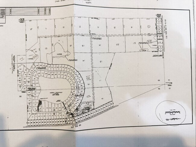
24 8S 22 THAT PORT OF THE FOLL LYING IN THIS SECTION. COM SW COR OF SEC 24. S89*11'09"E 1311.11' TO W R/W SE 8TH AVE, THENCE N00*46'13"W 926.43', THENCE N03*09'07"W 350.59', THENCE N13*11'58"W 1503.26', THENCE N20*52'33"W 550.53', THENCE S82*49'6"W 5
05710-0-00000
BRADFORD
Pasture
Florida
A Areas with a 1% annual chance of flooding and a 26% chance of flooding over the life of a 30-year mortgage.
1-32
2025
248.99 AC
2025
Florida Central North Area
000301
NEARBY LISTINGS FOR SALE OR LEASE
DEMOGRAPHICS near Se County Road 21B
1 mile
3 mile
5 mile
2025 Total Population
1,239
9,310
16,547
2030 Population
1,330
10,127
18,024
Pop Growth 2025-2030
+ 7.34%
+ 8.78%
+ 8.93%
Average Age
46
44
44
2025 Total Households
530
3,802
6,788
HH Growth 2025-2030
+ 6.60%
+ 8.68%
+ 8.90%
Median Household Inc
$71,076
$68,969
$70,503
Avg Household Size
2.30
2.40
2.40
2025 Avg HH Vehicles
2.00
2.00
2.00
Median Home Value
$362,837
$322,600
$293,305
Median Year Built
1984
1981
1983
Nearby Places
Map Layers
Map Styles
 Street
 Aerial
Layers
 Traffic
 Biking
Places
Listings with unknown addresses are not visible on the map
- Restaurants
- Banks
- Shops
- Fitness
- Groceries
PUBLIC TRANSPORTATION
AIRPORT
Gainesville Regional
Drive
Walk
Distance
Gainesville Regional
37 min
21.4 mi
Freight Ports
Jacksonville Port
Drive
Walk
Distance
Jacksonville Port
86 min
61.3 mi
SALE & LEASE HISTORY
LISTING DATE
SALE/LEASE

Sep 05, 2017
For Sale
Nov 28, 2017
For Sale
Jul 27, 2021
For Sale
Feb 20, 2018
For Sale
Feb 15, 2023
For Sale
Nearby Properties
Address
Land Use
TOTAL SIZE
Lot Size
Zoning
Address
Land Use
TOTAL SIZE
Lot Size
Zoning
23,953 SF
228.32 AC
Address
Land Use
TOTAL SIZE
Lot Size
Zoning
56,278 SF
39.66 AC
Address
Land Use
TOTAL SIZE
Lot Size
Zoning
68,670 SF
10 AC
Address
Land Use
TOTAL SIZE
Lot Size
Zoning
116,370 SF
23.88 AC
PS-5
Address
Land Use
TOTAL SIZE
Lot Size
Zoning
52,626 SF
28.21 AC
Address
Land Use
TOTAL SIZE
Lot Size
Zoning
61,803 SF
18.29 AC
Address
Land Use
TOTAL SIZE
Lot Size
Zoning
60,351 SF
11.59 AC
Address
Land Use
TOTAL SIZE
Lot Size
Zoning
123,219 SF
121 AC
Address
Land Use
TOTAL SIZE
Lot Size
Zoning
42,928 SF
4.69 AC
Address
Land Use
TOTAL SIZE
Lot Size
Zoning
26,203 SF
0.80 AC
Address
Land Use
TOTAL SIZE
Lot Size
Zoning
43,696 SF
14.90 AC
Address
Land Use
TOTAL SIZE
Lot Size
Zoning
14,736 SF
2.13 AC
Address
Land Use
TOTAL SIZE
Lot Size
Zoning
8,266 SF
1.20 AC
Address
Land Use
TOTAL SIZE
Lot Size
Zoning
13,000 SF
2.24 AC
RB
Address
Land Use
TOTAL SIZE
Lot Size
Zoning
10,115 SF
0.92 AC
PO-1
Address
Land Use
TOTAL SIZE
Lot Size
Zoning
33,258 SF
5.34 AC
Address
Land Use
TOTAL SIZE
Lot Size
Zoning
25,442 SF
36.61 AC
Address
Land Use
TOTAL SIZE
Lot Size
Zoning
2,485 SF
2.43 AC
Address
Land Use
TOTAL SIZE
Lot Size
Zoning
4,625 SF
1.84 AC
Address
Land Use
TOTAL SIZE
Lot Size
Zoning
3,133 SF
1.65 AC
Address
Land Use
TOTAL SIZE
Lot Size
Zoning
7,532 SF
1.06 AC
Address
Land Use
TOTAL SIZE
Lot Size
Zoning
20,001 SF
1.47 AC
Address
Land Use
TOTAL SIZE
Lot Size
Zoning
15,800 SF
2.47 AC
Address
Land Use
TOTAL SIZE
Lot Size
Zoning
1,782 SF
1.09 AC
Address
Land Use
TOTAL SIZE
Lot Size
Zoning
9,146 SF
1.52 AC
Address
Land Use
TOTAL SIZE
Lot Size
Zoning
7,360 SF
0.84 AC
Address
Land Use
TOTAL SIZE
Lot Size
Zoning
16,965 SF
5.64 AC
Address
Land Use
TOTAL SIZE
Lot Size
Zoning
5,724 SF
17.26 AC
A
Address
Land Use
TOTAL SIZE
Lot Size
Zoning
8,320 SF
1.01 AC
CG
Address
Land Use
TOTAL SIZE
Lot Size
Zoning
12,376 SF
50 AC
The World's #1 Commercial Real Estate Marketplace
Connect with us
© 2026 CoStar Group
The information above has been obtained from sources believed reliable. While we do not doubt its accuracy we have not verified it and make no guarantee, warranty or representation about it. It is your responsibility to independently confirm its accuracy and completeness. Any projections, opinions, assumptions, or estimates used are for example only and do not represent the current or future performance of the property. The value of this transaction to you depends on tax and other factors which should be evaluated by your tax, financial, and legal advisors. You and your advisors should conduct a careful, independent investigation of the property to determine to your satisfaction the suitability of the property for your needs.