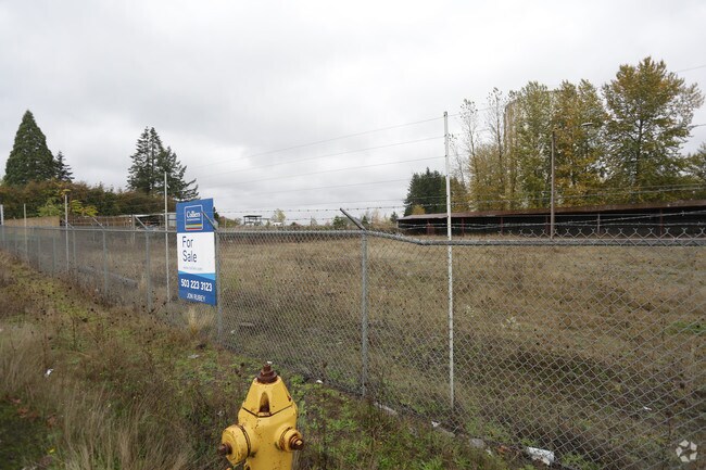
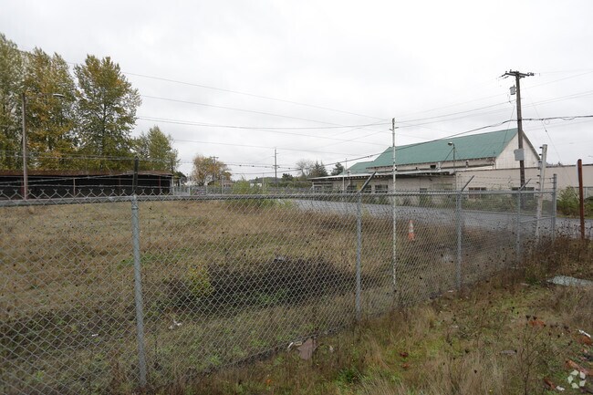
Property Record
Se Se Powell Valley Rd, Gresham, OR 97080

Property Detail
Se Se Powell Valley Rd
R342214
SECTION 19 1S 4E, TL 6500 0.73 ACRES
Commercialnec
MULTNOMAH
OCI
Oregon
B and X Area of moderate flood hazard, usually the area between the limits of the 100-year and 500-year floods.
0.73 AC
0
NE Outlying
2025
Portland
009907
Portland-Vancouver-Hillsboro, OR-WA
5,292 SF
NEARBY LISTINGS FOR SALE OR LEASE
-
-
No Photo
-
View all Gresham listings for sale on LoopNet.com
DEMOGRAPHICS near Se Se Powell Valley Rd
1 mile
3 mile
5 mile
2024 Total Population
5,883
39,232
106,233
2029 Population
5,915
38,665
104,502
Pop Growth 2024-2029
+ 0.54%
(1.45%)
(1.63%)
Average Age
40
41
41
2024 Total Households
1,885
13,556
38,085
HH Growth 2024-2029
+ 0.37%
(1.80%)
(1.93%)
Median Household Inc
$109,055
$90,437
$84,326
Avg Household Size
3.00
2.80
2.70
2024 Avg HH Vehicles
3.00
2.00
2.00
Median Home Value
$619,420
$492,938
$481,418
Median Year Built
1997
1984
1983
Nearby Places
Map Layers
Map Styles
 Street
 Aerial
Transit
 Traffic
 Biking
Places
Listings with unknown addresses are not visible on the map
- Restaurants
- Banks
- Shops
- Fitness
- Groceries
PUBLIC TRANSPORTATION
AIRPORT
Portland International
Drive
Walk
Distance
Portland International
30 min
18.6 mi
Freight Ports
Port of Portland
Drive
Walk
Distance
Port of Portland
36 min
24.0 mi
Nearby Properties
Address
Land Use
TOTAL SIZE
Lot Size
Zoning
Address
Land Use
TOTAL SIZE
Lot Size
Zoning
40.81 AC
LDR-5
Address
Land Use
TOTAL SIZE
Lot Size
Zoning
300,843 SF
37.27 AC
MUA20
Address
Land Use
TOTAL SIZE
Lot Size
Zoning
75,850 SF
11.55 AC
LDR-5
Address
Land Use
TOTAL SIZE
Lot Size
Zoning
83,072 SF
9.58 AC
LDR-5
Address
Land Use
TOTAL SIZE
Lot Size
Zoning
115,600 SF
28.24 AC
LDR-5
Address
Land Use
TOTAL SIZE
Lot Size
Zoning
235,728 SF
6.64 AC
MDR-24
Address
Land Use
TOTAL SIZE
Lot Size
Zoning
102,431 SF
11.56 AC
RC
Address
Land Use
TOTAL SIZE
Lot Size
Zoning
97,430 SF
13.91 AC
HI
Address
Land Use
TOTAL SIZE
Lot Size
Zoning
188,870 SF
17.13 AC
CC
Address
Land Use
TOTAL SIZE
Lot Size
Zoning
60,280 SF
10.62 AC
LDR
Address
Land Use
TOTAL SIZE
Lot Size
Zoning
203,148 SF
8.58 AC
MDR-24
Address
Land Use
TOTAL SIZE
Lot Size
Zoning
187,027 SF
9.09 AC
MDR-24
Address
Land Use
TOTAL SIZE
Lot Size
Zoning
31.05 AC
MDR12
Address
Land Use
TOTAL SIZE
Lot Size
Zoning
143,039 SF
8.02 AC
MDR24
Address
Land Use
TOTAL SIZE
Lot Size
Zoning
176,439 SF
9.15 AC
MDR24
Address
Land Use
TOTAL SIZE
Lot Size
Zoning
1,963 SF
86.37 AC
IND-SW
Address
Land Use
TOTAL SIZE
Lot Size
Zoning
224,358 SF
5.63 AC
MDR24
Address
Land Use
TOTAL SIZE
Lot Size
Zoning
94,898 SF
10.58 AC
CC
Address
Land Use
TOTAL SIZE
Lot Size
Zoning
70,320 SF
3.79 AC
MDR24
Address
Land Use
TOTAL SIZE
Lot Size
Zoning
98,384 SF
4.67 AC
MDR-24
Address
Land Use
TOTAL SIZE
Lot Size
Zoning
95,863 SF
9.20 AC
CC
Address
Land Use
TOTAL SIZE
Lot Size
Zoning
83,547 SF
3.49 AC
MDR
Address
Land Use
TOTAL SIZE
Lot Size
Zoning
38,916 SF
4.84 AC
MDR24
Address
Land Use
TOTAL SIZE
Lot Size
Zoning
85,637 SF
5.93 AC
CMU
Address
Land Use
TOTAL SIZE
Lot Size
Zoning
9.13 AC
LDR7
Address
Land Use
TOTAL SIZE
Lot Size
Zoning
90,814 SF
7.24 AC
CMF
Address
Land Use
TOTAL SIZE
Lot Size
Zoning
26,944 SF
1.70 AC
MC
Address
Land Use
TOTAL SIZE
Lot Size
Zoning
56,013 SF
6.27 AC
LDR-5
Address
Land Use
TOTAL SIZE
Lot Size
Zoning
69,880 SF
2.69 AC
MDR24
Address
Land Use
TOTAL SIZE
Lot Size
Zoning
70,280 SF
2.74 AC
CC
The World's #1 Commercial Real Estate Marketplace
Connect with us
© 2026 CoStar Group
The information above has been obtained from sources believed reliable. While we do not doubt its accuracy we have not verified it and make no guarantee, warranty or representation about it. It is your responsibility to independently confirm its accuracy and completeness. Any projections, opinions, assumptions, or estimates used are for example only and do not represent the current or future performance of the property. The value of this transaction to you depends on tax and other factors which should be evaluated by your tax, financial, and legal advisors. You and your advisors should conduct a careful, independent investigation of the property to determine to your satisfaction the suitability of the property for your needs.