Property Record
Seaforth Rd, Pittsboro, NC 27312

Save to a Folder
{{folder.Name}}
{{folder.ListingIds.length}} Properties
{{folder.ListingIds.length}} Property
Create a New Folder
Property Detail
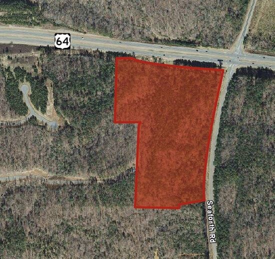
Seaforth Rd
Durham-Chapel Hill, NC
LOT 2 AC 21.35 BK 2017 PG 225
17436
CHATHAM
Vacantlandnec
North Carolina
R-1
2
B and X Area of moderate flood hazard, usually the area between the limits of the 100-year and 500-year floods.
21.35 AC
2025
Chatham County
2025
Raleigh/Durham
020801
NEARBY LISTINGS FOR SALE OR LEASE
-
-
View all Pittsboro listings for sale on LoopNet.com
DEMOGRAPHICS near Seaforth Rd
1 mile
3 mile
5 mile
2025 Total Population
396
3,579
9,745
2030 Population
435
3,929
10,687
Pop Growth 2025-2030
+ 9.85%
+ 9.78%
+ 9.67%
Average Age
46
45
51
2025 Total Households
153
1,357
4,113
HH Growth 2025-2030
+ 10.46%
+ 9.87%
+ 9.36%
Median Household Inc
$149,218
$137,255
$125,697
Avg Household Size
2.50
2.50
2.30
2025 Avg HH Vehicles
3.00
3.00
2.00
Median Home Value
$666,666
$703,241
$641,700
Median Year Built
1999
2004
2003
Nearby Places
Map Layers
Map Styles
 Street
 Aerial
Layers
 Traffic
 Biking
Places
Listings with unknown addresses are not visible on the map
- Restaurants
- Banks
- Shops
- Fitness
- Groceries
PUBLIC TRANSPORTATION
AIRPORT
Raleigh-Durham International
Drive
Walk
Distance
Raleigh-Durham International
33 min
23.7 mi
Freight Ports
Port of Wilmington
Drive
Walk
Distance
Port of Wilmington
182 min
156.1 mi
SALE & LEASE HISTORY
LISTING DATE
SALE/LEASE

May 15, 2018
For Sale
Nearby Properties
Address
Land Use
TOTAL SIZE
Lot Size
Zoning
Address
Land Use
TOTAL SIZE
Lot Size
Zoning
263,480 SF
75.49 AC
R-1
Address
Land Use
TOTAL SIZE
Lot Size
Zoning
14,320 SF
7.44 AC
CU-IND-L
Address
Land Use
TOTAL SIZE
Lot Size
Zoning
125.46 AC
R-5
Address
Land Use
TOTAL SIZE
Lot Size
Zoning
54.48 AC
R-1
Address
Land Use
TOTAL SIZE
Lot Size
Zoning
7,362 SF
27.21 AC
R-1
Address
Land Use
TOTAL SIZE
Lot Size
Zoning
972 SF
30.97 AC
R-1
Address
Land Use
TOTAL SIZE
Lot Size
Zoning
15,200 SF
10.70 AC
CU-B-1
Address
Land Use
TOTAL SIZE
Lot Size
Zoning
8,000 SF
4.05 AC
B-1
Address
Land Use
TOTAL SIZE
Lot Size
Zoning
4,461 SF
9.73 AC
R-5
Address
Land Use
TOTAL SIZE
Lot Size
Zoning
56.10 AC
R-1
Address
Land Use
TOTAL SIZE
Lot Size
Zoning
3,481 SF
1.81 AC
R-1
Address
Land Use
TOTAL SIZE
Lot Size
Zoning
2,283 SF
11.47 AC
R-1
Address
Land Use
TOTAL SIZE
Lot Size
Zoning
399 SF
41.93 AC
R-1
Address
Land Use
TOTAL SIZE
Lot Size
Zoning
4,694 SF
0.72 AC
R-1
Address
Land Use
TOTAL SIZE
Lot Size
Zoning
7,045 SF
0.64 AC
R-1
Address
Land Use
TOTAL SIZE
Lot Size
Zoning
4,156 SF
5.77 AC
R-5
Address
Land Use
TOTAL SIZE
Lot Size
Zoning
3,725 SF
22.07 AC
R-5
Address
Land Use
TOTAL SIZE
Lot Size
Zoning
7,860 SF
5.63 AC
R-5
Address
Land Use
TOTAL SIZE
Lot Size
Zoning
10,584 SF
5.11 AC
B-1
Address
Land Use
TOTAL SIZE
Lot Size
Zoning
3,352 SF
8.32 AC
R-1
Address
Land Use
TOTAL SIZE
Lot Size
Zoning
2,922 SF
5.61 AC
R-5
Address
Land Use
TOTAL SIZE
Lot Size
Zoning
5,069 SF
10.50 AC
R-1
Address
Land Use
TOTAL SIZE
Lot Size
Zoning
2,466 SF
12.14 AC
R-A-5
Address
Land Use
TOTAL SIZE
Lot Size
Zoning
3,452 SF
1.51 AC
R-1
Address
Land Use
TOTAL SIZE
Lot Size
Zoning
7,222 SF
9 AC
OI
Address
Land Use
TOTAL SIZE
Lot Size
Zoning
7,386 SF
28.26 AC
R-1
Address
Land Use
TOTAL SIZE
Lot Size
Zoning
399 SF
123.06 AC
R-1
Address
Land Use
TOTAL SIZE
Lot Size
Zoning
1,136 SF
10.93 AC
R-1
Address
Land Use
TOTAL SIZE
Lot Size
Zoning
1,584 SF
5.75 AC
R-5
Address
Land Use
TOTAL SIZE
Lot Size
Zoning
800 SF
37.60 AC
R-1
The World's #1 Commercial Real Estate Marketplace
Connect with us
© 2026 CoStar Group
The information above has been obtained from sources believed reliable. While we do not doubt its accuracy we have not verified it and make no guarantee, warranty or representation about it. It is your responsibility to independently confirm its accuracy and completeness. Any projections, opinions, assumptions, or estimates used are for example only and do not represent the current or future performance of the property. The value of this transaction to you depends on tax and other factors which should be evaluated by your tax, financial, and legal advisors. You and your advisors should conduct a careful, independent investigation of the property to determine to your satisfaction the suitability of the property for your needs.