Property Record
11901 S Ewing Ave, Chicago, IL 60617
This Property Is For Sale
NEARBY LISTINGS FOR SALE OR LEASE
Property Detail
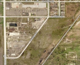
11901 S Ewing Ave
26-20-300-029-0000
Cook
Vacantlandnec
Illinois
X
0.64 AC
17031C0670J
South Chicago
2023
Chicago
2024
Chicago-Naperville-Elgin, IL-IN-WI
480500
DEMOGRAPHICS near 11901 S Ewing Ave
1 Mile
3 Mile
5 Mile
2024 Total Population
3,836
51,102
209,313
2029 Population
3,682
49,116
203,594
Pop Growth 2024-2029
(4.01%)
(3.89%)
(2.73%)
Average Age
40
39
39
2024 Total Households
1,238
18,253
78,394
HH Growth 2024-2029
(4.36%)
(3.99%)
(3.02%)
Median Household Inc
$65,539
$54,468
$46,665
Avg Household Size
3.10
2.70
2.60
2024 Avg HH Vehicles
2.00
2.00
1.00
Median Home Value
$169,767
$149,653
$140,154
Median Year Built
1954
1947
1949
Nearby Places
Map Layers
Map Styles
 Street
 Aerial
- Restaurants
- Banks
- Shops
- Fitness
- Groceries
PUBLIC TRANSPORTATION
COMMUTER RAIL
Hegewisch Station (South Shore Line - Northern Indiana Commuter Transportation District (South Shore Line))
DRIVE
WALK
Distance
Hegewisch Station (South Shore Line - Northern Indiana Commuter Transportation District (South Shore Line))
6 min
2.9 mi
Hammond-Whiting Amtrak Station (Wolverine - Amtrak)
DRIVE
WALK
Distance
Hammond-Whiting Amtrak Station (Wolverine - Amtrak)
9 min
3.6 mi
AIRPORT
Chicago Midway International
DRIVE
WALK
Distance
Chicago Midway International
33 min
17.7 mi
Chicago O'Hare International
DRIVE
WALK
Distance
Chicago O'Hare International
55 min
34.7 mi
Freight Ports
Port Milwaukee
DRIVE
WALK
Distance
Port Milwaukee
133 min
103.0 mi
Nearby Properties
Address
Land Use
TOTAL SIZE
Lot Size
Zoning
Address
Land Use
TOTAL SIZE
Lot Size
Zoning
282,089 SF
3.82 AC
R33
Address
Land Use
TOTAL SIZE
Lot Size
Zoning
112,300 SF
2.34 AC
Address
Land Use
TOTAL SIZE
Lot Size
Zoning
99,042 SF
255 AC
Address
Land Use
TOTAL SIZE
Lot Size
Zoning
196,210 SF
21.55 AC
Address
Land Use
TOTAL SIZE
Lot Size
Zoning
790,642 SF
37.20 AC
Address
Land Use
TOTAL SIZE
Lot Size
Zoning
244,773 SF
65.01 AC
Address
Land Use
TOTAL SIZE
Lot Size
Zoning
8,400 SF
65.94 AC
PMD 6
Address
Land Use
TOTAL SIZE
Lot Size
Zoning
678,912 SF
29.68 AC
Address
Land Use
TOTAL SIZE
Lot Size
Zoning
29.25 AC
PMD 6
Address
Land Use
TOTAL SIZE
Lot Size
Zoning
55,357 SF
5.23 AC
Address
Land Use
TOTAL SIZE
Lot Size
Zoning
600,448 SF
36.42 AC
Address
Land Use
TOTAL SIZE
Lot Size
Zoning
209,753 SF
8.94 AC
Address
Land Use
TOTAL SIZE
Lot Size
Zoning
108,999 SF
109.32 AC
Address
Land Use
TOTAL SIZE
Lot Size
Zoning
5,119 SF
55.47 AC
Address
Land Use
TOTAL SIZE
Lot Size
Zoning
46,056 SF
0.43 AC
Address
Land Use
TOTAL SIZE
Lot Size
Zoning
9,680 SF
5.26 AC
Address
Land Use
TOTAL SIZE
Lot Size
Zoning
344,488 SF
30.19 AC
Address
Land Use
TOTAL SIZE
Lot Size
Zoning
92,633 SF
8 AC
Address
Land Use
TOTAL SIZE
Lot Size
Zoning
35,133 SF
0.20 AC
Address
Land Use
TOTAL SIZE
Lot Size
Zoning
547,200 SF
29.76 AC
PD 804
Address
Land Use
TOTAL SIZE
Lot Size
Zoning
17,692 SF
32.17 AC
Address
Land Use
TOTAL SIZE
Lot Size
Zoning
361,023 SF
Address
Land Use
TOTAL SIZE
Lot Size
Zoning
60,220 SF
3.28 AC
Address
Land Use
TOTAL SIZE
Lot Size
Zoning
49,250 SF
7.62 AC
Address
Land Use
TOTAL SIZE
Lot Size
Zoning
592 SF
8.81 AC
Address
Land Use
TOTAL SIZE
Lot Size
Zoning
460,800 SF
20.63 AC
PD 804
Address
Land Use
TOTAL SIZE
Lot Size
Zoning
17,360 SF
6.74 AC
Address
Land Use
TOTAL SIZE
Lot Size
Zoning
11,862 SF
137.06 AC
Address
Land Use
TOTAL SIZE
Lot Size
Zoning
164,909 SF
14.28 AC
PD 248
Address
Land Use
TOTAL SIZE
Lot Size
Zoning
607,000 SF
The World's #1 Commercial Real Estate Marketplace
Connect with us
© 2025 CoStar Group
The information above has been obtained from sources believed reliable. While we do not doubt its accuracy we have not verified it and make no guarantee, warranty or representation about it. It is your responsibility to independently confirm its accuracy and completeness. Any projections, opinions, assumptions, or estimates used are for example only and do not represent the current or future performance of the property. The value of this transaction to you depends on tax and other factors which should be evaluated by your tax, financial, and legal advisors. You and your advisors should conduct a careful, independent investigation of the property to determine to your satisfaction the suitability of the property for your needs.