Property Record
W Battaglia Rd, , AZ
NEARBY LISTINGS FOR SALE OR LEASE
Property Detail
W Battaglia Rd
Phoenix-Mesa-Scottsdale, AZ
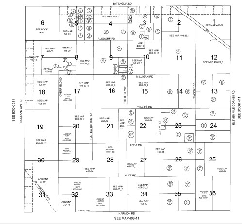
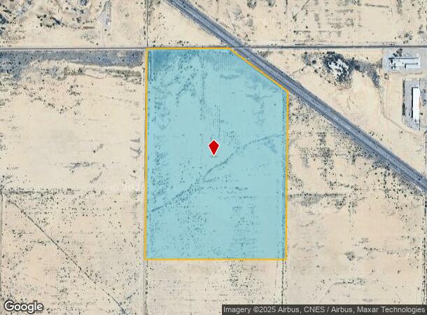
Landmark Ranch Unit 1 Parcel 2
408-01-001F
NW OF SEC 2-LYING S & W OF INTERSTATE HWY #10 & N1/2 OF SW ALL IN SEC 2-8S-7E 226.30 AC
Vacantlandnec
Pinal
A
Arizona
04021C1590F
226.30 AC
2024
Pinal County
2025
Phoenix
001900
DEMOGRAPHICS near W Battaglia Rd
1 Mile
3 Mile
5 Mile
2024 Total Population
0
8,390
23,775
2029 Population
0
10,730
30,789
Pop Growth 2024-2029
0.00%
+ 27.89%
+ 29.50%
Average Age
0
36
43
2024 Total Households
0
2,690
9,115
HH Growth 2024-2029
0.00%
+ 27.58%
+ 29.47%
Median Household Inc
$0
$43,031
$52,409
Avg Household Size
.00
3.10
2.60
2024 Avg HH Vehicles
.00
2.00
2.00
Median Home Value
$0
$86,137
$192,453
Median Year Built
0
1987
2003
Nearby Places
Map Layers
Map Styles
 Street
 Aerial
- Restaurants
- Banks
- Shops
- Fitness
- Groceries
SALE & LEASE HISTORY
LISTING DATE
SALE/LEASE

Apr 06, 2021
For Sale
Nearby Properties
Address
Land Use
TOTAL SIZE
Lot Size
Zoning
Address
Land Use
TOTAL SIZE
Lot Size
Zoning
134,131 SF
44.33 AC
Address
Land Use
TOTAL SIZE
Lot Size
Zoning
22.79 AC
Address
Land Use
TOTAL SIZE
Lot Size
Zoning
37,469 SF
20.01 AC
UNDESIGNAT
Address
Land Use
TOTAL SIZE
Lot Size
Zoning
71,361 SF
15.19 AC
Address
Land Use
TOTAL SIZE
Lot Size
Zoning
107,496 SF
20 AC
UNDESIGNAT
Address
Land Use
TOTAL SIZE
Lot Size
Zoning
178.50 AC
Address
Land Use
TOTAL SIZE
Lot Size
Zoning
11,382 SF
13.33 AC
Address
Land Use
TOTAL SIZE
Lot Size
Zoning
17,880 SF
4.11 AC
UNDESIGNAT
Address
Land Use
TOTAL SIZE
Lot Size
Zoning
27.14 AC
UNDESIGNAT
Address
Land Use
TOTAL SIZE
Lot Size
Zoning
Address
Land Use
TOTAL SIZE
Lot Size
Zoning
36,480 SF
18.12 AC
UNDESIGNAT
Address
Land Use
TOTAL SIZE
Lot Size
Zoning
70,027 SF
9.28 AC
Address
Land Use
TOTAL SIZE
Lot Size
Zoning
5.97 AC
UNDESIGNAT
Address
Land Use
TOTAL SIZE
Lot Size
Zoning
11,950 SF
2.28 AC
UNDESIGNAT
Address
Land Use
TOTAL SIZE
Lot Size
Zoning
51,979 SF
7.99 AC
UNDESIGNAT
Address
Land Use
TOTAL SIZE
Lot Size
Zoning
17.79 AC
Address
Land Use
TOTAL SIZE
Lot Size
Zoning
28,252 SF
10.35 AC
Address
Land Use
TOTAL SIZE
Lot Size
Zoning
4.12 AC
Address
Land Use
TOTAL SIZE
Lot Size
Zoning
21,800 SF
17.27 AC
UNDESIGNAT
Address
Land Use
TOTAL SIZE
Lot Size
Zoning
24,543 SF
2.28 AC
UNDESIGNAT
Address
Land Use
TOTAL SIZE
Lot Size
Zoning
46.81 AC
Address
Land Use
TOTAL SIZE
Lot Size
Zoning
21.54 AC
Address
Land Use
TOTAL SIZE
Lot Size
Zoning
11,852 SF
1.22 AC
Address
Land Use
TOTAL SIZE
Lot Size
Zoning
8,303 SF
0.69 AC
Address
Land Use
TOTAL SIZE
Lot Size
Zoning
10,000 SF
24.53 AC
Address
Land Use
TOTAL SIZE
Lot Size
Zoning
352 SF
22.81 AC
UNDESIGNAT
Address
Land Use
TOTAL SIZE
Lot Size
Zoning
60.31 AC
UNDESIGNAT
Address
Land Use
TOTAL SIZE
Lot Size
Zoning
5,136 SF
0.13 AC
Address
Land Use
TOTAL SIZE
Lot Size
Zoning
13,384 SF
23.96 AC
The World's #1 Commercial Real Estate Marketplace
Connect with us
© 2025 CoStar Group
The information above has been obtained from sources believed reliable. While we do not doubt its accuracy we have not verified it and make no guarantee, warranty or representation about it. It is your responsibility to independently confirm its accuracy and completeness. Any projections, opinions, assumptions, or estimates used are for example only and do not represent the current or future performance of the property. The value of this transaction to you depends on tax and other factors which should be evaluated by your tax, financial, and legal advisors. You and your advisors should conduct a careful, independent investigation of the property to determine to your satisfaction the suitability of the property for your needs.