Property Record
Security Blvd, Woodlawn, MD 21207
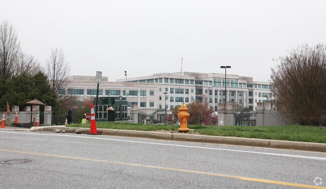

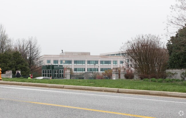
Property Detail
Security Blvd
01-2200014850
57.7775 AC PARCEL B HLTH CARE FINANCING ADM
Officebuilding
BALTIMORE
MLR
Maryland
B and X Area of moderate flood hazard, usually the area between the limits of the 100-year and 500-year floods.
57.77 AC
2024
Woodlawn
2025
Baltimore
401200
Baltimore-Columbia-Towson, MD
883,140 SF
NEARBY LISTINGS FOR SALE OR LEASE
DEMOGRAPHICS near Security Blvd
1 mile
3 mile
5 mile
2025 Total Population
18,362
92,223
283,921
2030 Population
18,446
92,190
282,229
Pop Growth 2025-2030
+ 0.46%
(0.04%)
(0.60%)
Average Age
36
40
41
2025 Total Households
6,884
34,702
109,697
HH Growth 2025-2030
+ 0.39%
(0.06%)
(0.72%)
Median Household Inc
$79,099
$81,139
$76,254
Avg Household Size
2.60
2.60
2.50
2025 Avg HH Vehicles
2.00
2.00
2.00
Median Home Value
$268,459
$299,445
$310,455
Median Year Built
1985
1969
1965
Nearby Places
Map Layers
Map Styles
 Street
 Aerial
Layers
 Traffic
 Biking
Places
Listings with unknown addresses are not visible on the map
- Restaurants
- Banks
- Shops
- Fitness
- Groceries
Nearby Properties
Address
Land Use
TOTAL SIZE
Lot Size
Zoning
Address
Land Use
TOTAL SIZE
Lot Size
Zoning
1,809,709 SF
50 AC
DR3.5
Address
Land Use
TOTAL SIZE
Lot Size
Zoning
608,642 SF
56.37 AC
DR3.5
Address
Land Use
TOTAL SIZE
Lot Size
Zoning
48,414 SF
19.18 AC
RA15
Address
Land Use
TOTAL SIZE
Lot Size
Zoning
271,096 SF
6 AC
02
Address
Land Use
TOTAL SIZE
Lot Size
Zoning
278,271 SF
55.16 AC
DR5.5
Address
Land Use
TOTAL SIZE
Lot Size
Zoning
233,082 SF
10.98 AC
Address
Land Use
TOTAL SIZE
Lot Size
Zoning
29.11 AC
DR16
Address
Land Use
TOTAL SIZE
Lot Size
Zoning
26.14 AC
DR16
Address
Land Use
TOTAL SIZE
Lot Size
Zoning
27.75 AC
DR16
Address
Land Use
TOTAL SIZE
Lot Size
Zoning
184,320 SF
13.37 AC
DR5.5
Address
Land Use
TOTAL SIZE
Lot Size
Zoning
16.75 AC
MLR02
Address
Land Use
TOTAL SIZE
Lot Size
Zoning
325,203 SF
6.24 AC
DR5.5
Address
Land Use
TOTAL SIZE
Lot Size
Zoning
16.70 AC
Address
Land Use
TOTAL SIZE
Lot Size
Zoning
26.88 AC
DR16
Address
Land Use
TOTAL SIZE
Lot Size
Zoning
29.14 AC
DR16
Address
Land Use
TOTAL SIZE
Lot Size
Zoning
19.10 AC
DR16
Address
Land Use
TOTAL SIZE
Lot Size
Zoning
131,176 SF
33.97 AC
BMCT
Address
Land Use
TOTAL SIZE
Lot Size
Zoning
118,460 SF
17.85 AC
O2
Address
Land Use
TOTAL SIZE
Lot Size
Zoning
23,962 SF
17.31 AC
BRCS2
Address
Land Use
TOTAL SIZE
Lot Size
Zoning
23.78 AC
DR5.5
Address
Land Use
TOTAL SIZE
Lot Size
Zoning
129,423 SF
38.77 AC
DR5.5
Address
Land Use
TOTAL SIZE
Lot Size
Zoning
2,960 SF
18.72 AC
DR3.5
Address
Land Use
TOTAL SIZE
Lot Size
Zoning
22.99 AC
DR16
Address
Land Use
TOTAL SIZE
Lot Size
Zoning
194,844 SF
14.33 AC
ML
Address
Land Use
TOTAL SIZE
Lot Size
Zoning
19.35 AC
DR16
Address
Land Use
TOTAL SIZE
Lot Size
Zoning
12.07 AC
DR16
Address
Land Use
TOTAL SIZE
Lot Size
Zoning
11.01 AC
DR16
Address
Land Use
TOTAL SIZE
Lot Size
Zoning
162,386 SF
30.68 AC
DR5.5
Address
Land Use
TOTAL SIZE
Lot Size
Zoning
116,645 SF
9.86 AC
The World's #1 Commercial Real Estate Marketplace
Connect with us
© 2026 CoStar Group
The information above has been obtained from sources believed reliable. While we do not doubt its accuracy we have not verified it and make no guarantee, warranty or representation about it. It is your responsibility to independently confirm its accuracy and completeness. Any projections, opinions, assumptions, or estimates used are for example only and do not represent the current or future performance of the property. The value of this transaction to you depends on tax and other factors which should be evaluated by your tax, financial, and legal advisors. You and your advisors should conduct a careful, independent investigation of the property to determine to your satisfaction the suitability of the property for your needs.