Property Record
Serv Rd N, Waskom, TX 75692
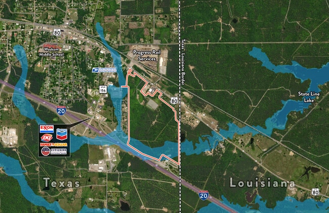
Property Detail
Serv Rd N
Longview, TX
E Pollock Survey A-566
R000045573
ACRES: 123.370 ABST: 566 E POLLOCK V
Ruralagriculturalresidence
Harrison
A
Texas
48203C0550F
123.37 AC
2024
Longview
2025
Other Market Areas
020106
NEARBY LISTINGS FOR SALE OR LEASE
-
-
View all Waskom listings for sale on LoopNet.com
DEMOGRAPHICS near Serv Rd N
1 mile
3 mile
5 mile
2024 Total Population
247
3,007
4,821
2029 Population
247
2,992
4,762
Pop Growth 2024-2029
0.00%
(0.50%)
(1.22%)
Average Age
42
42
43
2024 Total Households
93
1,150
1,896
HH Growth 2024-2029
0.00%
(0.43%)
(1.21%)
Median Household Inc
$39,999
$44,577
$51,852
Avg Household Size
2.70
2.60
2.50
2024 Avg HH Vehicles
2.00
2.00
2.00
Median Home Value
$78,571
$132,160
$159,063
Median Year Built
1980
1984
1986
Nearby Places
Map Layers
Map Styles
 Street
 Aerial
Transit
 Traffic
 Biking
Places
Listings with unknown addresses are not visible on the map
- Restaurants
- Banks
- Shops
- Fitness
- Groceries
PUBLIC TRANSPORTATION
AIRPORT
Shreveport Regional
Drive
Walk
Distance
Shreveport Regional
28 min
17.4 mi
Freight Ports
Port of Shreveport
Drive
Walk
Distance
Port of Shreveport
40 min
30.3 mi
SALE & LEASE HISTORY
LISTING DATE
SALE/LEASE

Jan 03, 2019
For Sale
Nearby Properties
Address
Land Use
TOTAL SIZE
Lot Size
Zoning
Address
Land Use
TOTAL SIZE
Lot Size
Zoning
89,896 SF
5.57 AC
Address
Land Use
TOTAL SIZE
Lot Size
Zoning
14,580 SF
1.43 AC
Address
Land Use
TOTAL SIZE
Lot Size
Zoning
18,370 SF
15.98 AC
Address
Land Use
TOTAL SIZE
Lot Size
Zoning
14,654 SF
1.46 AC
Address
Land Use
TOTAL SIZE
Lot Size
Zoning
800 SF
2.24 AC
Address
Land Use
TOTAL SIZE
Lot Size
Zoning
12,000 SF
2 AC
Address
Land Use
TOTAL SIZE
Lot Size
Zoning
15,696 SF
20.26 AC
Address
Land Use
TOTAL SIZE
Lot Size
Zoning
5,500 SF
15.78 AC
Address
Land Use
TOTAL SIZE
Lot Size
Zoning
3,600 SF
5 AC
Address
Land Use
TOTAL SIZE
Lot Size
Zoning
6,032 SF
0.33 AC
Address
Land Use
TOTAL SIZE
Lot Size
Zoning
7,255 SF
1.32 AC
Address
Land Use
TOTAL SIZE
Lot Size
Zoning
10,000 SF
4.72 AC
Address
Land Use
TOTAL SIZE
Lot Size
Zoning
18,656 SF
0.45 AC
Address
Land Use
TOTAL SIZE
Lot Size
Zoning
16,990 SF
3.04 AC
Address
Land Use
TOTAL SIZE
Lot Size
Zoning
6,640 SF
2.51 AC
Address
Land Use
TOTAL SIZE
Lot Size
Zoning
5,580 SF
1.42 AC
Address
Land Use
TOTAL SIZE
Lot Size
Zoning
10,705 SF
1.28 AC
Address
Land Use
TOTAL SIZE
Lot Size
Zoning
1,456 SF
5.08 AC
Address
Land Use
TOTAL SIZE
Lot Size
Zoning
4,457 SF
0.85 AC
Address
Land Use
TOTAL SIZE
Lot Size
Zoning
2,380 SF
3.93 AC
Address
Land Use
TOTAL SIZE
Lot Size
Zoning
9,100 SF
0.90 AC
Address
Land Use
TOTAL SIZE
Lot Size
Zoning
13,000 SF
2.46 AC
Address
Land Use
TOTAL SIZE
Lot Size
Zoning
3,329 SF
66.27 AC
Address
Land Use
TOTAL SIZE
Lot Size
Zoning
3,420 SF
154.59 AC
Address
Land Use
TOTAL SIZE
Lot Size
Zoning
7,666 SF
5.30 AC
Address
Land Use
TOTAL SIZE
Lot Size
Zoning
6,104 SF
1 AC
Address
Land Use
TOTAL SIZE
Lot Size
Zoning
237.40 AC
Address
Land Use
TOTAL SIZE
Lot Size
Zoning
3,744 SF
14.99 AC
Address
Land Use
TOTAL SIZE
Lot Size
Zoning
2,707 SF
17.67 AC
Address
Land Use
TOTAL SIZE
Lot Size
Zoning
3,024 SF
5 AC
The World's #1 Commercial Real Estate Marketplace
Connect with us
© 2026 CoStar Group
The information above has been obtained from sources believed reliable. While we do not doubt its accuracy we have not verified it and make no guarantee, warranty or representation about it. It is your responsibility to independently confirm its accuracy and completeness. Any projections, opinions, assumptions, or estimates used are for example only and do not represent the current or future performance of the property. The value of this transaction to you depends on tax and other factors which should be evaluated by your tax, financial, and legal advisors. You and your advisors should conduct a careful, independent investigation of the property to determine to your satisfaction the suitability of the property for your needs.