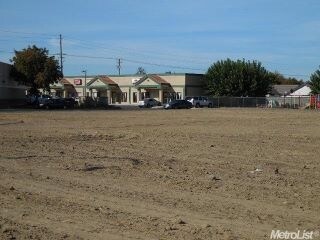
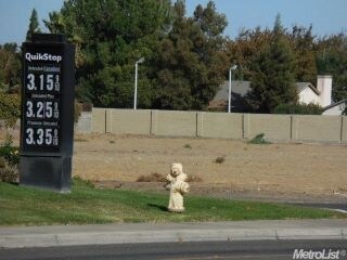
Property Record
Service Rd, Ceres, CA 95307


Property Detail
Service Rd
Modesto, CA
PCL 3 42 PM 9
053-52-32
STANISLAUS
Commercialacreage
California
B and X Area of moderate flood hazard, usually the area between the limits of the 100-year and 500-year floods.
3
2025
3.23 AC
2025
Modesto
002602
Stockton/Modesto
NEARBY LISTINGS FOR SALE OR LEASE
DEMOGRAPHICS near Service Rd
1 mile
3 mile
5 mile
2025 Total Population
13,071
75,111
147,797
2030 Population
13,153
75,488
148,614
Pop Growth 2025-2030
+ 0.63%
+ 0.50%
+ 0.55%
Average Age
35
35
35
2025 Total Households
3,415
20,387
42,504
HH Growth 2025-2030
+ 0.64%
+ 0.54%
+ 0.56%
Median Household Inc
$90,736
$74,977
$70,784
Avg Household Size
3.80
3.60
3.40
2025 Avg HH Vehicles
2.00
2.00
2.00
Median Home Value
$443,003
$421,300
$402,881
Median Year Built
1994
1981
1976
Nearby Places
Map Layers
Map Styles
 Street
 Aerial
Transit
 Traffic
 Biking
Places
Listings with unknown addresses are not visible on the map
- Restaurants
- Banks
- Shops
- Fitness
- Groceries
SALE & LEASE HISTORY
LISTING DATE
SALE/LEASE

Sep 24, 2016
For Sale
Mar 29, 2017
For Sale
Nearby Properties
Address
Land Use
TOTAL SIZE
Lot Size
Zoning
Address
Land Use
TOTAL SIZE
Lot Size
Zoning
782,375 SF
119.40 AC
Address
Land Use
TOTAL SIZE
Lot Size
Zoning
877,788 SF
103.22 AC
MI
Address
Land Use
TOTAL SIZE
Lot Size
Zoning
726,299 SF
38.86 AC
M2
Address
Land Use
TOTAL SIZE
Lot Size
Zoning
774,633 SF
39.18 AC
MODM2
Address
Land Use
TOTAL SIZE
Lot Size
Zoning
1,897,790 SF
92.04 AC
M2
Address
Land Use
TOTAL SIZE
Lot Size
Zoning
697,000 SF
37.82 AC
MODM2
Address
Land Use
TOTAL SIZE
Lot Size
Zoning
4,558 SF
77.52 AC
A240
Address
Land Use
TOTAL SIZE
Lot Size
Zoning
194,384 SF
17.34 AC
MODM2
Address
Land Use
TOTAL SIZE
Lot Size
Zoning
186,058 SF
14.35 AC
CERRC
Address
Land Use
TOTAL SIZE
Lot Size
Zoning
204,801 SF
12.99 AC
M2
Address
Land Use
TOTAL SIZE
Lot Size
Zoning
326,176 SF
14.92 AC
MODM2
Address
Land Use
TOTAL SIZE
Lot Size
Zoning
255,404 SF
17.49 AC
Address
Land Use
TOTAL SIZE
Lot Size
Zoning
71,572 SF
5.35 AC
Address
Land Use
TOTAL SIZE
Lot Size
Zoning
362,384 SF
19.43 AC
Address
Land Use
TOTAL SIZE
Lot Size
Zoning
61,640 SF
5.39 AC
Address
Land Use
TOTAL SIZE
Lot Size
Zoning
174,524 SF
11.61 AC
M
Address
Land Use
TOTAL SIZE
Lot Size
Zoning
172,380 SF
11.92 AC
M2
Address
Land Use
TOTAL SIZE
Lot Size
Zoning
102,489 SF
10.27 AC
C2
Address
Land Use
TOTAL SIZE
Lot Size
Zoning
75,262 SF
2.31 AC
C1
Address
Land Use
TOTAL SIZE
Lot Size
Zoning
325,000 SF
14.26 AC
Address
Land Use
TOTAL SIZE
Lot Size
Zoning
57,395 SF
3.43 AC
CERIP
Address
Land Use
TOTAL SIZE
Lot Size
Zoning
88,283 SF
11.48 AC
Address
Land Use
TOTAL SIZE
Lot Size
Zoning
62,761 SF
5.27 AC
Address
Land Use
TOTAL SIZE
Lot Size
Zoning
87,361 SF
3.84 AC
CERPC
Address
Land Use
TOTAL SIZE
Lot Size
Zoning
66,169 SF
4.06 AC
Address
Land Use
TOTAL SIZE
Lot Size
Zoning
98,100 SF
5.65 AC
Address
Land Use
TOTAL SIZE
Lot Size
Zoning
2.14 AC
CERRC
Address
Land Use
TOTAL SIZE
Lot Size
Zoning
64,747 SF
3.85 AC
Address
Land Use
TOTAL SIZE
Lot Size
Zoning
41,223 SF
18.03 AC
CERPC
Address
Land Use
TOTAL SIZE
Lot Size
Zoning
33,600 SF
3.01 AC
M
The World's #1 Commercial Real Estate Marketplace
Connect with us
© 2026 CoStar Group
The information above has been obtained from sources believed reliable. While we do not doubt its accuracy we have not verified it and make no guarantee, warranty or representation about it. It is your responsibility to independently confirm its accuracy and completeness. Any projections, opinions, assumptions, or estimates used are for example only and do not represent the current or future performance of the property. The value of this transaction to you depends on tax and other factors which should be evaluated by your tax, financial, and legal advisors. You and your advisors should conduct a careful, independent investigation of the property to determine to your satisfaction the suitability of the property for your needs.