Property Record
Sessions Dr, Grand Rapids, MI 49534

Property Detail
Sessions Dr
Grand Rapids-Wyoming-Kentwood, MI
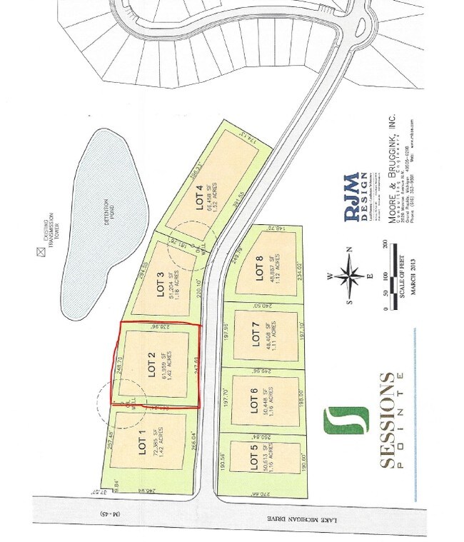
UNIT 2 SESSIONS POINTE BUSINESS PARK CONDOMINIUMS AS RECORDED IN OTTAWA COUNTY REGISTER OF DEEDS DOC # 2008-0044520 CONDO
70-10-24-392-002
OTTAWA
Commercialacreage
Michigan
B and X Area of moderate flood hazard, usually the area between the limits of the 100-year and 500-year floods.
1.42 AC
2025
Northern Ottawa County
2025
West Michigan
011701
NEARBY LISTINGS FOR SALE OR LEASE
DEMOGRAPHICS near Sessions Dr
1 mile
3 mile
5 mile
2025 Total Population
2,855
24,722
74,642
2030 Population
2,999
25,527
76,547
Pop Growth 2025-2030
+ 5.04%
+ 3.26%
+ 2.55%
Average Age
39
40
39
2025 Total Households
1,026
10,128
28,165
HH Growth 2025-2030
+ 5.17%
+ 3.28%
+ 2.75%
Median Household Inc
$76,042
$76,630
$80,469
Avg Household Size
2.70
2.40
2.40
2025 Avg HH Vehicles
2.00
2.00
2.00
Median Home Value
$276,169
$299,514
$291,289
Median Year Built
1997
1988
1978
Nearby Places
Map Layers
Map Styles
 Street
 Aerial
Layers
 Traffic
 Biking
Places
Listings with unknown addresses are not visible on the map
- Restaurants
- Banks
- Shops
- Fitness
- Groceries
PUBLIC TRANSPORTATION
COMMUTER RAIL
Grand Rapids Vernon J. Ehlers Station (Pere Marquette - Amtrak)
Drive
Walk
Distance
Grand Rapids Vernon J. Ehlers Station (Pere Marquette - Amtrak)
14 min
7.2 mi
AIRPORT
Gerald R Ford International
Drive
Walk
Distance
Gerald R Ford International
33 min
21.4 mi
Freight Ports
Port Milwaukee
Drive
Walk
Distance
Port Milwaukee
304 min
261.1 mi
SALE & LEASE HISTORY
LISTING DATE
SALE/LEASE

Sep 24, 2016
For Sale
Mar 22, 2019
For Sale
Nearby Properties
Address
Land Use
TOTAL SIZE
Lot Size
Zoning
Address
Land Use
TOTAL SIZE
Lot Size
Zoning
390,682 SF
47.73 AC
ARM - MULT
Address
Land Use
TOTAL SIZE
Lot Size
Zoning
389,181 SF
51.01 AC
RPUD - 2
Address
Land Use
TOTAL SIZE
Lot Size
Zoning
32.89 AC
TN-LDR
Address
Land Use
TOTAL SIZE
Lot Size
Zoning
245,620 SF
20.13 AC
RPUD - 2
Address
Land Use
TOTAL SIZE
Lot Size
Zoning
209,522 SF
27.89 AC
CPUD
Address
Land Use
TOTAL SIZE
Lot Size
Zoning
147,232 SF
18.42 AC
ARM - MULT
Address
Land Use
TOTAL SIZE
Lot Size
Zoning
107,800 SF
13.29 AC
CPUD
Address
Land Use
TOTAL SIZE
Lot Size
Zoning
104,295 SF
8.91 AC
SD-PRD
Address
Land Use
TOTAL SIZE
Lot Size
Zoning
140,841 SF
8.96 AC
Address
Land Use
TOTAL SIZE
Lot Size
Zoning
123,668 SF
Address
Land Use
TOTAL SIZE
Lot Size
Zoning
78,872 SF
3.09 AC
MON-LDR
Address
Land Use
TOTAL SIZE
Lot Size
Zoning
88,113 SF
12.50 AC
Address
Land Use
TOTAL SIZE
Lot Size
Zoning
4.80 AC
Address
Land Use
TOTAL SIZE
Lot Size
Zoning
37,268 SF
3.32 AC
Address
Land Use
TOTAL SIZE
Lot Size
Zoning
1,992 SF
48.64 AC
RMT
Address
Land Use
TOTAL SIZE
Lot Size
Zoning
53,600 SF
Address
Land Use
TOTAL SIZE
Lot Size
Zoning
67,821 SF
4.95 AC
Address
Land Use
TOTAL SIZE
Lot Size
Zoning
65,562 SF
8.18 AC
Address
Land Use
TOTAL SIZE
Lot Size
Zoning
2,173 SF
40.87 AC
RMT
Address
Land Use
TOTAL SIZE
Lot Size
Zoning
78,451 SF
4.57 AC
Address
Land Use
TOTAL SIZE
Lot Size
Zoning
47,178 SF
2.64 AC
Address
Land Use
TOTAL SIZE
Lot Size
Zoning
45,000 SF
2.31 AC
Address
Land Use
TOTAL SIZE
Lot Size
Zoning
13,255 SF
1.36 AC
CPUD
Address
Land Use
TOTAL SIZE
Lot Size
Zoning
62,978 SF
7.58 AC
Address
Land Use
TOTAL SIZE
Lot Size
Zoning
19,078 SF
3.46 AC
CPUD
Address
Land Use
TOTAL SIZE
Lot Size
Zoning
77,750 SF
5.46 AC
IPUD
Address
Land Use
TOTAL SIZE
Lot Size
Zoning
36,975 SF
Address
Land Use
TOTAL SIZE
Lot Size
Zoning
16,734 SF
3.76 AC
ORP
Address
Land Use
TOTAL SIZE
Lot Size
Zoning
20,020 SF
1.90 AC
C-1
Address
Land Use
TOTAL SIZE
Lot Size
Zoning
14,591 SF
6.38 AC
C-1
The World's #1 Commercial Real Estate Marketplace
Connect with us
© 2026 CoStar Group
The information above has been obtained from sources believed reliable. While we do not doubt its accuracy we have not verified it and make no guarantee, warranty or representation about it. It is your responsibility to independently confirm its accuracy and completeness. Any projections, opinions, assumptions, or estimates used are for example only and do not represent the current or future performance of the property. The value of this transaction to you depends on tax and other factors which should be evaluated by your tax, financial, and legal advisors. You and your advisors should conduct a careful, independent investigation of the property to determine to your satisfaction the suitability of the property for your needs.