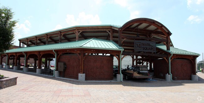
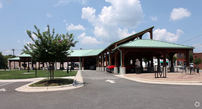
Property Record
Settle St, Reidsville, NC 27320
NEARBY LISTINGS FOR SALE OR LEASE
Property Detail
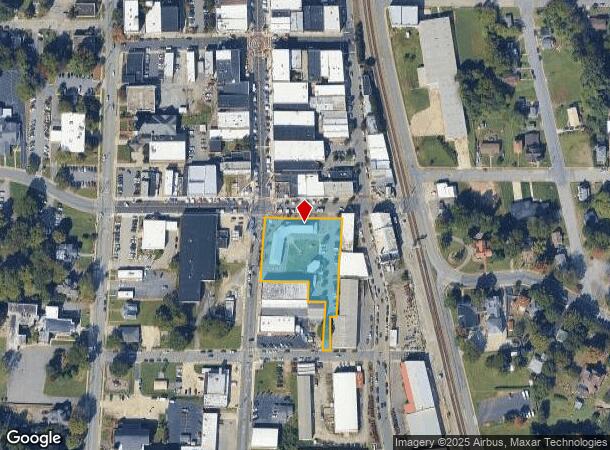
Settle St
173673
1.35 AC SETTLE ST
Governmentalpublicusegeneral
Rockingham
X
North Carolina
3710890500J
1.35 AC
2025
Rockingham County
2025
Greensboro/Winston-Salem
041502
Greensboro-High Point, NC
DEMOGRAPHICS near Settle St
1 Mile
3 Mile
5 Mile
2024 Total Population
6,287
17,471
24,711
2029 Population
6,508
18,055
25,479
Pop Growth 2024-2029
+ 3.52%
+ 3.34%
+ 3.11%
Average Age
42
42
43
2024 Total Households
2,758
7,682
10,714
HH Growth 2024-2029
+ 3.55%
+ 3.36%
+ 3.12%
Median Household Inc
$25,833
$30,769
$35,530
Avg Household Size
2.20
2.20
2.20
2024 Avg HH Vehicles
2.00
2.00
2.00
Median Home Value
$100,202
$137,021
$143,617
Median Year Built
1955
1969
1973
Nearby Places
Map Layers
Map Styles
 Street
 Aerial
- Restaurants
- Banks
- Shops
- Fitness
- Groceries
PUBLIC TRANSPORTATION
AIRPORT
Piedmont Triad International
DRIVE
WALK
Distance
Piedmont Triad International
44 min
31.1 mi
Nearby Properties
Address
Land Use
TOTAL SIZE
Lot Size
Zoning
Address
Land Use
TOTAL SIZE
Lot Size
Zoning
195,076 SF
13.32 AC
OFFICE&INS
Address
Land Use
TOTAL SIZE
Lot Size
Zoning
26,544 SF
9.50 AC
COND USE R
Address
Land Use
TOTAL SIZE
Lot Size
Zoning
204,811 SF
34.54 AC
HWY BUS RE
Address
Land Use
TOTAL SIZE
Lot Size
Zoning
26,814 SF
10.50 AC
RES 12 REI
Address
Land Use
TOTAL SIZE
Lot Size
Zoning
208,950 SF
27.55 AC
HVY INDUST
Address
Land Use
TOTAL SIZE
Lot Size
Zoning
3,640 SF
60.89 AC
HVY INDUST
Address
Land Use
TOTAL SIZE
Lot Size
Zoning
112,953 SF
75 AC
RES 20 REI
Address
Land Use
TOTAL SIZE
Lot Size
Zoning
61,494 SF
35.85 AC
RES 20 REI
Address
Land Use
TOTAL SIZE
Lot Size
Zoning
23,046 SF
10 AC
RES 12 REI
Address
Land Use
TOTAL SIZE
Lot Size
Zoning
135,451 SF
31.68 AC
HWY BUS RE
Address
Land Use
TOTAL SIZE
Lot Size
Zoning
258,288 SF
54.97 AC
HVY INDUST
Address
Land Use
TOTAL SIZE
Lot Size
Zoning
452,063 SF
37.92 AC
HVY INDUST
Address
Land Use
TOTAL SIZE
Lot Size
Zoning
451,624 SF
56.68 AC
HVY INDUST
Address
Land Use
TOTAL SIZE
Lot Size
Zoning
160,800 SF
19.13 AC
HVY INDUST
Address
Land Use
TOTAL SIZE
Lot Size
Zoning
144,346 SF
22.56 AC
HVY INDUST
Address
Land Use
TOTAL SIZE
Lot Size
Zoning
25,348 SF
3.47 AC
OFFICE&INS
Address
Land Use
TOTAL SIZE
Lot Size
Zoning
78,762 SF
11.50 AC
HWY BUS RE
Address
Land Use
TOTAL SIZE
Lot Size
Zoning
23,093 SF
14.63 AC
OFFICE&INS
Address
Land Use
TOTAL SIZE
Lot Size
Zoning
67,862 SF
26.21 AC
IN MORE TH
Address
Land Use
TOTAL SIZE
Lot Size
Zoning
12,904 SF
17.40 AC
HWY BUS RE
Address
Land Use
TOTAL SIZE
Lot Size
Zoning
38,765 SF
1.72 AC
HWY BUS RE
Address
Land Use
TOTAL SIZE
Lot Size
Zoning
96,209 SF
10.17 AC
HVY INDUST
Address
Land Use
TOTAL SIZE
Lot Size
Zoning
42,972 SF
7.69 AC
HWY BUS RE
Address
Land Use
TOTAL SIZE
Lot Size
Zoning
46,055 SF
7.89 AC
HWY BUS RE
Address
Land Use
TOTAL SIZE
Lot Size
Zoning
20,984 SF
26.67 AC
RES 20 REI
Address
Land Use
TOTAL SIZE
Lot Size
Zoning
47,365 SF
14.46 AC
HVY INDUST
Address
Land Use
TOTAL SIZE
Lot Size
Zoning
15,712 SF
14.62 AC
IN MORE TH
Address
Land Use
TOTAL SIZE
Lot Size
Zoning
113,496 SF
14.75 AC
HVY INDUST
Address
Land Use
TOTAL SIZE
Lot Size
Zoning
14,732 SF
2 AC
HWY BUS RE
Address
Land Use
TOTAL SIZE
Lot Size
Zoning
8,120 SF
4.85 AC
RES 12 REI
The World's #1 Commercial Real Estate Marketplace
Connect with us
© 2026 CoStar Group
The information above has been obtained from sources believed reliable. While we do not doubt its accuracy we have not verified it and make no guarantee, warranty or representation about it. It is your responsibility to independently confirm its accuracy and completeness. Any projections, opinions, assumptions, or estimates used are for example only and do not represent the current or future performance of the property. The value of this transaction to you depends on tax and other factors which should be evaluated by your tax, financial, and legal advisors. You and your advisors should conduct a careful, independent investigation of the property to determine to your satisfaction the suitability of the property for your needs.