Property Record
Sh19 N State Highway 19 N, Riverside, TX 77367

Save to a Folder
{{folder.Name}}
{{folder.ListingIds.length}} Properties
{{folder.ListingIds.length}} Property
Create a New Folder
Property Detail
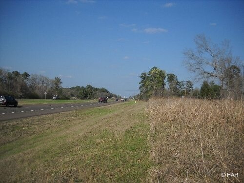
Sh19 N State Highway 19 N
Huntsville, TX
PORTER J (A-38), TRACT 20, ACRES 37.43
14103
WALKER
Residentialacreage
Texas
B and X Area of moderate flood hazard, usually the area between the limits of the 100-year and 500-year floods.
37.43 AC
2025
Texas East Area
2025
Other Market Areas
790103
NEARBY LISTINGS FOR SALE OR LEASE
-
-
View all Riverside listings for sale on LoopNet.com
DEMOGRAPHICS near Sh19 N State Highway 19 N
1 mile
3 mile
5 mile
2025 Total Population
502
3,419
6,665
2030 Population
540
3,664
7,136
Pop Growth 2025-2030
+ 7.57%
+ 7.17%
+ 7.07%
Average Age
43
44
43
2025 Total Households
203
1,188
2,507
HH Growth 2025-2030
+ 8.37%
+ 8.42%
+ 8.06%
Median Household Inc
$59,582
$62,812
$62,810
Avg Household Size
2.40
2.40
2.40
2025 Avg HH Vehicles
2.00
2.00
2.00
Median Home Value
$116,000
$129,134
$118,647
Median Year Built
1998
1997
1996
Nearby Places
Map Layers
Map Styles
 Street
 Aerial
Layers
 Traffic
 Biking
Places
Listings with unknown addresses are not visible on the map
- Restaurants
- Banks
- Shops
- Fitness
- Groceries
Nearby Properties
Address
Land Use
TOTAL SIZE
Lot Size
Zoning
Address
Land Use
TOTAL SIZE
Lot Size
Zoning
345.58 AC
Address
Land Use
TOTAL SIZE
Lot Size
Zoning
51,390 SF
4.05 AC
Address
Land Use
TOTAL SIZE
Lot Size
Zoning
54,560 SF
6 AC
Address
Land Use
TOTAL SIZE
Lot Size
Zoning
11,708 SF
9.28 AC
Address
Land Use
TOTAL SIZE
Lot Size
Zoning
6,093 SF
550.64 AC
Address
Land Use
TOTAL SIZE
Lot Size
Zoning
4,752 SF
1.09 AC
Address
Land Use
TOTAL SIZE
Lot Size
Zoning
5,684 SF
189.67 AC
Address
Land Use
TOTAL SIZE
Lot Size
Zoning
26,196 SF
0.99 AC
Address
Land Use
TOTAL SIZE
Lot Size
Zoning
7,374 SF
46.70 AC
Address
Land Use
TOTAL SIZE
Lot Size
Zoning
600 SF
10.96 AC
Address
Land Use
TOTAL SIZE
Lot Size
Zoning
13,600 SF
2.19 AC
Address
Land Use
TOTAL SIZE
Lot Size
Zoning
51.53 AC
Address
Land Use
TOTAL SIZE
Lot Size
Zoning
2,256 SF
10 AC
Address
Land Use
TOTAL SIZE
Lot Size
Zoning
39,850 SF
3.72 AC
Address
Land Use
TOTAL SIZE
Lot Size
Zoning
1,800 SF
12.08 AC
Address
Land Use
TOTAL SIZE
Lot Size
Zoning
1,840 SF
150.80 AC
Address
Land Use
TOTAL SIZE
Lot Size
Zoning
1,296 SF
21.23 AC
Address
Land Use
TOTAL SIZE
Lot Size
Zoning
48,532 SF
3 AC
Address
Land Use
TOTAL SIZE
Lot Size
Zoning
3,001 SF
19.09 AC
Address
Land Use
TOTAL SIZE
Lot Size
Zoning
2,898 SF
30.40 AC
Address
Land Use
TOTAL SIZE
Lot Size
Zoning
24,097 SF
1.53 AC
Address
Land Use
TOTAL SIZE
Lot Size
Zoning
18,400 SF
0.93 AC
Address
Land Use
TOTAL SIZE
Lot Size
Zoning
28,390 SF
4.59 AC
Address
Land Use
TOTAL SIZE
Lot Size
Zoning
5,484 SF
7.35 AC
Address
Land Use
TOTAL SIZE
Lot Size
Zoning
28,915 SF
0.91 AC
Address
Land Use
TOTAL SIZE
Lot Size
Zoning
3,914 SF
54.09 AC
Address
Land Use
TOTAL SIZE
Lot Size
Zoning
2,119 SF
4.43 AC
Address
Land Use
TOTAL SIZE
Lot Size
Zoning
61.05 AC
Address
Land Use
TOTAL SIZE
Lot Size
Zoning
3,332 SF
124.32 AC
The World's #1 Commercial Real Estate Marketplace
Connect with us
© 2026 CoStar Group
The information above has been obtained from sources believed reliable. While we do not doubt its accuracy we have not verified it and make no guarantee, warranty or representation about it. It is your responsibility to independently confirm its accuracy and completeness. Any projections, opinions, assumptions, or estimates used are for example only and do not represent the current or future performance of the property. The value of this transaction to you depends on tax and other factors which should be evaluated by your tax, financial, and legal advisors. You and your advisors should conduct a careful, independent investigation of the property to determine to your satisfaction the suitability of the property for your needs.