Property Record
Shell Rd, Georgetown, TX 78628

Save to a Folder
{{folder.Name}}
{{folder.ListingIds.length}} Properties
{{folder.ListingIds.length}} Property
Create a New Folder
Property Detail
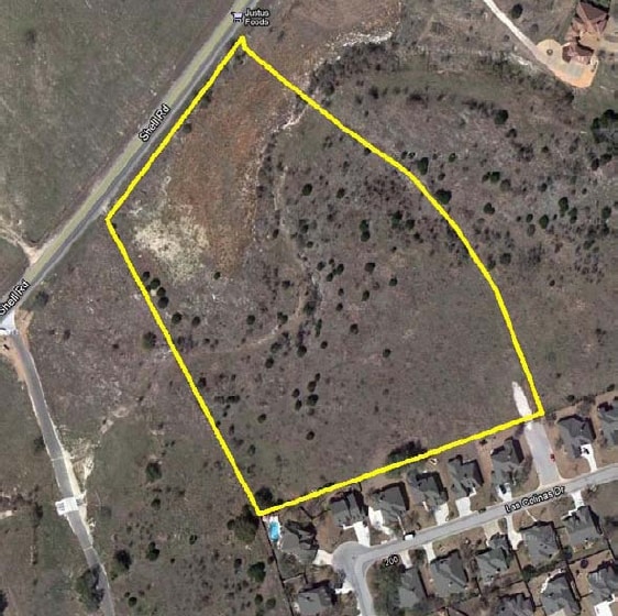
Shell Rd
Austin-Round Rock-San Marcos, TX
AW0524 AW0524 - ROBERTS, WM. SUR., ACRES 10.054
R365539
WILLIAMSON
Agriculturalland
Texas
B and X Area of moderate flood hazard, usually the area between the limits of the 100-year and 500-year floods.
10.05 AC
2024
Georgetown
2025
Austin
020121
NEARBY LISTINGS FOR SALE OR LEASE
DEMOGRAPHICS near Shell Rd
1 mile
3 mile
5 mile
2025 Total Population
2,905
29,122
64,412
2030 Population
3,298
33,047
74,097
Pop Growth 2025-2030
+ 13.53%
+ 13.48%
+ 15.04%
Average Age
47
54
50
2025 Total Households
1,109
13,522
28,718
HH Growth 2025-2030
+ 13.98%
+ 13.82%
+ 15.42%
Median Household Inc
$148,832
$101,738
$99,064
Avg Household Size
2.60
2.10
2.20
2025 Avg HH Vehicles
2.00
2.00
2.00
Median Home Value
$616,028
$471,372
$477,406
Median Year Built
2001
2004
2006
Nearby Places
Map Layers
Map Styles
 Street
 Aerial
Layers
 Traffic
 Biking
Places
Listings with unknown addresses are not visible on the map
- Restaurants
- Banks
- Shops
- Fitness
- Groceries
PUBLIC TRANSPORTATION
AIRPORT
Killeen Municipal
Drive
Walk
Distance
Killeen Municipal
46 min
35.7 mi
Robert Gray AAF
Drive
Walk
Distance
Robert Gray AAF
50 min
36.6 mi
Freight Ports
Calhoun Port
Drive
Walk
Distance
Calhoun Port
216 min
190.5 mi
SALE & LEASE HISTORY
LISTING DATE
SALE/LEASE

Mar 08, 2019
For Sale
Nearby Properties
Address
Land Use
TOTAL SIZE
Lot Size
Zoning
Address
Land Use
TOTAL SIZE
Lot Size
Zoning
389,888 SF
30 AC
1-MF
Address
Land Use
TOTAL SIZE
Lot Size
Zoning
200,200 SF
34.02 AC
Address
Land Use
TOTAL SIZE
Lot Size
Zoning
326,646 SF
19.33 AC
Address
Land Use
TOTAL SIZE
Lot Size
Zoning
425,144 SF
32.97 AC
Address
Land Use
TOTAL SIZE
Lot Size
Zoning
439,044 SF
32.68 AC
Address
Land Use
TOTAL SIZE
Lot Size
Zoning
233,173 SF
9.89 AC
Address
Land Use
TOTAL SIZE
Lot Size
Zoning
495,945 SF
56.14 AC
Address
Land Use
TOTAL SIZE
Lot Size
Zoning
326,666 SF
16.74 AC
Address
Land Use
TOTAL SIZE
Lot Size
Zoning
520,121 SF
56.73 AC
Address
Land Use
TOTAL SIZE
Lot Size
Zoning
120,653 SF
12.83 AC
Address
Land Use
TOTAL SIZE
Lot Size
Zoning
193,985 SF
38.17 AC
Address
Land Use
TOTAL SIZE
Lot Size
Zoning
298,302 SF
20.96 AC
Address
Land Use
TOTAL SIZE
Lot Size
Zoning
241,857 SF
26.60 AC
Address
Land Use
TOTAL SIZE
Lot Size
Zoning
200,746 SF
17.52 AC
Address
Land Use
TOTAL SIZE
Lot Size
Zoning
592 SF
42.32 AC
Address
Land Use
TOTAL SIZE
Lot Size
Zoning
154,603 SF
20.04 AC
Address
Land Use
TOTAL SIZE
Lot Size
Zoning
172,657 SF
8.84 AC
Address
Land Use
TOTAL SIZE
Lot Size
Zoning
174,955 SF
9.28 AC
Address
Land Use
TOTAL SIZE
Lot Size
Zoning
90,821 SF
41.97 AC
Address
Land Use
TOTAL SIZE
Lot Size
Zoning
160,042 SF
10.15 AC
Address
Land Use
TOTAL SIZE
Lot Size
Zoning
184,242 SF
11 AC
Address
Land Use
TOTAL SIZE
Lot Size
Zoning
129,281 SF
17.68 AC
Address
Land Use
TOTAL SIZE
Lot Size
Zoning
123,984 SF
6.89 AC
Address
Land Use
TOTAL SIZE
Lot Size
Zoning
209,508 SF
13.25 AC
Address
Land Use
TOTAL SIZE
Lot Size
Zoning
192.21 AC
Address
Land Use
TOTAL SIZE
Lot Size
Zoning
219,839 SF
24.74 AC
Address
Land Use
TOTAL SIZE
Lot Size
Zoning
22,936 SF
111.18 AC
Address
Land Use
TOTAL SIZE
Lot Size
Zoning
150,808 SF
7.72 AC
2-I
Address
Land Use
TOTAL SIZE
Lot Size
Zoning
100,956 SF
5.32 AC
Address
Land Use
TOTAL SIZE
Lot Size
Zoning
124,292 SF
8.67 AC
The World's #1 Commercial Real Estate Marketplace
Connect with us
© 2026 CoStar Group
The information above has been obtained from sources believed reliable. While we do not doubt its accuracy we have not verified it and make no guarantee, warranty or representation about it. It is your responsibility to independently confirm its accuracy and completeness. Any projections, opinions, assumptions, or estimates used are for example only and do not represent the current or future performance of the property. The value of this transaction to you depends on tax and other factors which should be evaluated by your tax, financial, and legal advisors. You and your advisors should conduct a careful, independent investigation of the property to determine to your satisfaction the suitability of the property for your needs.