Property Record
Sherman Rd, Galena, OH 43021


Property Detail
Sherman Rd
Columbus, OH
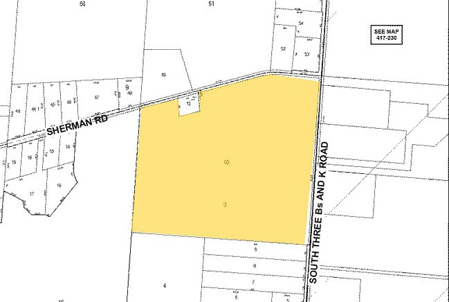
LANDS 18 4 1 7 8
418-140-02-010-000
DELAWARE
Recreationalacreage
Ohio
B and X Area of moderate flood hazard, usually the area between the limits of the 100-year and 500-year floods.
7
2024
51.91 AC
2024
Outlying Delaware County
011764
Columbus
NEARBY LISTINGS FOR SALE OR LEASE
DEMOGRAPHICS near Sherman Rd
1 mile
3 mile
5 mile
2025 Total Population
1,346
10,146
36,267
2030 Population
1,502
11,245
40,169
Pop Growth 2025-2030
+ 11.59%
+ 10.83%
+ 10.76%
Average Age
37
39
38
2025 Total Households
428
3,338
11,931
HH Growth 2025-2030
+ 11.92%
+ 11.02%
+ 10.86%
Median Household Inc
$170,258
$156,794
$150,538
Avg Household Size
3.10
3.00
3.00
2025 Avg HH Vehicles
2.00
2.00
2.00
Median Home Value
$650,398
$595,044
$521,068
Median Year Built
2010
2008
2008
Nearby Places
Map Layers
Map Styles
 Street
 Aerial
Layers
 Traffic
 Biking
Places
Listings with unknown addresses are not visible on the map
- Restaurants
- Banks
- Shops
- Fitness
- Groceries
PUBLIC TRANSPORTATION
AIRPORT
John Glenn Columbus International
Drive
Walk
Distance
John Glenn Columbus International
34 min
26.1 mi
Freight Ports
Port of Toledo
Drive
Walk
Distance
Port of Toledo
158 min
127.8 mi
SALE & LEASE HISTORY
LISTING DATE
SALE/LEASE

Sep 24, 2016
For Sale
Nearby Properties
Address
Land Use
TOTAL SIZE
Lot Size
Zoning
Address
Land Use
TOTAL SIZE
Lot Size
Zoning
388,229 SF
61.33 AC
Address
Land Use
TOTAL SIZE
Lot Size
Zoning
46,084 SF
22.60 AC
Address
Land Use
TOTAL SIZE
Lot Size
Zoning
60,007 SF
3,469.61 AC
Address
Land Use
TOTAL SIZE
Lot Size
Zoning
158,888 SF
89.14 AC
Address
Land Use
TOTAL SIZE
Lot Size
Zoning
76,049 SF
20.69 AC
Address
Land Use
TOTAL SIZE
Lot Size
Zoning
172.18 AC
Address
Land Use
TOTAL SIZE
Lot Size
Zoning
71,773 SF
28.79 AC
Address
Land Use
TOTAL SIZE
Lot Size
Zoning
31,600 SF
17.39 AC
Address
Land Use
TOTAL SIZE
Lot Size
Zoning
39,200 SF
19.47 AC
Address
Land Use
TOTAL SIZE
Lot Size
Zoning
35,922 SF
12.79 AC
Address
Land Use
TOTAL SIZE
Lot Size
Zoning
40,124 SF
293.58 AC
Address
Land Use
TOTAL SIZE
Lot Size
Zoning
1,584 SF
38.90 AC
Address
Land Use
TOTAL SIZE
Lot Size
Zoning
86.70 AC
Address
Land Use
TOTAL SIZE
Lot Size
Zoning
125.82 AC
Address
Land Use
TOTAL SIZE
Lot Size
Zoning
27,626 SF
2.06 AC
Address
Land Use
TOTAL SIZE
Lot Size
Zoning
2,304 SF
114.10 AC
Address
Land Use
TOTAL SIZE
Lot Size
Zoning
25,540 SF
22.37 AC
Address
Land Use
TOTAL SIZE
Lot Size
Zoning
560.16 AC
Address
Land Use
TOTAL SIZE
Lot Size
Zoning
12,133 SF
45.55 AC
Address
Land Use
TOTAL SIZE
Lot Size
Zoning
Address
Land Use
TOTAL SIZE
Lot Size
Zoning
96.63 AC
Address
Land Use
TOTAL SIZE
Lot Size
Zoning
3,769 SF
90.75 AC
Address
Land Use
TOTAL SIZE
Lot Size
Zoning
32,354 SF
2.72 AC
Address
Land Use
TOTAL SIZE
Lot Size
Zoning
60.19 AC
Address
Land Use
TOTAL SIZE
Lot Size
Zoning
33,999 SF
3.30 AC
Address
Land Use
TOTAL SIZE
Lot Size
Zoning
69.53 AC
Address
Land Use
TOTAL SIZE
Lot Size
Zoning
73,797 SF
23.53 AC
Address
Land Use
TOTAL SIZE
Lot Size
Zoning
20,806 SF
7.47 AC
Address
Land Use
TOTAL SIZE
Lot Size
Zoning
1,990 SF
62.64 AC
The World's #1 Commercial Real Estate Marketplace
Connect with us
© 2026 CoStar Group
The information above has been obtained from sources believed reliable. While we do not doubt its accuracy we have not verified it and make no guarantee, warranty or representation about it. It is your responsibility to independently confirm its accuracy and completeness. Any projections, opinions, assumptions, or estimates used are for example only and do not represent the current or future performance of the property. The value of this transaction to you depends on tax and other factors which should be evaluated by your tax, financial, and legal advisors. You and your advisors should conduct a careful, independent investigation of the property to determine to your satisfaction the suitability of the property for your needs.