Property Record
Sherwood Av & Wildwd Rd, Shafter, CA 93263
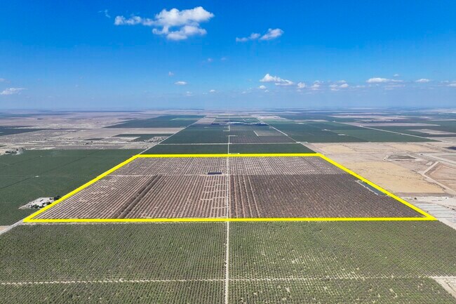


Property Detail
Sherwood Av & Wildwd Rd
059-270-01-01-9
SECTION 18 , TOWNSHIP 26 , RANGE 24 , QUARTER
Orchard
KERN
A
California
A Areas with a 1% annual chance of flooding and a 26% chance of flooding over the life of a 30-year mortgage.
631.12 AC
2024
NW Outlying Kern County
2025
Bakersfield
004102
Bakersfield-Delano, CA
NEARBY LISTINGS FOR SALE OR LEASE
-
-
View all Shafter listings for sale on LoopNet.com
DEMOGRAPHICS near Sherwood Av & Wildwd Rd
1 mile
3 mile
5 mile
2025 Total Population
19
136
1,828
2030 Population
19
135
1,828
Pop Growth 2025-2030
0.00%
(0.74%)
0.00%
Average Age
30
31
31
2025 Total Households
5
34
457
HH Growth 2025-2030
0.00%
0.00%
0.00%
Median Household Inc
$99,999
$74,999
$71,458
Avg Household Size
4.00
4.10
4.00
2025 Avg HH Vehicles
2.00
2.00
3.00
Median Home Value
$350,000
$383,333
$365,789
Median Year Built
1969
1982
1997
Nearby Places
Map Layers
Map Styles
 Street
 Aerial
Transit
 Traffic
 Biking
Places
Listings with unknown addresses are not visible on the map
- Restaurants
- Banks
- Shops
- Fitness
- Groceries
PUBLIC TRANSPORTATION
AIRPORT
Meadows Field
Drive
Walk
Distance
Meadows Field
59 min
33.2 mi
Freight Ports
The Port of Hueneme
Drive
Walk
Distance
The Port of Hueneme
207 min
157.9 mi
SALE & LEASE HISTORY
LISTING DATE
SALE/LEASE

Oct 09, 2025
For Sale
Nearby Properties
Address
Land Use
TOTAL SIZE
Lot Size
Zoning
Address
Land Use
TOTAL SIZE
Lot Size
Zoning
608.97 AC
A
Address
Land Use
TOTAL SIZE
Lot Size
Zoning
390.75 AC
Address
Land Use
TOTAL SIZE
Lot Size
Zoning
640 AC
A
Address
Land Use
TOTAL SIZE
Lot Size
Zoning
312.47 AC
A
Address
Land Use
TOTAL SIZE
Lot Size
Zoning
296.32 AC
A
Address
Land Use
TOTAL SIZE
Lot Size
Zoning
159.09 AC
A
Address
Land Use
TOTAL SIZE
Lot Size
Zoning
156.52 AC
A
Address
Land Use
TOTAL SIZE
Lot Size
Zoning
78.81 AC
A FP
Address
Land Use
TOTAL SIZE
Lot Size
Zoning
63.03 AC
A
Address
Land Use
TOTAL SIZE
Lot Size
Zoning
154.54 AC
A
Address
Land Use
TOTAL SIZE
Lot Size
Zoning
79.09 AC
A FP
Address
Land Use
TOTAL SIZE
Lot Size
Zoning
66.40 AC
A
Address
Land Use
TOTAL SIZE
Lot Size
Zoning
1,770 SF
3.27 AC
Address
Land Use
TOTAL SIZE
Lot Size
Zoning
155.34 AC
A
Address
Land Use
TOTAL SIZE
Lot Size
Zoning
319.30 AC
Address
Land Use
TOTAL SIZE
Lot Size
Zoning
79.09 AC
A FP
Address
Land Use
TOTAL SIZE
Lot Size
Zoning
39.24 AC
A
Address
Land Use
TOTAL SIZE
Lot Size
Zoning
159.09 AC
A
Address
Land Use
TOTAL SIZE
Lot Size
Zoning
130.61 AC
A
Address
Land Use
TOTAL SIZE
Lot Size
Zoning
20.04 AC
A
Address
Land Use
TOTAL SIZE
Lot Size
Zoning
2.50 AC
Address
Land Use
TOTAL SIZE
Lot Size
Zoning
1,104 SF
37.84 AC
A
Address
Land Use
TOTAL SIZE
Lot Size
Zoning
2.50 AC
The World's #1 Commercial Real Estate Marketplace
Connect with us
© 2026 CoStar Group
The information above has been obtained from sources believed reliable. While we do not doubt its accuracy we have not verified it and make no guarantee, warranty or representation about it. It is your responsibility to independently confirm its accuracy and completeness. Any projections, opinions, assumptions, or estimates used are for example only and do not represent the current or future performance of the property. The value of this transaction to you depends on tax and other factors which should be evaluated by your tax, financial, and legal advisors. You and your advisors should conduct a careful, independent investigation of the property to determine to your satisfaction the suitability of the property for your needs.