Property Record
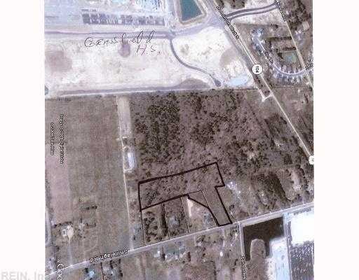
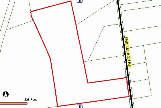
Shillelagh Rd, Chesapeake, VA 23323
Property Detail
Shillelagh Rd
0460000001380
LOTS 6-9 SUR C E & L W KNOWLES 13.084AC & PT STRIP
Residentialacreage
CHESAPEAKE
R15: RESID
Virginia
B and X Area of moderate flood hazard, usually the area between the limits of the 100-year and 500-year floods.
3.41 AC
2024
Southern Chesapeake
2025
Hampton Roads
021200
Virginia Beach-Chesapeake-Norfolk, VA-NC
NEARBY LISTINGS FOR SALE OR LEASE
DEMOGRAPHICS near Shillelagh Rd
1 mile
3 mile
5 mile
2025 Total Population
4,464
40,021
99,674
2030 Population
4,563
40,747
101,149
Pop Growth 2025-2030
+ 2.22%
+ 1.81%
+ 1.48%
Average Age
39
38
39
2025 Total Households
1,556
13,225
35,840
HH Growth 2025-2030
+ 2.25%
+ 1.88%
+ 1.50%
Median Household Inc
$148,012
$139,135
$105,478
Avg Household Size
2.90
3.00
2.70
2025 Avg HH Vehicles
2.00
2.00
2.00
Median Home Value
$467,708
$452,781
$403,350
Median Year Built
2001
1996
1992
Nearby Places
Map Layers
Map Styles
 Street
 Aerial
Transit
 Traffic
 Biking
Places
Listings with unknown addresses are not visible on the map
- Restaurants
- Banks
- Shops
- Fitness
- Groceries
PUBLIC TRANSPORTATION
AIRPORT
Norfolk International
Drive
Walk
Distance
Norfolk International
28 min
17.7 mi
Freight Ports
Virginia Port Authority - Portsmouth
Drive
Walk
Distance
Virginia Port Authority - Portsmouth
26 min
15.3 mi
Nearby Properties
Address
Land Use
TOTAL SIZE
Lot Size
Zoning
Address
Land Use
TOTAL SIZE
Lot Size
Zoning
6,820 SF
89.90 AC
R15S: RESI
Address
Land Use
TOTAL SIZE
Lot Size
Zoning
338,400 SF
96.79 AC
A1: AGRICU
Address
Land Use
TOTAL SIZE
Lot Size
Zoning
26.78 AC
RMF1: MULT
Address
Land Use
TOTAL SIZE
Lot Size
Zoning
195,637 SF
96.05 AC
RE1: RESID
Address
Land Use
TOTAL SIZE
Lot Size
Zoning
63,050 SF
27.71 AC
O-I: OFFIC
Address
Land Use
TOTAL SIZE
Lot Size
Zoning
107,223 SF
48.07 AC
O-I: OFFIC
Address
Land Use
TOTAL SIZE
Lot Size
Zoning
148,905 SF
7.32 AC
PUD: PLANN
Address
Land Use
TOTAL SIZE
Lot Size
Zoning
213,740 SF
26.51 AC
B2: GENERA
Address
Land Use
TOTAL SIZE
Lot Size
Zoning
91,968 SF
6.33 AC
O-I: OFFIC
Address
Land Use
TOTAL SIZE
Lot Size
Zoning
38,354 SF
2.23 AC
PUD: PLANN
Address
Land Use
TOTAL SIZE
Lot Size
Zoning
103,693 SF
5.83 AC
O-I: OFFIC
Address
Land Use
TOTAL SIZE
Lot Size
Zoning
4,300 SF
11.21 AC
PUD: PLANN
Address
Land Use
TOTAL SIZE
Lot Size
Zoning
53,454 SF
8.43 AC
B4: SHOPPI
Address
Land Use
TOTAL SIZE
Lot Size
Zoning
210,964 SF
55.68 AC
M1: LIGHT
Address
Land Use
TOTAL SIZE
Lot Size
Zoning
59,712 SF
8.33 AC
O-I: OFFIC
Address
Land Use
TOTAL SIZE
Lot Size
Zoning
48,360 SF
14.75 AC
M3: WATERF
Address
Land Use
TOTAL SIZE
Lot Size
Zoning
65,088 SF
20.50 AC
R10S: RESI
Address
Land Use
TOTAL SIZE
Lot Size
Zoning
43,800 SF
2.50 AC
PUD: PLANN
Address
Land Use
TOTAL SIZE
Lot Size
Zoning
63,350 SF
9.69 AC
B1: NEIGHB
Address
Land Use
TOTAL SIZE
Lot Size
Zoning
42,174 SF
5.28 AC
PUD: PLANN
Address
Land Use
TOTAL SIZE
Lot Size
Zoning
41,092 SF
5.96 AC
B1: NEIGHB
Address
Land Use
TOTAL SIZE
Lot Size
Zoning
71,438 SF
20.14 AC
B2: GENERA
Address
Land Use
TOTAL SIZE
Lot Size
Zoning
44,500 SF
15.54 AC
M3: WATERF
Address
Land Use
TOTAL SIZE
Lot Size
Zoning
58,190 SF
5.85 AC
B2: GENERA
Address
Land Use
TOTAL SIZE
Lot Size
Zoning
71.97 AC
MULTI: MUL
Address
Land Use
TOTAL SIZE
Lot Size
Zoning
26.90 AC
PUD: PLANN
Address
Land Use
TOTAL SIZE
Lot Size
Zoning
57,330 SF
16.52 AC
RMF1: MULT
Address
Land Use
TOTAL SIZE
Lot Size
Zoning
14.85 AC
RMF1: MULT
Address
Land Use
TOTAL SIZE
Lot Size
Zoning
1,536 SF
15.20 AC
PUD: PLANN
Address
Land Use
TOTAL SIZE
Lot Size
Zoning
73,075 SF
4.36 AC
M1: LIGHT
The World's #1 Commercial Real Estate Marketplace
Connect with us
© 2026 CoStar Group
The information above has been obtained from sources believed reliable. While we do not doubt its accuracy we have not verified it and make no guarantee, warranty or representation about it. It is your responsibility to independently confirm its accuracy and completeness. Any projections, opinions, assumptions, or estimates used are for example only and do not represent the current or future performance of the property. The value of this transaction to you depends on tax and other factors which should be evaluated by your tax, financial, and legal advisors. You and your advisors should conduct a careful, independent investigation of the property to determine to your satisfaction the suitability of the property for your needs.