Property Record
Shilling Dr, Elyria, OH 44035
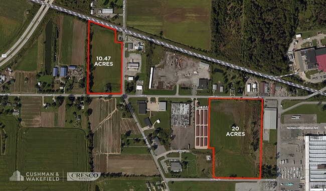

This Property Is For Sale
Property Detail
Shilling Dr
Cleveland-Elyria, OH
FROM -011
06-24-014-000-088
Lorain
Commercialacreage
Ohio
2024
10.93 AC
2024
Lorain County
070600
Cleveland
NEARBY LISTINGS FOR SALE OR LEASE
DEMOGRAPHICS near Shilling Dr
1 mile
3 mile
5 mile
2024 Total Population
2,907
35,109
108,505
2029 Population
3,025
36,598
112,949
Pop Growth 2024-2029
+ 4.06%
+ 4.24%
+ 4.10%
Average Age
41
41
41
2024 Total Households
1,349
15,290
45,943
HH Growth 2024-2029
+ 4.00%
+ 4.26%
+ 4.05%
Median Household Inc
$44,687
$42,840
$49,927
Avg Household Size
2.10
2.20
2.30
2024 Avg HH Vehicles
1.00
2.00
2.00
Median Home Value
$113,475
$116,444
$139,913
Median Year Built
1968
1959
1964
Nearby Places
Map Layers
Map Styles
 Street
 Aerial
Transit
 Traffic
 Biking
Places
Listings with unknown addresses are not visible on the map
- Restaurants
- Banks
- Shops
- Fitness
- Groceries
PUBLIC TRANSPORTATION
COMMUTER RAIL
Elyria Amtrak (Capitol Limited - Amtrak, Lake Shore Limited - Amtrak)
Drive
Walk
Distance
Elyria Amtrak (Capitol Limited - Amtrak, Lake Shore Limited - Amtrak)
9 min
4.7 mi
AIRPORT
Cleveland-Hopkins International
Drive
Walk
Distance
Cleveland-Hopkins International
31 min
19.9 mi
Freight Ports
Port of Toledo
Drive
Walk
Distance
Port of Toledo
108 min
87.6 mi
Nearby Properties
Address
Land Use
TOTAL SIZE
Lot Size
Zoning
Address
Land Use
TOTAL SIZE
Lot Size
Zoning
427,871 SF
6.24 AC
Address
Land Use
TOTAL SIZE
Lot Size
Zoning
351,623 SF
3.13 AC
Address
Land Use
TOTAL SIZE
Lot Size
Zoning
199,200 SF
1.77 AC
Address
Land Use
TOTAL SIZE
Lot Size
Zoning
264,274 SF
15.03 AC
Address
Land Use
TOTAL SIZE
Lot Size
Zoning
187,340 SF
42.98 AC
Address
Land Use
TOTAL SIZE
Lot Size
Zoning
61,570 SF
0.20 AC
Address
Land Use
TOTAL SIZE
Lot Size
Zoning
150,180 SF
20.21 AC
Address
Land Use
TOTAL SIZE
Lot Size
Zoning
112,888 SF
8.92 AC
Address
Land Use
TOTAL SIZE
Lot Size
Zoning
106,938 SF
1.12 AC
Address
Land Use
TOTAL SIZE
Lot Size
Zoning
32,784 SF
0.25 AC
Address
Land Use
TOTAL SIZE
Lot Size
Zoning
126,448 SF
22.54 AC
Address
Land Use
TOTAL SIZE
Lot Size
Zoning
158,510 SF
6.01 AC
Address
Land Use
TOTAL SIZE
Lot Size
Zoning
169,280 SF
15.56 AC
Address
Land Use
TOTAL SIZE
Lot Size
Zoning
194,787 SF
19.04 AC
Address
Land Use
TOTAL SIZE
Lot Size
Zoning
61,278 SF
8.25 AC
Address
Land Use
TOTAL SIZE
Lot Size
Zoning
89,540 SF
4.62 AC
Address
Land Use
TOTAL SIZE
Lot Size
Zoning
57,634 SF
4.73 AC
Address
Land Use
TOTAL SIZE
Lot Size
Zoning
56.71 AC
Address
Land Use
TOTAL SIZE
Lot Size
Zoning
971,475 SF
54.21 AC
Address
Land Use
TOTAL SIZE
Lot Size
Zoning
151,565 SF
0.11 AC
Address
Land Use
TOTAL SIZE
Lot Size
Zoning
39,249 SF
0.74 AC
Address
Land Use
TOTAL SIZE
Lot Size
Zoning
76,610 SF
2.49 AC
Address
Land Use
TOTAL SIZE
Lot Size
Zoning
29,864 SF
3.96 AC
Address
Land Use
TOTAL SIZE
Lot Size
Zoning
52,685 SF
13.19 AC
Address
Land Use
TOTAL SIZE
Lot Size
Zoning
21,693 SF
1.27 AC
Address
Land Use
TOTAL SIZE
Lot Size
Zoning
1,560 SF
47.20 AC
Address
Land Use
TOTAL SIZE
Lot Size
Zoning
42,095 SF
2.34 AC
Address
Land Use
TOTAL SIZE
Lot Size
Zoning
47,277 SF
54.68 AC
Address
Land Use
TOTAL SIZE
Lot Size
Zoning
56,244 SF
0.17 AC
Address
Land Use
TOTAL SIZE
Lot Size
Zoning
111,470 SF
8.34 AC
The World's #1 Commercial Real Estate Marketplace
Connect with us
© 2026 CoStar Group
The information above has been obtained from sources believed reliable. While we do not doubt its accuracy we have not verified it and make no guarantee, warranty or representation about it. It is your responsibility to independently confirm its accuracy and completeness. Any projections, opinions, assumptions, or estimates used are for example only and do not represent the current or future performance of the property. The value of this transaction to you depends on tax and other factors which should be evaluated by your tax, financial, and legal advisors. You and your advisors should conduct a careful, independent investigation of the property to determine to your satisfaction the suitability of the property for your needs.