Property Record
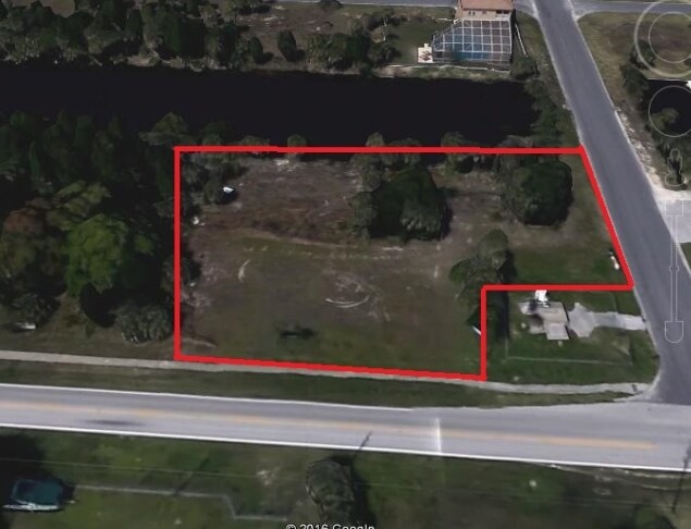
Shoal Line Blvd, Spring Hill, FL 34607

NEARBY LISTINGS FOR SALE OR LEASE
Property Detail
Shoal Line Blvd
Tampa-St. Petersburg-Clearwater, FL
Hernando Beach Unit 14-A
R18-423-17-0000-0010-0000
ALL OF SEC 18-23-17
Stateproperty
Hernando
0
Florida
2025
631.30 AC
041502
Hernando County
5,300 SF
Tampa/St Petersburg
DEMOGRAPHICS near Shoal Line Blvd
1 Mile
3 Mile
5 Mile
2024 Total Population
1,962
10,009
48,456
2029 Population
2,279
11,625
56,328
Pop Growth 2024-2029
+ 16.16%
+ 16.15%
+ 16.25%
Average Age
53
54
50
2024 Total Households
939
4,815
21,809
HH Growth 2024-2029
+ 16.08%
+ 16.07%
+ 16.32%
Median Household Inc
$74,327
$53,310
$51,267
Avg Household Size
2.10
2.00
2.20
2024 Avg HH Vehicles
2.00
2.00
2.00
Median Home Value
$343,356
$253,604
$222,621
Median Year Built
1986
1986
1987
Nearby Places
Map Layers
Map Styles
 Street
 Aerial
- Restaurants
- Banks
- Shops
- Fitness
- Groceries
SALE & LEASE HISTORY
LISTING DATE
SALE/LEASE

Sep 30, 2016
For Sale
Nearby Properties
Address
Land Use
TOTAL SIZE
Lot Size
Zoning
Address
Land Use
TOTAL SIZE
Lot Size
Zoning
222,888 SF
7 AC
Address
Land Use
TOTAL SIZE
Lot Size
Zoning
217,451 SF
19.40 AC
Address
Land Use
TOTAL SIZE
Lot Size
Zoning
232,408 SF
24.40 AC
Address
Land Use
TOTAL SIZE
Lot Size
Zoning
212,404 SF
13.06 AC
Address
Land Use
TOTAL SIZE
Lot Size
Zoning
118,173 SF
13.60 AC
Address
Land Use
TOTAL SIZE
Lot Size
Zoning
108,275 SF
1.79 AC
Address
Land Use
TOTAL SIZE
Lot Size
Zoning
115,496 SF
12.20 AC
Address
Land Use
TOTAL SIZE
Lot Size
Zoning
115,277 SF
8.40 AC
Address
Land Use
TOTAL SIZE
Lot Size
Zoning
226,102 SF
15.20 AC
Address
Land Use
TOTAL SIZE
Lot Size
Zoning
155,070 SF
10.69 AC
Address
Land Use
TOTAL SIZE
Lot Size
Zoning
89,263 SF
3.54 AC
Address
Land Use
TOTAL SIZE
Lot Size
Zoning
40,066 SF
1.99 AC
Address
Land Use
TOTAL SIZE
Lot Size
Zoning
Address
Land Use
TOTAL SIZE
Lot Size
Zoning
54,136 SF
8.20 AC
Address
Land Use
TOTAL SIZE
Lot Size
Zoning
103,808 SF
10.10 AC
Address
Land Use
TOTAL SIZE
Lot Size
Zoning
Address
Land Use
TOTAL SIZE
Lot Size
Zoning
67,576 SF
2.11 AC
Address
Land Use
TOTAL SIZE
Lot Size
Zoning
6,743 SF
3.47 AC
Address
Land Use
TOTAL SIZE
Lot Size
Zoning
83,815 SF
12.10 AC
Address
Land Use
TOTAL SIZE
Lot Size
Zoning
44,369 SF
2.64 AC
Address
Land Use
TOTAL SIZE
Lot Size
Zoning
47,910 SF
0.68 AC
Address
Land Use
TOTAL SIZE
Lot Size
Zoning
8,760 SF
2.29 AC
Address
Land Use
TOTAL SIZE
Lot Size
Zoning
35,276 SF
3.55 AC
Address
Land Use
TOTAL SIZE
Lot Size
Zoning
45,146 SF
3.21 AC
Address
Land Use
TOTAL SIZE
Lot Size
Zoning
34,389 SF
4.87 AC
Address
Land Use
TOTAL SIZE
Lot Size
Zoning
42,942 SF
4.55 AC
Address
Land Use
TOTAL SIZE
Lot Size
Zoning
83,834 SF
7 AC
Address
Land Use
TOTAL SIZE
Lot Size
Zoning
51,259 SF
4.89 AC
Address
Land Use
TOTAL SIZE
Lot Size
Zoning
18,480 SF
7.60 AC
Address
Land Use
TOTAL SIZE
Lot Size
Zoning
16,438 SF
4.16 AC
The World's #1 Commercial Real Estate Marketplace
Connect with us
© 2026 CoStar Group
The information above has been obtained from sources believed reliable. While we do not doubt its accuracy we have not verified it and make no guarantee, warranty or representation about it. It is your responsibility to independently confirm its accuracy and completeness. Any projections, opinions, assumptions, or estimates used are for example only and do not represent the current or future performance of the property. The value of this transaction to you depends on tax and other factors which should be evaluated by your tax, financial, and legal advisors. You and your advisors should conduct a careful, independent investigation of the property to determine to your satisfaction the suitability of the property for your needs.