No Photo
Property Record
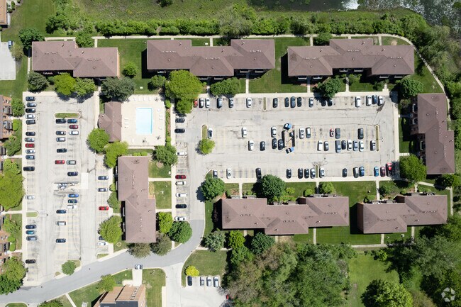
Shorewood Dr, Glendale Heights, IL 60139


NEARBY LISTINGS FOR SALE OR LEASE
Property Detail
Shorewood Dr
Chicago-Naperville-Elgin, IL-IN-WI
Shorewood-Phase 2
05-03-208-006
SHOREWOOD-PHASE 2 ALL
Commercialnec
DuPage
X
Illinois
17043C0064J
2
2024
5.95 AC
2024
Glen Ellyn to West Chicago Corridor
840911
Chicago
152,480 SF
DEMOGRAPHICS near Shorewood Dr
1 Mile
3 Mile
5 Mile
2024 Total Population
16,511
109,000
277,550
2029 Population
16,151
106,886
272,036
Pop Growth 2024-2029
(2.18%)
(1.94%)
(1.99%)
Average Age
38
39
41
2024 Total Households
6,058
38,434
101,757
HH Growth 2024-2029
(2.21%)
(1.94%)
(2.03%)
Median Household Inc
$83,048
$96,051
$97,463
Avg Household Size
2.60
2.70
2.60
2024 Avg HH Vehicles
2.00
2.00
2.00
Median Home Value
$270,483
$332,244
$330,539
Median Year Built
1978
1974
1975
Nearby Places
Map Layers
Map Styles
 Street
 Aerial
- Restaurants
- Banks
- Shops
- Fitness
- Groceries
PUBLIC TRANSPORTATION
COMMUTER RAIL
College Avenue Station (Union Pacific West Line - Northeast Illinois Regional Commuter Railroad (Metra))
DRIVE
WALK
Distance
College Avenue Station (Union Pacific West Line - Northeast Illinois Regional Commuter Railroad (Metra))
8 min
2.9 mi
Glen Ellyn Station (Union Pacific West Line - Northeast Illinois Regional Commuter Railroad (Metra))
DRIVE
WALK
Distance
Glen Ellyn Station (Union Pacific West Line - Northeast Illinois Regional Commuter Railroad (Metra))
8 min
3.1 mi
AIRPORT
Chicago O'Hare International
DRIVE
WALK
Distance
Chicago O'Hare International
31 min
18.8 mi
Chicago Midway International
DRIVE
WALK
Distance
Chicago Midway International
39 min
23.7 mi
Freight Ports
Port Milwaukee
DRIVE
WALK
Distance
Port Milwaukee
112 min
90.8 mi
Nearby Properties
Address
Land Use
TOTAL SIZE
Lot Size
Zoning
Address
Land Use
TOTAL SIZE
Lot Size
Zoning
818,262 SF
13.70 AC
M
Address
Land Use
TOTAL SIZE
Lot Size
Zoning
594,125 SF
2.60 AC
Address
Land Use
TOTAL SIZE
Lot Size
Zoning
693,153 SF
46.17 AC
Address
Land Use
TOTAL SIZE
Lot Size
Zoning
260,424 SF
16.87 AC
M
Address
Land Use
TOTAL SIZE
Lot Size
Zoning
268,400 SF
15.87 AC
M
Address
Land Use
TOTAL SIZE
Lot Size
Zoning
780,693 SF
42.30 AC
I
Address
Land Use
TOTAL SIZE
Lot Size
Zoning
146,492 SF
0.42 AC
Address
Land Use
TOTAL SIZE
Lot Size
Zoning
235,131 SF
14.18 AC
I
Address
Land Use
TOTAL SIZE
Lot Size
Zoning
258,793 SF
16.44 AC
M
Address
Land Use
TOTAL SIZE
Lot Size
Zoning
9.34 AC
M
Address
Land Use
TOTAL SIZE
Lot Size
Zoning
16.91 AC
C
Address
Land Use
TOTAL SIZE
Lot Size
Zoning
216,720 SF
12.40 AC
M
Address
Land Use
TOTAL SIZE
Lot Size
Zoning
290,280 SF
14 AC
Address
Land Use
TOTAL SIZE
Lot Size
Zoning
459,796 SF
18.15 AC
I
Address
Land Use
TOTAL SIZE
Lot Size
Zoning
204,464 SF
16.53 AC
Address
Land Use
TOTAL SIZE
Lot Size
Zoning
515,497 SF
21.98 AC
I
Address
Land Use
TOTAL SIZE
Lot Size
Zoning
235,203 SF
1.28 AC
Address
Land Use
TOTAL SIZE
Lot Size
Zoning
527,079 SF
29.01 AC
I
Address
Land Use
TOTAL SIZE
Lot Size
Zoning
240,918 SF
8.13 AC
C
Address
Land Use
TOTAL SIZE
Lot Size
Zoning
149,460 SF
10.62 AC
M
Address
Land Use
TOTAL SIZE
Lot Size
Zoning
367,020 SF
26.13 AC
I
Address
Land Use
TOTAL SIZE
Lot Size
Zoning
582,089 SF
41.71 AC
C
Address
Land Use
TOTAL SIZE
Lot Size
Zoning
381,600 SF
24.47 AC
Address
Land Use
TOTAL SIZE
Lot Size
Zoning
304,976 SF
23.98 AC
Address
Land Use
TOTAL SIZE
Lot Size
Zoning
400,032 SF
21.12 AC
I
Address
Land Use
TOTAL SIZE
Lot Size
Zoning
436,765 SF
7 AC
M
Address
Land Use
TOTAL SIZE
Lot Size
Zoning
311,052 SF
20.97 AC
M
Address
Land Use
TOTAL SIZE
Lot Size
Zoning
393,516 SF
18.08 AC
I
Address
Land Use
TOTAL SIZE
Lot Size
Zoning
347,400 SF
15.31 AC
I
Address
Land Use
TOTAL SIZE
Lot Size
Zoning
352,089 SF
21.13 AC
I
The World's #1 Commercial Real Estate Marketplace
Connect with us
© 2025 CoStar Group
The information above has been obtained from sources believed reliable. While we do not doubt its accuracy we have not verified it and make no guarantee, warranty or representation about it. It is your responsibility to independently confirm its accuracy and completeness. Any projections, opinions, assumptions, or estimates used are for example only and do not represent the current or future performance of the property. The value of this transaction to you depends on tax and other factors which should be evaluated by your tax, financial, and legal advisors. You and your advisors should conduct a careful, independent investigation of the property to determine to your satisfaction the suitability of the property for your needs.