Property Record
Vac Avenue A Vic Sierra Hwy, Lancaster, CA 93535
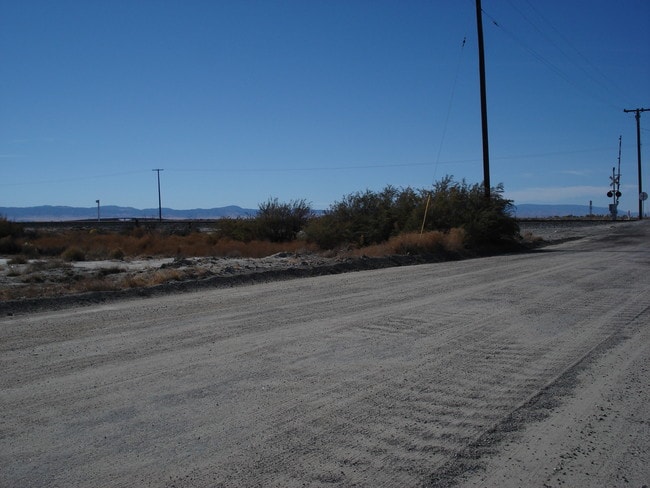

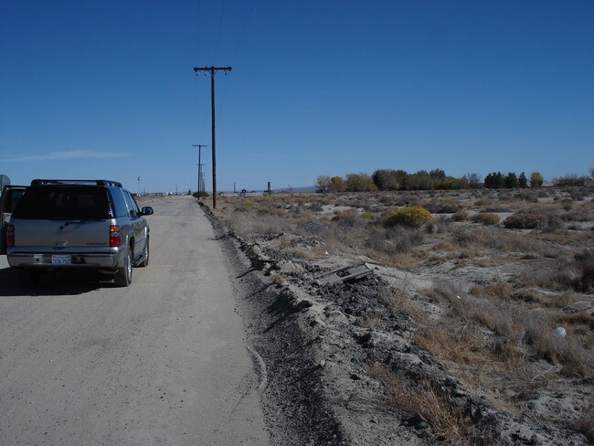

This Property Is For Sale
Property Detail
Vac Avenue A Vic Sierra Hwy
Los Angeles-Long Beach-Glendale, CA
W 1/2 OF NW 1/4 OF NE 1/4 OF NE 1/4 AND THAT PART E OF S P R R R W OF NE 1/4 OF NW 1/4 OF NE 1/4 PART OF LOT 2 IN NE 1/4 OF SEC 4 T 8N R 12W
3145-001-009
LOS ANGELES
Residentialacreage
California
LCA2
2
A Areas with a 1% annual chance of flooding and a 26% chance of flooding over the life of a 30-year mortgage.
13.45 AC
2025
Antelope Valley
2025
Los Angeles
900508
NEARBY LISTINGS FOR SALE OR LEASE
DEMOGRAPHICS near Vac Avenue A Vic Sierra Hwy
1 mile
3 mile
5 mile
2025 Total Population
169
4,605
20,562
2030 Population
170
4,713
21,087
Pop Growth 2025-2030
+ 0.59%
+ 2.35%
+ 2.55%
Average Age
37
34
36
2025 Total Households
59
1,581
7,103
HH Growth 2025-2030
0.00%
+ 2.15%
+ 2.60%
Median Household Inc
$42,500
$60,045
$75,340
Avg Household Size
2.90
2.90
2.80
2025 Avg HH Vehicles
2.00
2.00
2.00
Median Home Value
$142,105
$337,581
$350,219
Median Year Built
2001
1987
1993
Nearby Places
Map Layers
Map Styles
 Street
 Aerial
Layers
 Traffic
 Biking
Places
Listings with unknown addresses are not visible on the map
- Restaurants
- Banks
- Shops
- Fitness
- Groceries
PUBLIC TRANSPORTATION
COMMUTER RAIL
Lancaster (Antelope Valley Line - Southern California Regional Rail Authority (Metrolink))
Drive
Walk
Distance
Lancaster (Antelope Valley Line - Southern California Regional Rail Authority (Metrolink))
13 min
8.8 mi
Nearby Properties
Address
Land Use
TOTAL SIZE
Lot Size
Zoning
Address
Land Use
TOTAL SIZE
Lot Size
Zoning
12,240 SF
5.30 AC
M-2
Address
Land Use
TOTAL SIZE
Lot Size
Zoning
19,519 SF
9.32 AC
M-3
Address
Land Use
TOTAL SIZE
Lot Size
Zoning
22,352 SF
8.64 AC
M-3
Address
Land Use
TOTAL SIZE
Lot Size
Zoning
27,340 SF
1.54 AC
R-3 PD
Address
Land Use
TOTAL SIZE
Lot Size
Zoning
27,340 SF
1.54 AC
R-3 PD
Address
Land Use
TOTAL SIZE
Lot Size
Zoning
2,400 SF
0.82 AC
M-1
Address
Land Use
TOTAL SIZE
Lot Size
Zoning
1,120 SF
6.17 AC
M2
Address
Land Use
TOTAL SIZE
Lot Size
Zoning
2.13 AC
C-2 PD
Address
Land Use
TOTAL SIZE
Lot Size
Zoning
9,100 SF
1.02 AC
C-2
Address
Land Use
TOTAL SIZE
Lot Size
Zoning
28.93 AC
M-2
Address
Land Use
TOTAL SIZE
Lot Size
Zoning
7,378 SF
0.66 AC
C-2
Address
Land Use
TOTAL SIZE
Lot Size
Zoning
80.41 AC
M-3
Address
Land Use
TOTAL SIZE
Lot Size
Zoning
9,940 SF
9.32 AC
M-1
Address
Land Use
TOTAL SIZE
Lot Size
Zoning
576 SF
9.32 AC
M3
Address
Land Use
TOTAL SIZE
Lot Size
Zoning
2,632 SF
0.17 AC
C-2
Address
Land Use
TOTAL SIZE
Lot Size
Zoning
2,800 SF
0.34 AC
C2
Address
Land Use
TOTAL SIZE
Lot Size
Zoning
1,774 SF
1.30 AC
R-3
Address
Land Use
TOTAL SIZE
Lot Size
Zoning
79.05 AC
LCD22*
Address
Land Use
TOTAL SIZE
Lot Size
Zoning
3,694 SF
0.18 AC
C-2
Address
Land Use
TOTAL SIZE
Lot Size
Zoning
39.28 AC
M3
Address
Land Use
TOTAL SIZE
Lot Size
Zoning
4,000 SF
0.39 AC
M1
Address
Land Use
TOTAL SIZE
Lot Size
Zoning
154.58 AC
LCD22*
Address
Land Use
TOTAL SIZE
Lot Size
Zoning
76.61 AC
LCD22*
Address
Land Use
TOTAL SIZE
Lot Size
Zoning
10 AC
M-3
Address
Land Use
TOTAL SIZE
Lot Size
Zoning
39.24 AC
LCD22*
The World's #1 Commercial Real Estate Marketplace
Connect with us
© 2026 CoStar Group
The information above has been obtained from sources believed reliable. While we do not doubt its accuracy we have not verified it and make no guarantee, warranty or representation about it. It is your responsibility to independently confirm its accuracy and completeness. Any projections, opinions, assumptions, or estimates used are for example only and do not represent the current or future performance of the property. The value of this transaction to you depends on tax and other factors which should be evaluated by your tax, financial, and legal advisors. You and your advisors should conduct a careful, independent investigation of the property to determine to your satisfaction the suitability of the property for your needs.