Property Record
Signal Point Rd, Charleston, SC 29412
NEARBY LISTINGS FOR SALE OR LEASE
-
-
View all Charleston listings for sale on LoopNet.com
Property Detail
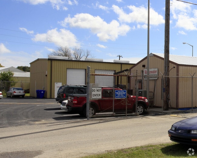
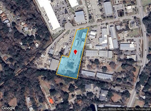
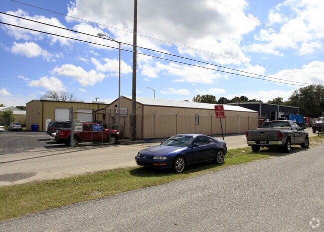
Signal Point Rd
Charleston-North Charleston, SC
Signal Point
334-00-00-059
SUBDIVISION NAME -SIGNAL POINT DESCRIPTION -LT I 3 SITE NAME -JAMES ISLAND SANITATION DEPARTMENT DESCRIPTION -LT I 3 SITE NAM
Commercialnec
Charleston
X
South Carolina
45019C0679K
i
2025
3.09 AC
2024
James Island/Folly Beach
002002
Charleston/N Charleston
DEMOGRAPHICS near Signal Point Rd
1 Mile
3 Mile
5 Mile
2024 Total Population
6,415
26,187
50,484
2029 Population
6,796
27,799
53,908
Pop Growth 2024-2029
+ 5.94%
+ 6.16%
+ 6.78%
Average Age
41
42
42
2024 Total Households
2,846
11,616
22,317
HH Growth 2024-2029
+ 5.80%
+ 6.03%
+ 6.68%
Median Household Inc
$81,978
$83,842
$90,071
Avg Household Size
2.20
2.20
2.20
2024 Avg HH Vehicles
2.00
2.00
2.00
Median Home Value
$350,853
$364,583
$428,088
Median Year Built
1995
1989
1986
Nearby Places
Map Layers
Map Styles
 Street
 Aerial
- Restaurants
- Banks
- Shops
- Fitness
- Groceries
PUBLIC TRANSPORTATION
AIRPORT
Charleston AFB/International
DRIVE
WALK
Distance
Charleston AFB/International
32 min
18.7 mi
Freight Ports
Columbus Street Terminal
DRIVE
WALK
Distance
Columbus Street Terminal
14 min
7.9 mi
Nearby Properties
Address
Land Use
TOTAL SIZE
Lot Size
Zoning
Address
Land Use
TOTAL SIZE
Lot Size
Zoning
3,780 SF
14.35 AC
Address
Land Use
TOTAL SIZE
Lot Size
Zoning
14,474 SF
23.53 AC
Address
Land Use
TOTAL SIZE
Lot Size
Zoning
12,766 SF
1.72 AC
Address
Land Use
TOTAL SIZE
Lot Size
Zoning
119.64 AC
Address
Land Use
TOTAL SIZE
Lot Size
Zoning
16,775 SF
5.93 AC
Address
Land Use
TOTAL SIZE
Lot Size
Zoning
Address
Land Use
TOTAL SIZE
Lot Size
Zoning
7,722 SF
20.48 AC
Address
Land Use
TOTAL SIZE
Lot Size
Zoning
Address
Land Use
TOTAL SIZE
Lot Size
Zoning
2,896 SF
18.13 AC
Address
Land Use
TOTAL SIZE
Lot Size
Zoning
11.80 AC
Address
Land Use
TOTAL SIZE
Lot Size
Zoning
7.46 AC
Address
Land Use
TOTAL SIZE
Lot Size
Zoning
3.94 AC
Address
Land Use
TOTAL SIZE
Lot Size
Zoning
8,172 SF
8.89 AC
Address
Land Use
TOTAL SIZE
Lot Size
Zoning
39,428 SF
17.98 AC
Address
Land Use
TOTAL SIZE
Lot Size
Zoning
1,348 SF
6.87 AC
Address
Land Use
TOTAL SIZE
Lot Size
Zoning
122,930 SF
22.78 AC
Address
Land Use
TOTAL SIZE
Lot Size
Zoning
11,270 SF
1.16 AC
Address
Land Use
TOTAL SIZE
Lot Size
Zoning
119,883 SF
14.95 AC
Address
Land Use
TOTAL SIZE
Lot Size
Zoning
Address
Land Use
TOTAL SIZE
Lot Size
Zoning
2,459 SF
0.39 AC
Address
Land Use
TOTAL SIZE
Lot Size
Zoning
66,474 SF
4.51 AC
Address
Land Use
TOTAL SIZE
Lot Size
Zoning
34,233 SF
9.64 AC
Address
Land Use
TOTAL SIZE
Lot Size
Zoning
16,188 SF
2.28 AC
Address
Land Use
TOTAL SIZE
Lot Size
Zoning
11,428 SF
3.05 AC
Address
Land Use
TOTAL SIZE
Lot Size
Zoning
3,208 SF
1.36 AC
Address
Land Use
TOTAL SIZE
Lot Size
Zoning
52,897 SF
4.89 AC
Address
Land Use
TOTAL SIZE
Lot Size
Zoning
4,108 SF
0.23 AC
Address
Land Use
TOTAL SIZE
Lot Size
Zoning
3,228 SF
0.46 AC
Address
Land Use
TOTAL SIZE
Lot Size
Zoning
5,341 SF
1.31 AC
Address
Land Use
TOTAL SIZE
Lot Size
Zoning
0.47 AC
The World's #1 Commercial Real Estate Marketplace
Connect with us
© 2025 CoStar Group
The information above has been obtained from sources believed reliable. While we do not doubt its accuracy we have not verified it and make no guarantee, warranty or representation about it. It is your responsibility to independently confirm its accuracy and completeness. Any projections, opinions, assumptions, or estimates used are for example only and do not represent the current or future performance of the property. The value of this transaction to you depends on tax and other factors which should be evaluated by your tax, financial, and legal advisors. You and your advisors should conduct a careful, independent investigation of the property to determine to your satisfaction the suitability of the property for your needs.