Property Record
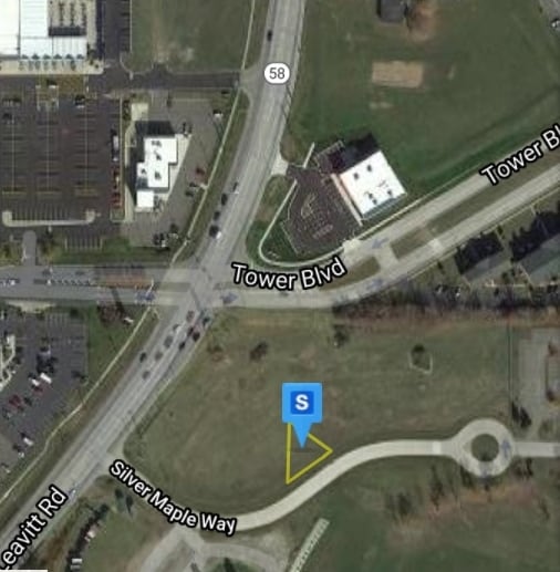
Silver Maple Way, Lorain, OH 44053

Property Detail
Silver Maple Way
02-02-007-101-064
LORAIN
Commercialacreage
Ohio
B and X Area of moderate flood hazard, usually the area between the limits of the 100-year and 500-year floods.
0.07 AC
2024
Lorain County
2024
Cleveland
097202
Cleveland-Elyria, OH
NEARBY LISTINGS FOR SALE OR LEASE
-
-
-
-
-
-
No Photo
-
View all Lorain listings for sale on LoopNet.com
DEMOGRAPHICS near Silver Maple Way
1 mile
3 mile
5 mile
2024 Total Population
11,109
60,925
98,649
2029 Population
11,377
62,648
101,321
Pop Growth 2024-2029
+ 2.41%
+ 2.83%
+ 2.71%
Average Age
43
41
41
2024 Total Households
4,853
25,237
40,687
HH Growth 2024-2029
+ 2.43%
+ 2.85%
+ 2.75%
Median Household Inc
$68,098
$59,556
$57,107
Avg Household Size
2.20
2.30
2.30
2024 Avg HH Vehicles
2.00
2.00
2.00
Median Home Value
$169,947
$172,646
$164,286
Median Year Built
1972
1964
1963
Nearby Places
Map Layers
Map Styles
 Street
 Aerial
Transit
 Traffic
 Biking
Places
Listings with unknown addresses are not visible on the map
- Restaurants
- Banks
- Shops
- Fitness
- Groceries
PUBLIC TRANSPORTATION
COMMUTER RAIL
Elyria Amtrak (Capitol Limited - Amtrak, Lake Shore Limited - Amtrak)
Drive
Walk
Distance
Elyria Amtrak (Capitol Limited - Amtrak, Lake Shore Limited - Amtrak)
16 min
9.8 mi
AIRPORT
Cleveland-Hopkins International
Drive
Walk
Distance
Cleveland-Hopkins International
36 min
24.0 mi
Freight Ports
Port of Toledo
Drive
Walk
Distance
Port of Toledo
105 min
85.8 mi
Nearby Properties
Address
Land Use
TOTAL SIZE
Lot Size
Zoning
Address
Land Use
TOTAL SIZE
Lot Size
Zoning
1,040,560 SF
28.68 AC
Address
Land Use
TOTAL SIZE
Lot Size
Zoning
33,339 SF
30.60 AC
Address
Land Use
TOTAL SIZE
Lot Size
Zoning
87,851 SF
15.44 AC
Address
Land Use
TOTAL SIZE
Lot Size
Zoning
187,340 SF
42.98 AC
Address
Land Use
TOTAL SIZE
Lot Size
Zoning
118,624 SF
19.80 AC
Address
Land Use
TOTAL SIZE
Lot Size
Zoning
53,266 SF
3 AC
Address
Land Use
TOTAL SIZE
Lot Size
Zoning
52,392 SF
2.71 AC
Address
Land Use
TOTAL SIZE
Lot Size
Zoning
43,773 SF
3.41 AC
Address
Land Use
TOTAL SIZE
Lot Size
Zoning
111,373 SF
9.35 AC
Address
Land Use
TOTAL SIZE
Lot Size
Zoning
160,080 SF
14.89 AC
Address
Land Use
TOTAL SIZE
Lot Size
Zoning
43,576 SF
12.37 AC
Address
Land Use
TOTAL SIZE
Lot Size
Zoning
191,168 SF
20.70 AC
Address
Land Use
TOTAL SIZE
Lot Size
Zoning
35,502 SF
23.29 AC
Address
Land Use
TOTAL SIZE
Lot Size
Zoning
36.66 AC
Address
Land Use
TOTAL SIZE
Lot Size
Zoning
53,266 SF
12.90 AC
Address
Land Use
TOTAL SIZE
Lot Size
Zoning
178,140 SF
15.67 AC
Address
Land Use
TOTAL SIZE
Lot Size
Zoning
118,800 SF
1.01 AC
Address
Land Use
TOTAL SIZE
Lot Size
Zoning
30,744 SF
5.10 AC
Address
Land Use
TOTAL SIZE
Lot Size
Zoning
9,880 SF
3.90 AC
Address
Land Use
TOTAL SIZE
Lot Size
Zoning
22,894 SF
9.60 AC
Address
Land Use
TOTAL SIZE
Lot Size
Zoning
52,602 SF
9.31 AC
Address
Land Use
TOTAL SIZE
Lot Size
Zoning
66,196 SF
7.05 AC
Address
Land Use
TOTAL SIZE
Lot Size
Zoning
80,852 SF
9.41 AC
Address
Land Use
TOTAL SIZE
Lot Size
Zoning
72,753 SF
3.03 AC
Address
Land Use
TOTAL SIZE
Lot Size
Zoning
46,708 SF
8.56 AC
Address
Land Use
TOTAL SIZE
Lot Size
Zoning
57,730 SF
7.35 AC
Address
Land Use
TOTAL SIZE
Lot Size
Zoning
67,408 SF
14.83 AC
Address
Land Use
TOTAL SIZE
Lot Size
Zoning
99,979 SF
3.54 AC
Address
Land Use
TOTAL SIZE
Lot Size
Zoning
52,176 SF
0.31 AC
Address
Land Use
TOTAL SIZE
Lot Size
Zoning
25,923 SF
5.16 AC
The World's #1 Commercial Real Estate Marketplace
Connect with us
© 2026 CoStar Group
The information above has been obtained from sources believed reliable. While we do not doubt its accuracy we have not verified it and make no guarantee, warranty or representation about it. It is your responsibility to independently confirm its accuracy and completeness. Any projections, opinions, assumptions, or estimates used are for example only and do not represent the current or future performance of the property. The value of this transaction to you depends on tax and other factors which should be evaluated by your tax, financial, and legal advisors. You and your advisors should conduct a careful, independent investigation of the property to determine to your satisfaction the suitability of the property for your needs.