Property Record
Simon Brown Rd, Mascotte, FL 34753
Property Detail
Simon Brown Rd
Orlando-Kissimmee-Sanford, FL
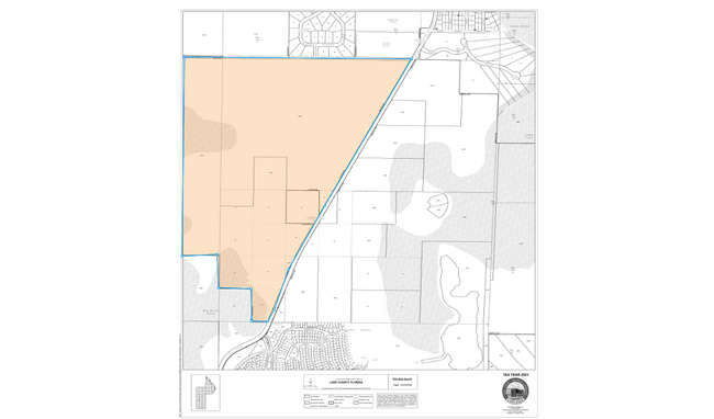
THE WEST 1/2 OF THE NORTHEAST 1/4 LYING NORTHWESTERLY OF COUNTY ROAD 565 IN SECTION 1 TOWNSHIP 22 SOUTH RANGE 24 EAST AND LYING NORTHEASTLY OF THE FOLLOWING DESCRIBED PARCEL: FROM THE NORTH 1/4 CORNER OF SECTION 1 TOWNSHIP 22 SOUTH RANGE 24 EAST RUN
01-22-24-0002-000-00200
LAKE
Pasture
Florida
A
2
A Areas with a 1% annual chance of flooding and a 26% chance of flooding over the life of a 30-year mortgage.
10.04 AC
2024
Lake County
2026
Orlando
031203
NEARBY LISTINGS FOR SALE OR LEASE
DEMOGRAPHICS near Simon Brown Rd
1 mile
3 mile
5 mile
2025 Total Population
817
15,195
35,852
2030 Population
974
17,556
41,114
Pop Growth 2025-2030
+ 19.22%
+ 15.54%
+ 14.68%
Average Age
43
39
42
2025 Total Households
302
5,049
12,661
HH Growth 2025-2030
+ 19.87%
+ 15.81%
+ 14.81%
Median Household Inc
$83,516
$83,553
$84,041
Avg Household Size
2.70
3.00
2.80
2025 Avg HH Vehicles
3.00
2.00
2.00
Median Home Value
$347,058
$306,948
$344,912
Median Year Built
2010
2005
2005
Nearby Places
Map Layers
Map Styles
 Street
 Aerial
Layers
 Traffic
 Biking
Places
Listings with unknown addresses are not visible on the map
- Restaurants
- Banks
- Shops
- Fitness
- Groceries
Nearby Properties
Address
Land Use
TOTAL SIZE
Lot Size
Zoning
Address
Land Use
TOTAL SIZE
Lot Size
Zoning
877,798 SF
71.91 AC
PUD
Address
Land Use
TOTAL SIZE
Lot Size
Zoning
707,178 SF
44.54 AC
PUD
Address
Land Use
TOTAL SIZE
Lot Size
Zoning
202,028 SF
47.71 AC
PUD
Address
Land Use
TOTAL SIZE
Lot Size
Zoning
291,197 SF
17.47 AC
PUD
Address
Land Use
TOTAL SIZE
Lot Size
Zoning
192,992 SF
20.66 AC
PUD
Address
Land Use
TOTAL SIZE
Lot Size
Zoning
195,697 SF
11.92 AC
PUD
Address
Land Use
TOTAL SIZE
Lot Size
Zoning
127,200 SF
10.54 AC
PUD
Address
Land Use
TOTAL SIZE
Lot Size
Zoning
125,956 SF
31.25 AC
PUD
Address
Land Use
TOTAL SIZE
Lot Size
Zoning
2,000 SF
19.48 AC
SFLD
Address
Land Use
TOTAL SIZE
Lot Size
Zoning
175.01 AC
A
Address
Land Use
TOTAL SIZE
Lot Size
Zoning
92,250 SF
6.03 AC
C1
Address
Land Use
TOTAL SIZE
Lot Size
Zoning
89,916 SF
10.72 AC
PUD
Address
Land Use
TOTAL SIZE
Lot Size
Zoning
48,772 SF
51.39 AC
LM
Address
Land Use
TOTAL SIZE
Lot Size
Zoning
151.43 AC
Address
Land Use
TOTAL SIZE
Lot Size
Zoning
69,000 SF
5.63 AC
PUD
Address
Land Use
TOTAL SIZE
Lot Size
Zoning
37,600 SF
13.16 AC
Address
Land Use
TOTAL SIZE
Lot Size
Zoning
38,958 SF
12.93 AC
PUD
Address
Land Use
TOTAL SIZE
Lot Size
Zoning
40,000 SF
4.06 AC
PUD
Address
Land Use
TOTAL SIZE
Lot Size
Zoning
42,400 SF
6.83 AC
PUD
Address
Land Use
TOTAL SIZE
Lot Size
Zoning
40,000 SF
6.40 AC
PUD
Address
Land Use
TOTAL SIZE
Lot Size
Zoning
18,083 SF
10.38 AC
PUD
Address
Land Use
TOTAL SIZE
Lot Size
Zoning
Address
Land Use
TOTAL SIZE
Lot Size
Zoning
29,200 SF
6 AC
CFD
Address
Land Use
TOTAL SIZE
Lot Size
Zoning
34,043 SF
74.61 AC
A
Address
Land Use
TOTAL SIZE
Lot Size
Zoning
40,000 SF
2.62 AC
PUD
Address
Land Use
TOTAL SIZE
Lot Size
Zoning
18,240 SF
3.61 AC
C1
Address
Land Use
TOTAL SIZE
Lot Size
Zoning
36,375 SF
2.41 AC
PUD
Address
Land Use
TOTAL SIZE
Lot Size
Zoning
17,500 SF
7.07 AC
PUD
Address
Land Use
TOTAL SIZE
Lot Size
Zoning
36,654 SF
120.55 AC
A
Address
Land Use
TOTAL SIZE
Lot Size
Zoning
15.02 AC
PUD
The World's #1 Commercial Real Estate Marketplace
Connect with us
© 2026 CoStar Group
The information above has been obtained from sources believed reliable. While we do not doubt its accuracy we have not verified it and make no guarantee, warranty or representation about it. It is your responsibility to independently confirm its accuracy and completeness. Any projections, opinions, assumptions, or estimates used are for example only and do not represent the current or future performance of the property. The value of this transaction to you depends on tax and other factors which should be evaluated by your tax, financial, and legal advisors. You and your advisors should conduct a careful, independent investigation of the property to determine to your satisfaction the suitability of the property for your needs.