Property Record
Simpson Rd, Kissimmee, FL 34744


Property Detail
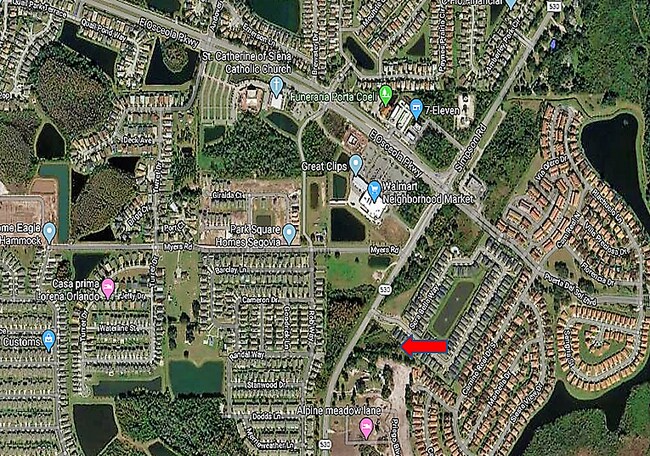
Simpson Rd
Orlando-Kissimmee-Sanford, FL
COM AT SW COR OF NW 1/4 OF 4-25-30, W 147.30 FT, S 36 DEG W 320.14 FT, N 54 DEG W 200 FT, S 36 DEG W 968.18 FT TO POB; N 36 DEG E 347.95 FT, S 54 DEG E 553.71 FT, S 36 DEG W 65.11 FT, N 78 DEG W 256.29 FT, N 83 DEG W 366.24 FT TO POB
05-25-30-0000-0082-0000
OSCEOLA
Commercialacreage
Florida
OPUD
82
B and X Area of moderate flood hazard, usually the area between the limits of the 100-year and 500-year floods.
2.58 AC
2024
Osceola Outlying
2025
Orlando
042701
NEARBY LISTINGS FOR SALE OR LEASE
DEMOGRAPHICS near Simpson Rd
1 mile
3 mile
5 mile
2025 Total Population
11,358
78,116
164,951
2030 Population
13,089
88,181
186,418
Pop Growth 2025-2030
+ 15.24%
+ 12.88%
+ 13.01%
Average Age
38
39
38
2025 Total Households
3,458
24,408
52,781
HH Growth 2025-2030
+ 15.88%
+ 13.51%
+ 13.68%
Median Household Inc
$84,395
$82,709
$81,344
Avg Household Size
3.20
3.10
3.10
2025 Avg HH Vehicles
2.00
2.00
2.00
Median Home Value
$404,054
$370,579
$375,218
Median Year Built
2005
1999
2001
Nearby Places
Map Layers
Map Styles
 Street
 Aerial
Transit
 Traffic
 Biking
Places
Listings with unknown addresses are not visible on the map
- Restaurants
- Banks
- Shops
- Fitness
- Groceries
PUBLIC TRANSPORTATION
COMMUTER RAIL
Tupperware (SunRail - Florida Department of Transportation)
Drive
Walk
Distance
Tupperware (SunRail - Florida Department of Transportation)
10 min
4.7 mi
Meadow Woods (SunRail - Florida Department of Transportation)
Drive
Walk
Distance
Meadow Woods (SunRail - Florida Department of Transportation)
13 min
6.9 mi
AIRPORT
Orlando International
Drive
Walk
Distance
Orlando International
15 min
8.8 mi
Freight Ports
Port Canaveral
Drive
Walk
Distance
Port Canaveral
62 min
50.5 mi
SALE & LEASE HISTORY
LISTING DATE
SALE/LEASE

Mar 22, 2024
For Sale
Nearby Properties
Address
Land Use
TOTAL SIZE
Lot Size
Zoning
Address
Land Use
TOTAL SIZE
Lot Size
Zoning
392,586 SF
20.14 AC
U-ORG-P-D
Address
Land Use
TOTAL SIZE
Lot Size
Zoning
366,524 SF
PD/AN
Address
Land Use
TOTAL SIZE
Lot Size
Zoning
415,318 SF
U-ORG-P-D
Address
Land Use
TOTAL SIZE
Lot Size
Zoning
422,767 SF
16.76 AC
P-D
Address
Land Use
TOTAL SIZE
Lot Size
Zoning
445,671 SF
20.03 AC
P-D
Address
Land Use
TOTAL SIZE
Lot Size
Zoning
337,649 SF
75.07 AC
OAC
Address
Land Use
TOTAL SIZE
Lot Size
Zoning
374,081 SF
36.66 AC
KRC1
Address
Land Use
TOTAL SIZE
Lot Size
Zoning
160,115 SF
25 AC
P-D
Address
Land Use
TOTAL SIZE
Lot Size
Zoning
117,502 SF
8.71 AC
P-D
Address
Land Use
TOTAL SIZE
Lot Size
Zoning
93,674 SF
10.72 AC
P-D
Address
Land Use
TOTAL SIZE
Lot Size
Zoning
165.89 AC
PD/AN
Address
Land Use
TOTAL SIZE
Lot Size
Zoning
94,100 SF
2.91 AC
P-D
Address
Land Use
TOTAL SIZE
Lot Size
Zoning
54.99 AC
P-D
Address
Land Use
TOTAL SIZE
Lot Size
Zoning
94,422 SF
11.23 AC
OPD
Address
Land Use
TOTAL SIZE
Lot Size
Zoning
58.99 AC
PD/AN
Address
Land Use
TOTAL SIZE
Lot Size
Zoning
88,788 SF
17.31 AC
P-D
Address
Land Use
TOTAL SIZE
Lot Size
Zoning
107,282 SF
1.99 AC
P-D
Address
Land Use
TOTAL SIZE
Lot Size
Zoning
67,745 SF
8.01 AC
P-D
Address
Land Use
TOTAL SIZE
Lot Size
Zoning
20,353 SF
65.61 AC
OPD
Address
Land Use
TOTAL SIZE
Lot Size
Zoning
10,353 SF
13.65 AC
P-D
Address
Land Use
TOTAL SIZE
Lot Size
Zoning
65,025 SF
14.78 AC
P-D
Address
Land Use
TOTAL SIZE
Lot Size
Zoning
85,734 SF
10.25 AC
P-D
Address
Land Use
TOTAL SIZE
Lot Size
Zoning
112,255 SF
16.31 AC
OPUD
Address
Land Use
TOTAL SIZE
Lot Size
Zoning
139,903 SF
13.32 AC
KRC1
Address
Land Use
TOTAL SIZE
Lot Size
Zoning
65,326 SF
9.51 AC
KB3
Address
Land Use
TOTAL SIZE
Lot Size
Zoning
81,525 SF
3.15 AC
Address
Land Use
TOTAL SIZE
Lot Size
Zoning
146,898 SF
15.24 AC
OPUD
Address
Land Use
TOTAL SIZE
Lot Size
Zoning
115,129 SF
15.01 AC
OPUD
Address
Land Use
TOTAL SIZE
Lot Size
Zoning
126,184 SF
25.33 AC
OPUD
Address
Land Use
TOTAL SIZE
Lot Size
Zoning
27.34 AC
PD/AN
The World's #1 Commercial Real Estate Marketplace
Connect with us
© 2026 CoStar Group
The information above has been obtained from sources believed reliable. While we do not doubt its accuracy we have not verified it and make no guarantee, warranty or representation about it. It is your responsibility to independently confirm its accuracy and completeness. Any projections, opinions, assumptions, or estimates used are for example only and do not represent the current or future performance of the property. The value of this transaction to you depends on tax and other factors which should be evaluated by your tax, financial, and legal advisors. You and your advisors should conduct a careful, independent investigation of the property to determine to your satisfaction the suitability of the property for your needs.