Property Record
Simpson Rd, Valley Mills, TX 76689

Save to a Folder
{{folder.Name}}
{{folder.ListingIds.length}} Properties
{{folder.ListingIds.length}} Property
Create a New Folder
Property Detail
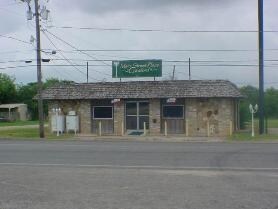
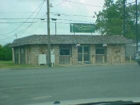
Simpson Rd
46-061600-000101-0
MOORE C ACRES 25.85
Privatepreserveopenspacevacantlandforestlandconservation
MCLENNAN
R
Texas
B and X Area of moderate flood hazard, usually the area between the limits of the 100-year and 500-year floods.
25.85 AC
2024
Waco
2025
Other Market Areas
950700
Waco, TX
NEARBY LISTINGS FOR SALE OR LEASE
-
-
View all Valley Mills listings for sale on LoopNet.com
DEMOGRAPHICS near Simpson Rd
1 mile
3 mile
5 mile
2025 Total Population
33
1,105
1,883
2030 Population
33
1,114
1,903
Pop Growth 2025-2030
0.00%
+ 0.81%
+ 1.06%
Average Age
40
41
41
2025 Total Households
12
402
691
HH Growth 2025-2030
0.00%
+ 0.75%
+ 1.01%
Median Household Inc
$112,500
$103,281
$110,950
Avg Household Size
2.50
2.70
2.70
2025 Avg HH Vehicles
2.00
2.00
2.00
Median Home Value
$399,999
$407,353
$408,955
Median Year Built
1975
1977
1980
Nearby Places
Map Layers
Map Styles
 Street
 Aerial
Layers
 Traffic
 Biking
Places
Listings with unknown addresses are not visible on the map
- Restaurants
- Banks
- Shops
- Fitness
- Groceries
PUBLIC TRANSPORTATION
COMMUTER RAIL
Mcgregor Amtrak (Texas Eagle - Amtrak)
Drive
Walk
Distance
Mcgregor Amtrak (Texas Eagle - Amtrak)
14 min
9.8 mi
AIRPORT
Waco Regional
Drive
Walk
Distance
Waco Regional
35 min
20.2 mi
Freight Ports
Port of Houston
Drive
Walk
Distance
Port of Houston
246 min
211.2 mi
Nearby Properties
Address
Land Use
TOTAL SIZE
Lot Size
Zoning
Address
Land Use
TOTAL SIZE
Lot Size
Zoning
109,466 SF
11.50 AC
R
Address
Land Use
TOTAL SIZE
Lot Size
Zoning
44,426 SF
2.90 AC
R
Address
Land Use
TOTAL SIZE
Lot Size
Zoning
6,775 SF
221.74 AC
R
Address
Land Use
TOTAL SIZE
Lot Size
Zoning
48,408 SF
34.42 AC
C
Address
Land Use
TOTAL SIZE
Lot Size
Zoning
8,312 SF
126.89 AC
C
Address
Land Use
TOTAL SIZE
Lot Size
Zoning
1,680 SF
18.40 AC
Address
Land Use
TOTAL SIZE
Lot Size
Zoning
6,300 SF
0.75 AC
C
Address
Land Use
TOTAL SIZE
Lot Size
Zoning
6,992 SF
123.97 AC
R
Address
Land Use
TOTAL SIZE
Lot Size
Zoning
5,257 SF
16 AC
Address
Land Use
TOTAL SIZE
Lot Size
Zoning
7,460 SF
0.96 AC
Address
Land Use
TOTAL SIZE
Lot Size
Zoning
11,107 SF
14.74 AC
Address
Land Use
TOTAL SIZE
Lot Size
Zoning
7,136 SF
24.50 AC
R
Address
Land Use
TOTAL SIZE
Lot Size
Zoning
15,990 SF
0.63 AC
R
Address
Land Use
TOTAL SIZE
Lot Size
Zoning
3,179 SF
18.90 AC
R
Address
Land Use
TOTAL SIZE
Lot Size
Zoning
5,446 SF
10.89 AC
R
Address
Land Use
TOTAL SIZE
Lot Size
Zoning
4,271 SF
223.90 AC
R
Address
Land Use
TOTAL SIZE
Lot Size
Zoning
11,506 SF
0.43 AC
R
Address
Land Use
TOTAL SIZE
Lot Size
Zoning
3,026 SF
29.97 AC
R
Address
Land Use
TOTAL SIZE
Lot Size
Zoning
4,080 SF
14.35 AC
R
Address
Land Use
TOTAL SIZE
Lot Size
Zoning
11,332 SF
2.07 AC
R
Address
Land Use
TOTAL SIZE
Lot Size
Zoning
3,622 SF
25 AC
R
Address
Land Use
TOTAL SIZE
Lot Size
Zoning
3,022 SF
12 AC
Address
Land Use
TOTAL SIZE
Lot Size
Zoning
4,228 SF
29.82 AC
R
Address
Land Use
TOTAL SIZE
Lot Size
Zoning
3,621 SF
172.82 AC
R
Address
Land Use
TOTAL SIZE
Lot Size
Zoning
6,354 SF
36.63 AC
R
Address
Land Use
TOTAL SIZE
Lot Size
Zoning
3,265 SF
10.94 AC
R
Address
Land Use
TOTAL SIZE
Lot Size
Zoning
4,670 SF
36.57 AC
R
Address
Land Use
TOTAL SIZE
Lot Size
Zoning
3,585 SF
13 AC
Address
Land Use
TOTAL SIZE
Lot Size
Zoning
2,772 SF
2.42 AC
R
Address
Land Use
TOTAL SIZE
Lot Size
Zoning
2,750 SF
10.03 AC
R
The World's #1 Commercial Real Estate Marketplace
Connect with us
© 2026 CoStar Group
The information above has been obtained from sources believed reliable. While we do not doubt its accuracy we have not verified it and make no guarantee, warranty or representation about it. It is your responsibility to independently confirm its accuracy and completeness. Any projections, opinions, assumptions, or estimates used are for example only and do not represent the current or future performance of the property. The value of this transaction to you depends on tax and other factors which should be evaluated by your tax, financial, and legal advisors. You and your advisors should conduct a careful, independent investigation of the property to determine to your satisfaction the suitability of the property for your needs.