Property Record
Smith Dr, Huntley, IL 60142
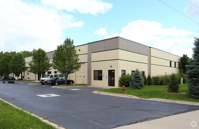


Property Detail
Smith Dr
Chicago-Naperville-Elgin, IL-IN
DOC 2005R0075988 (PLAT) UNIT 7 SMITH DRIVE HUNTLEY CONDOS (LTS 28 & 29 BERNAT INDUSTRIAL CENTER SUB UNIT 2)
18-33-456-015
MCHENRY
Industrialgeneral
Illinois
B and X Area of moderate flood hazard, usually the area between the limits of the 100-year and 500-year floods.
28,29
2024
2.12 AC
2024
McHenry County
871501
Chicago
2,917 SF
NEARBY LISTINGS FOR SALE OR LEASE
DEMOGRAPHICS near Smith Dr
1 mile
3 mile
5 mile
2024 Total Population
4,602
36,732
86,146
2029 Population
4,709
37,439
87,832
Pop Growth 2024-2029
+ 2.33%
+ 1.92%
+ 1.96%
Average Age
43
46
42
2024 Total Households
1,764
14,105
30,768
HH Growth 2024-2029
+ 2.49%
+ 1.95%
+ 2.02%
Median Household Inc
$94,894
$99,924
$115,949
Avg Household Size
2.60
2.60
2.80
2024 Avg HH Vehicles
2.00
2.00
2.00
Median Home Value
$333,634
$349,554
$356,203
Median Year Built
2000
2003
2001
Nearby Places
Map Layers
Map Styles
 Street
 Aerial
Transit
 Traffic
 Biking
Places
Listings with unknown addresses are not visible on the map
- Restaurants
- Banks
- Shops
- Fitness
- Groceries
PUBLIC TRANSPORTATION
AIRPORT
Chicago O'Hare International
Drive
Walk
Distance
Chicago O'Hare International
47 min
37.2 mi
Freight Ports
Port Milwaukee
Drive
Walk
Distance
Port Milwaukee
114 min
80.0 mi
SALE & LEASE HISTORY
LISTING DATE
SALE/LEASE

Sep 25, 2016
For Lease
Sep 25, 2016
For Lease
Sep 03, 2019
For Sale
Nov 05, 2019
For Lease
Nov 05, 2019
For Sale
Jun 15, 2020
For Sale
Jun 13, 2024
For Sale
Jan 26, 2018
For Sale
Jan 26, 2018
For Lease
Nearby Properties
Address
Land Use
TOTAL SIZE
Lot Size
Zoning
Address
Land Use
TOTAL SIZE
Lot Size
Zoning
Address
Land Use
TOTAL SIZE
Lot Size
Zoning
Address
Land Use
TOTAL SIZE
Lot Size
Zoning
Address
Land Use
TOTAL SIZE
Lot Size
Zoning
57.30 AC
Address
Land Use
TOTAL SIZE
Lot Size
Zoning
Address
Land Use
TOTAL SIZE
Lot Size
Zoning
Address
Land Use
TOTAL SIZE
Lot Size
Zoning
7.26 AC
Address
Land Use
TOTAL SIZE
Lot Size
Zoning
10.30 AC
Address
Land Use
TOTAL SIZE
Lot Size
Zoning
11.86 AC
Address
Land Use
TOTAL SIZE
Lot Size
Zoning
15.02 AC
Address
Land Use
TOTAL SIZE
Lot Size
Zoning
189,735 SF
21.85 AC
Address
Land Use
TOTAL SIZE
Lot Size
Zoning
3.50 AC
Address
Land Use
TOTAL SIZE
Lot Size
Zoning
89,940 SF
8.93 AC
Address
Land Use
TOTAL SIZE
Lot Size
Zoning
Address
Land Use
TOTAL SIZE
Lot Size
Zoning
0.71 AC
Address
Land Use
TOTAL SIZE
Lot Size
Zoning
14.26 AC
Address
Land Use
TOTAL SIZE
Lot Size
Zoning
66,164 SF
9.90 AC
Address
Land Use
TOTAL SIZE
Lot Size
Zoning
9.28 AC
Address
Land Use
TOTAL SIZE
Lot Size
Zoning
Address
Land Use
TOTAL SIZE
Lot Size
Zoning
8.23 AC
Address
Land Use
TOTAL SIZE
Lot Size
Zoning
141,588 SF
6.88 AC
Address
Land Use
TOTAL SIZE
Lot Size
Zoning
57,813 SF
4.11 AC
Address
Land Use
TOTAL SIZE
Lot Size
Zoning
41,122 SF
4.25 AC
Address
Land Use
TOTAL SIZE
Lot Size
Zoning
Address
Land Use
TOTAL SIZE
Lot Size
Zoning
11.15 AC
Address
Land Use
TOTAL SIZE
Lot Size
Zoning
Address
Land Use
TOTAL SIZE
Lot Size
Zoning
92,850 SF
5 AC
Address
Land Use
TOTAL SIZE
Lot Size
Zoning
24,700 SF
3.08 AC
Address
Land Use
TOTAL SIZE
Lot Size
Zoning
85,500 SF
7 AC
Address
Land Use
TOTAL SIZE
Lot Size
Zoning
2.55 AC
The World's #1 Commercial Real Estate Marketplace
Connect with us
© 2026 CoStar Group
The information above has been obtained from sources believed reliable. While we do not doubt its accuracy we have not verified it and make no guarantee, warranty or representation about it. It is your responsibility to independently confirm its accuracy and completeness. Any projections, opinions, assumptions, or estimates used are for example only and do not represent the current or future performance of the property. The value of this transaction to you depends on tax and other factors which should be evaluated by your tax, financial, and legal advisors. You and your advisors should conduct a careful, independent investigation of the property to determine to your satisfaction the suitability of the property for your needs.