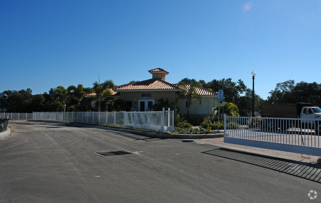
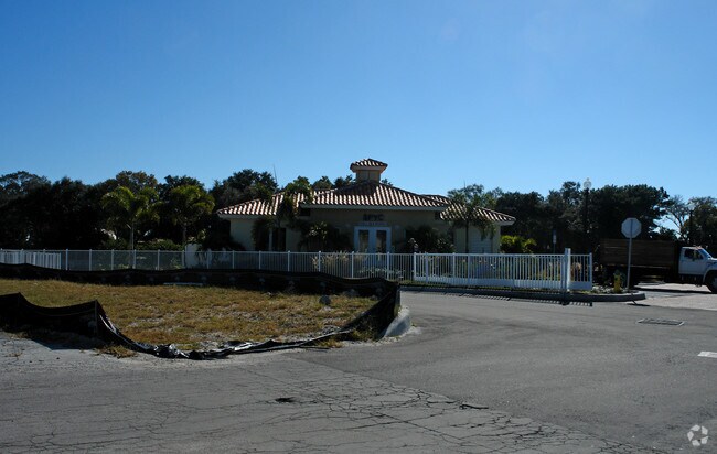
Property Record
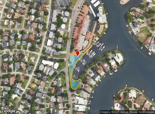
Snell Isle Blvd Ne, St Petersburg, FL 33704
NEARBY LISTINGS FOR SALE OR LEASE
Property Detail
Snell Isle Blvd Ne
09-31-17-00000-320-0100
Unplatted Tract In W 1/2
Nightclub
UNPLATTED TRACT IN W 1/2 OF SEC DESC BEG MOST SLY COR OF TR-A, BLK 1 OF SNELL ISLE BRIGHTWATERS UNIT H TH CUR LT RAD 858.66FT ARC 107.06FT CB S26D0242W 106.98FT TH CUR RT RAD 50FT ARC 129.69 FT CB N83D1306W 96.29FT TH CUR RT RAD 1950FT ARC 290.29FT C
AE
Pinellas
12103C0236H
Florida
2024
0.94 AC
2025
South Pinellas
023800
Tampa/St Petersburg
1,074 SF
Tampa-St. Petersburg-Clearwater, FL
DEMOGRAPHICS near Snell Isle Blvd Ne
1 Mile
3 Mile
5 Mile
2024 Total Population
5,963
63,499
155,753
2029 Population
5,921
63,820
156,340
Pop Growth 2024-2029
(0.70%)
+ 0.51%
+ 0.38%
Average Age
43
45
43
2024 Total Households
2,510
31,882
73,012
HH Growth 2024-2029
(1.00%)
+ 0.39%
+ 0.24%
Median Household Inc
$152,347
$78,798
$62,318
Avg Household Size
2.30
1.90
2.00
2024 Avg HH Vehicles
2.00
2.00
2.00
Median Home Value
$680,082
$441,880
$310,249
Median Year Built
1965
1966
1965
Nearby Places
Map Layers
Map Styles
 Street
 Aerial
- Restaurants
- Banks
- Shops
- Fitness
- Groceries
PUBLIC TRANSPORTATION
AIRPORT
St Pete-Clearwater International
DRIVE
WALK
Distance
St Pete-Clearwater International
28 min
13.5 mi
Tampa International
DRIVE
WALK
Distance
Tampa International
34 min
20.0 mi
Sarasota/Bradenton International
DRIVE
WALK
Distance
Sarasota/Bradenton International
56 min
36.7 mi
Freight Ports
Port Manatee
DRIVE
WALK
Distance
Port Manatee
43 min
29.3 mi
Nearby Properties
Address
Land Use
TOTAL SIZE
Lot Size
Zoning
Address
Land Use
TOTAL SIZE
Lot Size
Zoning
662,311 SF
2.89 AC
Address
Land Use
TOTAL SIZE
Lot Size
Zoning
655,966 SF
1.25 AC
Address
Land Use
TOTAL SIZE
Lot Size
Zoning
690,001 SF
2.28 AC
Address
Land Use
TOTAL SIZE
Lot Size
Zoning
12,611 SF
2,367.54 AC
Address
Land Use
TOTAL SIZE
Lot Size
Zoning
807,604 SF
9.61 AC
Address
Land Use
TOTAL SIZE
Lot Size
Zoning
593,859 SF
2.04 AC
Address
Land Use
TOTAL SIZE
Lot Size
Zoning
593,733 SF
4.35 AC
Address
Land Use
TOTAL SIZE
Lot Size
Zoning
399,617 SF
13.08 AC
Address
Land Use
TOTAL SIZE
Lot Size
Zoning
474,605 SF
1.84 AC
Address
Land Use
TOTAL SIZE
Lot Size
Zoning
443,983 SF
0.88 AC
Address
Land Use
TOTAL SIZE
Lot Size
Zoning
231,140 SF
5.10 AC
Address
Land Use
TOTAL SIZE
Lot Size
Zoning
193,444 SF
2,339.19 AC
Address
Land Use
TOTAL SIZE
Lot Size
Zoning
242,915 SF
2.20 AC
Address
Land Use
TOTAL SIZE
Lot Size
Zoning
21,232 SF
332.98 AC
Address
Land Use
TOTAL SIZE
Lot Size
Zoning
7,227 SF
10.78 AC
Address
Land Use
TOTAL SIZE
Lot Size
Zoning
339,332 SF
1.37 AC
Address
Land Use
TOTAL SIZE
Lot Size
Zoning
359,527 SF
19.65 AC
Address
Land Use
TOTAL SIZE
Lot Size
Zoning
17,700 SF
209.08 AC
Address
Land Use
TOTAL SIZE
Lot Size
Zoning
265,688 SF
27.52 AC
Address
Land Use
TOTAL SIZE
Lot Size
Zoning
376,327 SF
0.59 AC
Address
Land Use
TOTAL SIZE
Lot Size
Zoning
415,914 SF
2.13 AC
Address
Land Use
TOTAL SIZE
Lot Size
Zoning
94,875 SF
0.60 AC
Address
Land Use
TOTAL SIZE
Lot Size
Zoning
68,622 SF
4.24 AC
Address
Land Use
TOTAL SIZE
Lot Size
Zoning
344,428 SF
3.52 AC
Address
Land Use
TOTAL SIZE
Lot Size
Zoning
405,049 SF
1.65 AC
Address
Land Use
TOTAL SIZE
Lot Size
Zoning
25,465 SF
661.42 AC
Address
Land Use
TOTAL SIZE
Lot Size
Zoning
145,676 SF
10.09 AC
Address
Land Use
TOTAL SIZE
Lot Size
Zoning
154,178 SF
2.66 AC
Address
Land Use
TOTAL SIZE
Lot Size
Zoning
289,940 SF
12.10 AC
Address
Land Use
TOTAL SIZE
Lot Size
Zoning
111,757 SF
16.04 AC
The World's #1 Commercial Real Estate Marketplace
Connect with us
© 2025 CoStar Group
The information above has been obtained from sources believed reliable. While we do not doubt its accuracy we have not verified it and make no guarantee, warranty or representation about it. It is your responsibility to independently confirm its accuracy and completeness. Any projections, opinions, assumptions, or estimates used are for example only and do not represent the current or future performance of the property. The value of this transaction to you depends on tax and other factors which should be evaluated by your tax, financial, and legal advisors. You and your advisors should conduct a careful, independent investigation of the property to determine to your satisfaction the suitability of the property for your needs.