Property Record
4421 S State Rd, Ann Arbor, MI 48108
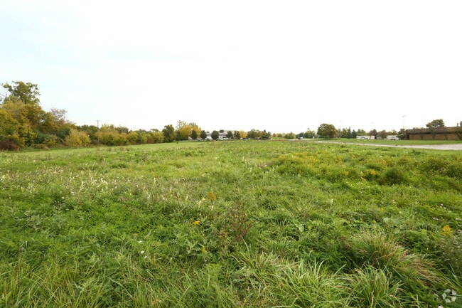

Property Detail
4421 S State Rd
Ann Arbor, MI
ASSR REEQUEST ****FROM 1216200027 06/10/98 ****FROM 1216200020 06/10/98 ****FROM 1216200021 06/10/98 PI 16-11A-2B-1 PARCEL A
12-16-200-028
WASHTENAW
Commercialacreage
Michigan
AE The base floodplain where base flood elevations are provided. AE Zones are now used on new format FIRMs instead of A1-A30 Zones.
2.11 AC
2025
Washtenaw W of 23
2025
Detroit
405600
NEARBY LISTINGS FOR SALE OR LEASE
DEMOGRAPHICS near 4421 S State Rd
1 mile
3 mile
5 mile
2025 Total Population
642
44,570
161,071
2030 Population
656
45,096
164,677
Pop Growth 2025-2030
+ 2.18%
+ 1.18%
+ 2.24%
Average Age
38
41
38
2025 Total Households
327
19,943
65,996
HH Growth 2025-2030
+ 2.14%
+ 1.05%
+ 2.27%
Median Household Inc
$72,769
$99,667
$86,966
Avg Household Size
2.00
2.20
2.20
2025 Avg HH Vehicles
1.00
2.00
2.00
Median Home Value
$238,571
$415,223
$418,274
Median Year Built
1991
1986
1979
Nearby Places
Map Layers
Map Styles
 Street
 Aerial
Layers
 Traffic
 Biking
Places
Listings with unknown addresses are not visible on the map
- Restaurants
- Banks
- Shops
- Fitness
- Groceries
PUBLIC TRANSPORTATION
COMMUTER RAIL
Drive
Walk
Distance
12 min
4.8 mi
AIRPORT
Detroit Metro Wayne County
Drive
Walk
Distance
Detroit Metro Wayne County
34 min
25.8 mi
Freight Ports
Drive
Walk
Distance
74 min
57.2 mi
SALE & LEASE HISTORY
LISTING DATE
SALE/LEASE

Oct 17, 2016
For Sale
Mar 23, 2020
For Sale
Nearby Properties
Address
Land Use
TOTAL SIZE
Lot Size
Zoning
Address
Land Use
TOTAL SIZE
Lot Size
Zoning
Address
Land Use
TOTAL SIZE
Lot Size
Zoning
315,108 SF
6.57 AC
C1B
Address
Land Use
TOTAL SIZE
Lot Size
Zoning
334,077 SF
20.41 AC
R4B
Address
Land Use
TOTAL SIZE
Lot Size
Zoning
357,978 SF
19.32 AC
R4B
Address
Land Use
TOTAL SIZE
Lot Size
Zoning
112,994 SF
45.12 AC
IH
Address
Land Use
TOTAL SIZE
Lot Size
Zoning
140,039 SF
Address
Land Use
TOTAL SIZE
Lot Size
Zoning
271,521 SF
15.11 AC
Address
Land Use
TOTAL SIZE
Lot Size
Zoning
214,559 SF
16.18 AC
PUD
Address
Land Use
TOTAL SIZE
Lot Size
Zoning
268,002 SF
18.34 AC
Address
Land Use
TOTAL SIZE
Lot Size
Zoning
234,076 SF
24.18 AC
R4A
Address
Land Use
TOTAL SIZE
Lot Size
Zoning
253,702 SF
30.23 AC
Address
Land Use
TOTAL SIZE
Lot Size
Zoning
111,435 SF
21.38 AC
R4B
Address
Land Use
TOTAL SIZE
Lot Size
Zoning
175,536 SF
12.98 AC
R4B
Address
Land Use
TOTAL SIZE
Lot Size
Zoning
88,460 SF
28.50 AC
DI
Address
Land Use
TOTAL SIZE
Lot Size
Zoning
192,726 SF
6.45 AC
O
Address
Land Use
TOTAL SIZE
Lot Size
Zoning
283,290 SF
10.42 AC
O
Address
Land Use
TOTAL SIZE
Lot Size
Zoning
137,182 SF
11.83 AC
R4C
Address
Land Use
TOTAL SIZE
Lot Size
Zoning
317,872 SF
11.79 AC
M1
Address
Land Use
TOTAL SIZE
Lot Size
Zoning
94,157 SF
7.20 AC
C3
Address
Land Use
TOTAL SIZE
Lot Size
Zoning
18,148 SF
21.62 AC
BI
Address
Land Use
TOTAL SIZE
Lot Size
Zoning
116,850 SF
5.27 AC
O
Address
Land Use
TOTAL SIZE
Lot Size
Zoning
167,294 SF
40.67 AC
Address
Land Use
TOTAL SIZE
Lot Size
Zoning
159,558 SF
10.59 AC
R4B
Address
Land Use
TOTAL SIZE
Lot Size
Zoning
129,872 SF
3.46 AC
R3
Address
Land Use
TOTAL SIZE
Lot Size
Zoning
19,236 SF
17.79 AC
BI
Address
Land Use
TOTAL SIZE
Lot Size
Zoning
74,481 SF
3.40 AC
R5
Address
Land Use
TOTAL SIZE
Lot Size
Zoning
178,367 SF
10.70 AC
R5
Address
Land Use
TOTAL SIZE
Lot Size
Zoning
74,152 SF
31.63 AC
BI
Address
Land Use
TOTAL SIZE
Lot Size
Zoning
170,742 SF
6.73 AC
R4B
Address
Land Use
TOTAL SIZE
Lot Size
Zoning
129,306 SF
8.65 AC
R4D
The World's #1 Commercial Real Estate Marketplace
Connect with us
© 2026 CoStar Group
The information above has been obtained from sources believed reliable. While we do not doubt its accuracy we have not verified it and make no guarantee, warranty or representation about it. It is your responsibility to independently confirm its accuracy and completeness. Any projections, opinions, assumptions, or estimates used are for example only and do not represent the current or future performance of the property. The value of this transaction to you depends on tax and other factors which should be evaluated by your tax, financial, and legal advisors. You and your advisors should conduct a careful, independent investigation of the property to determine to your satisfaction the suitability of the property for your needs.