Property Record
Southwood Dr At Old Diboll Hwy, Lufkin, TX 75904
NEARBY LISTINGS FOR SALE OR LEASE
Property Detail
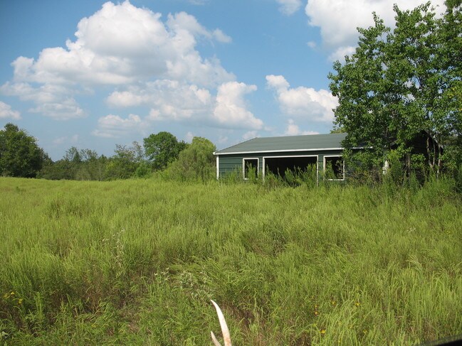
Southwood Dr At Old Diboll Hwy
Lufkin, TX
Longoria J. A
14683
ABS 0024 LONGORIA J. A.,TRACT 9,ACRES 5.107
Agriculturalnec
Angelina
A
Texas
48005C0265E
61.72 AC
2025
Texas East Area
2025
Other Market Areas
000301
DEMOGRAPHICS near Southwood Dr At Old Diboll Hwy
1 Mile
3 Mile
5 Mile
2024 Total Population
315
8,860
30,847
2029 Population
319
8,962
31,079
Pop Growth 2024-2029
+ 1.27%
+ 1.15%
+ 0.75%
Average Age
41
41
40
2024 Total Households
127
3,796
12,062
HH Growth 2024-2029
+ 1.57%
+ 1.16%
+ 0.75%
Median Household Inc
$77,273
$57,830
$54,642
Avg Household Size
2.50
2.30
2.50
2024 Avg HH Vehicles
2.00
2.00
2.00
Median Home Value
$189,130
$192,420
$160,483
Median Year Built
1998
1991
1986
Nearby Places
Map Layers
Map Styles
 Street
 Aerial
- Restaurants
- Banks
- Shops
- Fitness
- Groceries
SALE & LEASE HISTORY
LISTING DATE
SALE/LEASE

Mar 21, 2018
For Sale
Nearby Properties
Address
Land Use
TOTAL SIZE
Lot Size
Zoning
Address
Land Use
TOTAL SIZE
Lot Size
Zoning
217,014 SF
8.58 AC
Address
Land Use
TOTAL SIZE
Lot Size
Zoning
108,460 SF
11.39 AC
Address
Land Use
TOTAL SIZE
Lot Size
Zoning
67,014 SF
23.42 AC
Address
Land Use
TOTAL SIZE
Lot Size
Zoning
60,189 SF
46.10 AC
Address
Land Use
TOTAL SIZE
Lot Size
Zoning
2,319 SF
19.10 AC
Address
Land Use
TOTAL SIZE
Lot Size
Zoning
2,576 SF
14.68 AC
Address
Land Use
TOTAL SIZE
Lot Size
Zoning
20,820 SF
17.42 AC
RL
Address
Land Use
TOTAL SIZE
Lot Size
Zoning
52,832 SF
5.47 AC
RL
Address
Land Use
TOTAL SIZE
Lot Size
Zoning
232,026 SF
27.14 AC
Address
Land Use
TOTAL SIZE
Lot Size
Zoning
68,340 SF
3.52 AC
Address
Land Use
TOTAL SIZE
Lot Size
Zoning
43,552 SF
2.01 AC
Address
Land Use
TOTAL SIZE
Lot Size
Zoning
71,140 SF
9.22 AC
Address
Land Use
TOTAL SIZE
Lot Size
Zoning
134,748 SF
16.08 AC
CSU
Address
Land Use
TOTAL SIZE
Lot Size
Zoning
126,715 SF
10.93 AC
LB
Address
Land Use
TOTAL SIZE
Lot Size
Zoning
122,655 SF
18.76 AC
Address
Land Use
TOTAL SIZE
Lot Size
Zoning
91,100 SF
8.28 AC
CB
Address
Land Use
TOTAL SIZE
Lot Size
Zoning
104,779 SF
6.55 AC
RL
Address
Land Use
TOTAL SIZE
Lot Size
Zoning
27,368 SF
17.33 AC
Address
Land Use
TOTAL SIZE
Lot Size
Zoning
48,400 SF
3.91 AC
Address
Land Use
TOTAL SIZE
Lot Size
Zoning
5,620 SF
11.78 AC
RLSU
Address
Land Use
TOTAL SIZE
Lot Size
Zoning
60,546 SF
5.04 AC
Address
Land Use
TOTAL SIZE
Lot Size
Zoning
46,046 SF
1.94 AC
C
Address
Land Use
TOTAL SIZE
Lot Size
Zoning
89,332 SF
6.32 AC
C
Address
Land Use
TOTAL SIZE
Lot Size
Zoning
2,675 SF
7.18 AC
PUD
Address
Land Use
TOTAL SIZE
Lot Size
Zoning
88,498 SF
7.81 AC
ASU
Address
Land Use
TOTAL SIZE
Lot Size
Zoning
18,724 SF
9.61 AC
Address
Land Use
TOTAL SIZE
Lot Size
Zoning
1,935 SF
74.60 AC
Address
Land Use
TOTAL SIZE
Lot Size
Zoning
12,800 SF
10.04 AC
The World's #1 Commercial Real Estate Marketplace
Connect with us
© 2025 CoStar Group
The information above has been obtained from sources believed reliable. While we do not doubt its accuracy we have not verified it and make no guarantee, warranty or representation about it. It is your responsibility to independently confirm its accuracy and completeness. Any projections, opinions, assumptions, or estimates used are for example only and do not represent the current or future performance of the property. The value of this transaction to you depends on tax and other factors which should be evaluated by your tax, financial, and legal advisors. You and your advisors should conduct a careful, independent investigation of the property to determine to your satisfaction the suitability of the property for your needs.