Property Record
Specht Rd, San Antonio, TX 78260
Property Detail
Specht Rd
San Antonio-New Braunfels, TX
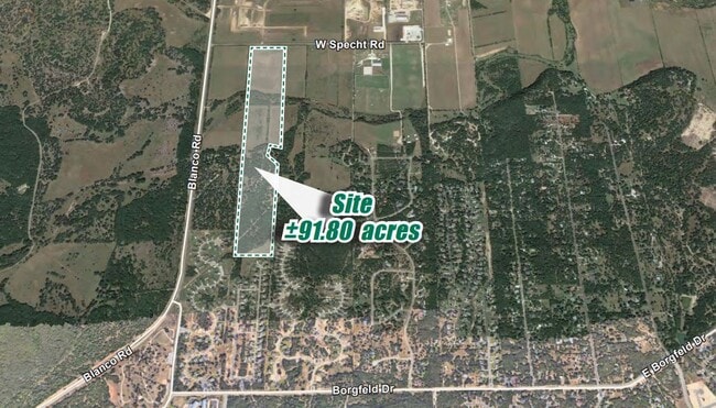
CB 4837 P-9 (2.467 AC), P-9A(24.87 AC), P-10 (3.455 AC) & P-10B (28.208 AC) ABS 612 2025 RESURVEY/ST XFR PER DEED 20240071012 FILED 04/22/2024 PER CR #62880.
04837-000-0095
BEXAR
Privatepreserveopenspacevacantlandforestlandconservation
Texas
A Areas with a 1% annual chance of flooding and a 26% chance of flooding over the life of a 30-year mortgage.
9
2024
64.02 AC
2025
Far North Central
191804
San Antonio
NEARBY LISTINGS FOR SALE OR LEASE
DEMOGRAPHICS near Specht Rd
1 mile
3 mile
5 mile
2025 Total Population
813
16,661
56,942
2030 Population
888
18,013
61,783
Pop Growth 2025-2030
+ 9.23%
+ 8.11%
+ 8.50%
Average Age
39
40
39
2025 Total Households
261
5,694
19,002
HH Growth 2025-2030
+ 9.20%
+ 8.22%
+ 8.75%
Median Household Inc
$164,634
$142,268
$142,322
Avg Household Size
3.10
2.90
3.00
2025 Avg HH Vehicles
2.00
2.00
2.00
Median Home Value
$515,625
$469,019
$483,999
Median Year Built
2011
2009
2007
Nearby Places
Map Layers
Map Styles
 Street
 Aerial
Layers
 Traffic
 Biking
Places
Listings with unknown addresses are not visible on the map
- Restaurants
- Banks
- Shops
- Fitness
- Groceries
PUBLIC TRANSPORTATION
AIRPORT
San Antonio International
Drive
Walk
Distance
San Antonio International
24 min
17.3 mi
Freight Ports
Calhoun Port
Drive
Walk
Distance
Calhoun Port
200 min
166.2 mi
SALE & LEASE HISTORY
LISTING DATE
SALE/LEASE

Aug 02, 2022
For Sale
Nearby Properties
Address
Land Use
TOTAL SIZE
Lot Size
Zoning
Address
Land Use
TOTAL SIZE
Lot Size
Zoning
310,384 SF
14.25 AC
Address
Land Use
TOTAL SIZE
Lot Size
Zoning
66,166 SF
85.74 AC
Address
Land Use
TOTAL SIZE
Lot Size
Zoning
76,120 SF
3.90 AC
Address
Land Use
TOTAL SIZE
Lot Size
Zoning
8,740 SF
6.36 AC
Address
Land Use
TOTAL SIZE
Lot Size
Zoning
134.81 AC
Address
Land Use
TOTAL SIZE
Lot Size
Zoning
6,590 SF
211.63 AC
Address
Land Use
TOTAL SIZE
Lot Size
Zoning
13,557 SF
2.31 AC
Address
Land Use
TOTAL SIZE
Lot Size
Zoning
39,433 SF
1.17 AC
Address
Land Use
TOTAL SIZE
Lot Size
Zoning
7.47 AC
Address
Land Use
TOTAL SIZE
Lot Size
Zoning
13,904 SF
2.36 AC
Address
Land Use
TOTAL SIZE
Lot Size
Zoning
46,891 SF
2.14 AC
Address
Land Use
TOTAL SIZE
Lot Size
Zoning
4,908 SF
92.87 AC
Address
Land Use
TOTAL SIZE
Lot Size
Zoning
19,523 SF
1.68 AC
Address
Land Use
TOTAL SIZE
Lot Size
Zoning
10.55 AC
Address
Land Use
TOTAL SIZE
Lot Size
Zoning
7,500 SF
0.71 AC
Address
Land Use
TOTAL SIZE
Lot Size
Zoning
95.60 AC
Address
Land Use
TOTAL SIZE
Lot Size
Zoning
25,200 SF
35.54 AC
Address
Land Use
TOTAL SIZE
Lot Size
Zoning
11,183 SF
23.09 AC
Address
Land Use
TOTAL SIZE
Lot Size
Zoning
62.34 AC
Address
Land Use
TOTAL SIZE
Lot Size
Zoning
1,659 SF
119.96 AC
Address
Land Use
TOTAL SIZE
Lot Size
Zoning
41.39 AC
Address
Land Use
TOTAL SIZE
Lot Size
Zoning
7,609 SF
2.18 AC
Address
Land Use
TOTAL SIZE
Lot Size
Zoning
9,750 SF
6.50 AC
Address
Land Use
TOTAL SIZE
Lot Size
Zoning
67.19 AC
Address
Land Use
TOTAL SIZE
Lot Size
Zoning
9,600 SF
7 AC
Address
Land Use
TOTAL SIZE
Lot Size
Zoning
6,647 SF
Address
Land Use
TOTAL SIZE
Lot Size
Zoning
68.93 AC
Address
Land Use
TOTAL SIZE
Lot Size
Zoning
13.79 AC
Address
Land Use
TOTAL SIZE
Lot Size
Zoning
1,568 SF
5.73 AC
The World's #1 Commercial Real Estate Marketplace
Connect with us
© 2026 CoStar Group
The information above has been obtained from sources believed reliable. While we do not doubt its accuracy we have not verified it and make no guarantee, warranty or representation about it. It is your responsibility to independently confirm its accuracy and completeness. Any projections, opinions, assumptions, or estimates used are for example only and do not represent the current or future performance of the property. The value of this transaction to you depends on tax and other factors which should be evaluated by your tax, financial, and legal advisors. You and your advisors should conduct a careful, independent investigation of the property to determine to your satisfaction the suitability of the property for your needs.