Property Record
Squankum-Yellowbrook, Howell, NJ 07731
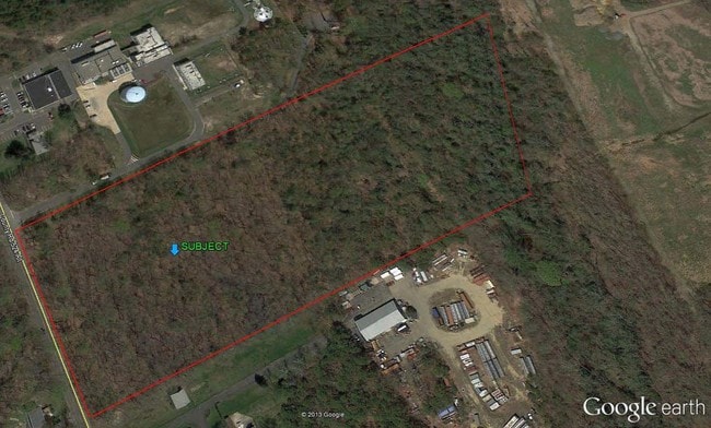

Property Detail
Squankum-Yellowbrook
21-00049-0000-00017
MONMOUTH
Vacantlandnec
New Jersey
SED
17
A Areas with a 1% annual chance of flooding and a 26% chance of flooding over the life of a 30-year mortgage.
14.81 AC
2024
Western Monmouth
2025
Northern New Jersey
811402
Lakewood-New Brunswick, NJ
NEARBY LISTINGS FOR SALE OR LEASE
DEMOGRAPHICS near Squankum-Yellowbrook
1 mile
3 mile
5 mile
2025 Total Population
471
10,112
59,472
2030 Population
461
10,018
59,071
Pop Growth 2025-2030
(2.12%)
(0.93%)
(0.67%)
Average Age
42
41
41
2025 Total Households
177
3,449
20,073
HH Growth 2025-2030
(2.26%)
(1.19%)
(0.96%)
Median Household Inc
$135,227
$135,086
$130,008
Avg Household Size
2.50
2.80
2.80
2025 Avg HH Vehicles
2.00
2.00
2.00
Median Home Value
$496,153
$575,443
$565,575
Median Year Built
1988
1982
1983
Nearby Places
Map Layers
Map Styles
 Street
 Aerial
Transit
 Traffic
 Biking
Places
Listings with unknown addresses are not visible on the map
- Restaurants
- Banks
- Shops
- Fitness
- Groceries
PUBLIC TRANSPORTATION
COMMUTER RAIL
Manasquan (North Jersey Coast Line - NJ Transit Commuter Rail (NJ Transit))
Drive
Walk
Distance
Manasquan (North Jersey Coast Line - NJ Transit Commuter Rail (NJ Transit))
15 min
7.9 mi
Freight Ports
New York Container Terminal
Drive
Walk
Distance
New York Container Terminal
58 min
41.9 mi
SALE & LEASE HISTORY
LISTING DATE
SALE/LEASE

Sep 24, 2016
For Sale
Nearby Properties
Address
Land Use
TOTAL SIZE
Lot Size
Zoning
Address
Land Use
TOTAL SIZE
Lot Size
Zoning
192,708 SF
33.36 AC
OR10
Address
Land Use
TOTAL SIZE
Lot Size
Zoning
13 AC
SF40
Address
Land Use
TOTAL SIZE
Lot Size
Zoning
19,996 SF
386.01 AC
POS
Address
Land Use
TOTAL SIZE
Lot Size
Zoning
912 SF
201.36 AC
RRC
Address
Land Use
TOTAL SIZE
Lot Size
Zoning
240,362 SF
61.13 AC
ARE6
Address
Land Use
TOTAL SIZE
Lot Size
Zoning
360,400 SF
35.98 AC
SED
Address
Land Use
TOTAL SIZE
Lot Size
Zoning
3,400 SF
262.97 AC
AI
Address
Land Use
TOTAL SIZE
Lot Size
Zoning
2,976 SF
336.41 AC
POS
Address
Land Use
TOTAL SIZE
Lot Size
Zoning
13,350 SF
71.10 AC
ARE6
Address
Land Use
TOTAL SIZE
Lot Size
Zoning
161,000 SF
21.60 AC
ARE2
Address
Land Use
TOTAL SIZE
Lot Size
Zoning
142,676 SF
10.47 AC
OR-2
Address
Land Use
TOTAL SIZE
Lot Size
Zoning
4,060 SF
270.36 AC
CR40
Address
Land Use
TOTAL SIZE
Lot Size
Zoning
55,984 SF
16.11 AC
I0
Address
Land Use
TOTAL SIZE
Lot Size
Zoning
58,200 SF
6.04 AC
OP-2
Address
Land Use
TOTAL SIZE
Lot Size
Zoning
10.11 AC
SED
Address
Land Use
TOTAL SIZE
Lot Size
Zoning
86,936 SF
3.42 AC
I0
Address
Land Use
TOTAL SIZE
Lot Size
Zoning
13.24 AC
SED
Address
Land Use
TOTAL SIZE
Lot Size
Zoning
65.74 AC
SED
Address
Land Use
TOTAL SIZE
Lot Size
Zoning
34,240 SF
12.68 AC
ARE6
Address
Land Use
TOTAL SIZE
Lot Size
Zoning
8,676 SF
8.19 AC
OP-2
Address
Land Use
TOTAL SIZE
Lot Size
Zoning
212.49 AC
ARE6
Address
Land Use
TOTAL SIZE
Lot Size
Zoning
190.72 AC
POS
Address
Land Use
TOTAL SIZE
Lot Size
Zoning
27,105 SF
9.41 AC
OP-2
Address
Land Use
TOTAL SIZE
Lot Size
Zoning
13.33 AC
SED
Address
Land Use
TOTAL SIZE
Lot Size
Zoning
7.04 AC
SED
Address
Land Use
TOTAL SIZE
Lot Size
Zoning
6.24 AC
SED
Address
Land Use
TOTAL SIZE
Lot Size
Zoning
7,764 SF
1.35 AC
OR10
Address
Land Use
TOTAL SIZE
Lot Size
Zoning
360 SF
167.72 AC
POS
Address
Land Use
TOTAL SIZE
Lot Size
Zoning
13,832 SF
11.60 AC
SED
Address
Land Use
TOTAL SIZE
Lot Size
Zoning
8,170 SF
9.99 AC
OR-2
The World's #1 Commercial Real Estate Marketplace
Connect with us
© 2026 CoStar Group
The information above has been obtained from sources believed reliable. While we do not doubt its accuracy we have not verified it and make no guarantee, warranty or representation about it. It is your responsibility to independently confirm its accuracy and completeness. Any projections, opinions, assumptions, or estimates used are for example only and do not represent the current or future performance of the property. The value of this transaction to you depends on tax and other factors which should be evaluated by your tax, financial, and legal advisors. You and your advisors should conduct a careful, independent investigation of the property to determine to your satisfaction the suitability of the property for your needs.