Property Record
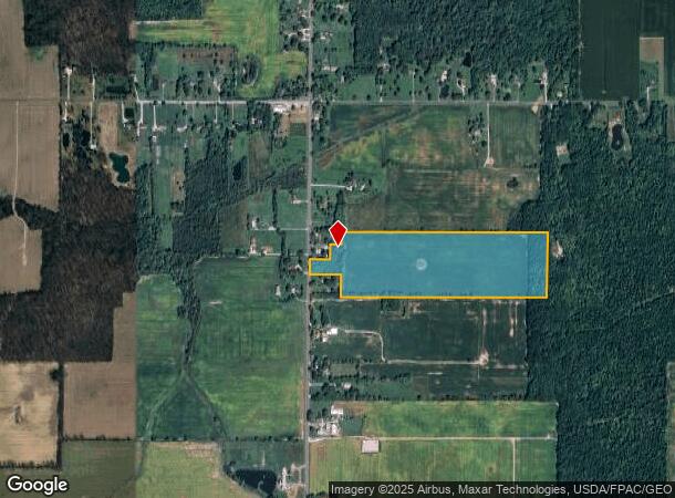
State Route 301, Lagrange, OH 44050

NEARBY LISTINGS FOR SALE OR LEASE
Property Detail
State Route 301
15-00-075-000-014
75
Agriculturalland
Lorain
X
Ohio
39093C0330D
36.86 AC
2024
Lorain County
2024
Cleveland
094102
Cleveland-Elyria, OH
DEMOGRAPHICS near State Route 301
1 Mile
3 Mile
5 Mile
2024 Total Population
187
6,540
11,277
2029 Population
191
6,740
11,544
Pop Growth 2024-2029
+ 2.14%
+ 3.06%
+ 2.37%
Average Age
42
42
43
2024 Total Households
70
2,463
4,168
HH Growth 2024-2029
+ 2.86%
+ 3.00%
+ 2.38%
Median Household Inc
$71,874
$80,362
$85,378
Avg Household Size
2.60
2.60
2.60
2024 Avg HH Vehicles
2.00
2.00
2.00
Median Home Value
$181,999
$220,685
$238,062
Median Year Built
1974
1981
1978
Nearby Places
Map Layers
Map Styles
 Street
 Aerial
- Restaurants
- Banks
- Shops
- Fitness
- Groceries
PUBLIC TRANSPORTATION
AIRPORT
Cleveland-Hopkins International
DRIVE
WALK
Distance
Cleveland-Hopkins International
36 min
24.4 mi
Freight Ports
Port of Toledo
DRIVE
WALK
Distance
Port of Toledo
124 min
96.8 mi
SALE & LEASE HISTORY
LISTING DATE
SALE/LEASE

Feb 05, 2024
For Sale
Nearby Properties
Address
Land Use
TOTAL SIZE
Lot Size
Zoning
Address
Land Use
TOTAL SIZE
Lot Size
Zoning
242,218 SF
58.63 AC
Address
Land Use
TOTAL SIZE
Lot Size
Zoning
62,653 SF
10 AC
Address
Land Use
TOTAL SIZE
Lot Size
Zoning
104,257 SF
4.11 AC
Address
Land Use
TOTAL SIZE
Lot Size
Zoning
15,200 SF
9.50 AC
Address
Land Use
TOTAL SIZE
Lot Size
Zoning
10,480 SF
0.50 AC
Address
Land Use
TOTAL SIZE
Lot Size
Zoning
2,112 SF
72.85 AC
Address
Land Use
TOTAL SIZE
Lot Size
Zoning
7,416 SF
6.36 AC
Address
Land Use
TOTAL SIZE
Lot Size
Zoning
62,040 SF
9.62 AC
Address
Land Use
TOTAL SIZE
Lot Size
Zoning
104,257 SF
16.86 AC
Address
Land Use
TOTAL SIZE
Lot Size
Zoning
7.18 AC
Address
Land Use
TOTAL SIZE
Lot Size
Zoning
51,998 SF
9.01 AC
Address
Land Use
TOTAL SIZE
Lot Size
Zoning
28,598 SF
6 AC
Address
Land Use
TOTAL SIZE
Lot Size
Zoning
3,672 SF
1.71 AC
Address
Land Use
TOTAL SIZE
Lot Size
Zoning
4,257 SF
0.29 AC
Address
Land Use
TOTAL SIZE
Lot Size
Zoning
44,900 SF
6.05 AC
Address
Land Use
TOTAL SIZE
Lot Size
Zoning
47,576 SF
1.02 AC
Address
Land Use
TOTAL SIZE
Lot Size
Zoning
133.70 AC
Address
Land Use
TOTAL SIZE
Lot Size
Zoning
26,640 SF
3.69 AC
Address
Land Use
TOTAL SIZE
Lot Size
Zoning
43,817 SF
13.63 AC
Address
Land Use
TOTAL SIZE
Lot Size
Zoning
25,388 SF
2.23 AC
Address
Land Use
TOTAL SIZE
Lot Size
Zoning
9,331 SF
84.40 AC
Address
Land Use
TOTAL SIZE
Lot Size
Zoning
5,486 SF
1.92 AC
Address
Land Use
TOTAL SIZE
Lot Size
Zoning
980 SF
12.79 AC
Address
Land Use
TOTAL SIZE
Lot Size
Zoning
3,912 SF
120.90 AC
Address
Land Use
TOTAL SIZE
Lot Size
Zoning
100 AC
Address
Land Use
TOTAL SIZE
Lot Size
Zoning
88.31 AC
Address
Land Use
TOTAL SIZE
Lot Size
Zoning
2,996 SF
0.78 AC
Address
Land Use
TOTAL SIZE
Lot Size
Zoning
4,946 SF
116.33 AC
Address
Land Use
TOTAL SIZE
Lot Size
Zoning
6,884 SF
1.82 AC
Address
Land Use
TOTAL SIZE
Lot Size
Zoning
2,100 SF
4.03 AC
The World's #1 Commercial Real Estate Marketplace
Connect with us
© 2026 CoStar Group
The information above has been obtained from sources believed reliable. While we do not doubt its accuracy we have not verified it and make no guarantee, warranty or representation about it. It is your responsibility to independently confirm its accuracy and completeness. Any projections, opinions, assumptions, or estimates used are for example only and do not represent the current or future performance of the property. The value of this transaction to you depends on tax and other factors which should be evaluated by your tax, financial, and legal advisors. You and your advisors should conduct a careful, independent investigation of the property to determine to your satisfaction the suitability of the property for your needs.