Property Record
1909 Unknown, Cocoa, FL 32926
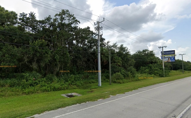

This Property Is For Sale
Property Detail
1909 Unknown
24-35-34-00-00031.0-0000.00
PT OF NE 1/4 OF NE 1/4 AS DESC IN ORB 2221 PG 249 EXC ORB 2822 PG'S 105,109 & 113, 2841 PG 1307, 2872 PG 1087, 2900 PG 1879 & RD R/W
Commercialacreage
BREVARD
BU-1
Florida
B and X Area of moderate flood hazard, usually the area between the limits of the 100-year and 500-year floods.
2.88 AC
2024
Brevard County
2025
Orlando
062500
Palm Bay-Melbourne-Titusville, FL
NEARBY LISTINGS FOR SALE OR LEASE
DEMOGRAPHICS near 1909 Unknown
1 mile
3 mile
5 mile
2025 Total Population
3,372
14,909
49,880
2030 Population
3,685
16,100
53,662
Pop Growth 2025-2030
+ 9.28%
+ 7.99%
+ 7.58%
Average Age
49
44
43
2025 Total Households
1,548
6,083
20,416
HH Growth 2025-2030
+ 9.24%
+ 7.78%
+ 7.31%
Median Household Inc
$63,750
$54,835
$61,281
Avg Household Size
2.20
2.40
2.40
2025 Avg HH Vehicles
2.00
2.00
2.00
Median Home Value
$255,454
$258,242
$281,405
Median Year Built
1989
1986
1982
Nearby Places
Map Layers
Map Styles
 Street
 Aerial
Layers
 Traffic
 Biking
Places
Listings with unknown addresses are not visible on the map
- Restaurants
- Banks
- Shops
- Fitness
- Groceries
PUBLIC TRANSPORTATION
AIRPORT
Melbourne Orlando International
Drive
Walk
Distance
Melbourne Orlando International
34 min
25.2 mi
Freight Ports
Port Canaveral
Drive
Walk
Distance
Port Canaveral
21 min
14.3 mi
Nearby Properties
Address
Land Use
TOTAL SIZE
Lot Size
Zoning
Address
Land Use
TOTAL SIZE
Lot Size
Zoning
658,069 SF
268.45 AC
RU17
Address
Land Use
TOTAL SIZE
Lot Size
Zoning
497,135 SF
34.13 AC
CW
Address
Land Use
TOTAL SIZE
Lot Size
Zoning
307,934 SF
13.66 AC
RU215
Address
Land Use
TOTAL SIZE
Lot Size
Zoning
264,679 SF
59.90 AC
RU17
Address
Land Use
TOTAL SIZE
Lot Size
Zoning
102,141 SF
47.88 AC
BU1
Address
Land Use
TOTAL SIZE
Lot Size
Zoning
101,945 SF
11.15 AC
CG
Address
Land Use
TOTAL SIZE
Lot Size
Zoning
141,592 SF
20.22 AC
CG
Address
Land Use
TOTAL SIZE
Lot Size
Zoning
49,208 SF
18.28 AC
Address
Land Use
TOTAL SIZE
Lot Size
Zoning
86,391 SF
12.02 AC
GU
Address
Land Use
TOTAL SIZE
Lot Size
Zoning
77,885 SF
11.54 AC
BU2
Address
Land Use
TOTAL SIZE
Lot Size
Zoning
65,316 SF
956.57 AC
GML(H)
Address
Land Use
TOTAL SIZE
Lot Size
Zoning
38,033 SF
10.72 AC
Address
Land Use
TOTAL SIZE
Lot Size
Zoning
66,210 SF
12.22 AC
M2
Address
Land Use
TOTAL SIZE
Lot Size
Zoning
62,439 SF
14.19 AC
TU-2
Address
Land Use
TOTAL SIZE
Lot Size
Zoning
76,142 SF
8.26 AC
BU-2
Address
Land Use
TOTAL SIZE
Lot Size
Zoning
78,343 SF
8.50 AC
CG
Address
Land Use
TOTAL SIZE
Lot Size
Zoning
33,221 SF
6.31 AC
Address
Land Use
TOTAL SIZE
Lot Size
Zoning
13,616 SF
12.92 AC
Address
Land Use
TOTAL SIZE
Lot Size
Zoning
69,352 SF
3.81 AC
BU-2
Address
Land Use
TOTAL SIZE
Lot Size
Zoning
42,612 SF
7.41 AC
CW
Address
Land Use
TOTAL SIZE
Lot Size
Zoning
49,460 SF
5 AC
CG
Address
Land Use
TOTAL SIZE
Lot Size
Zoning
23,864 SF
3.89 AC
BU-2
Address
Land Use
TOTAL SIZE
Lot Size
Zoning
66,216 SF
16.04 AC
AU
Address
Land Use
TOTAL SIZE
Lot Size
Zoning
40,102 SF
11.51 AC
CW
Address
Land Use
TOTAL SIZE
Lot Size
Zoning
63,760 SF
5.46 AC
BU2
Address
Land Use
TOTAL SIZE
Lot Size
Zoning
2,520 SF
69.41 AC
IU
Address
Land Use
TOTAL SIZE
Lot Size
Zoning
19.77 AC
Address
Land Use
TOTAL SIZE
Lot Size
Zoning
10,864 SF
12 AC
RVP
Address
Land Use
TOTAL SIZE
Lot Size
Zoning
23,617 SF
48.92 AC
GML
Address
Land Use
TOTAL SIZE
Lot Size
Zoning
3,360 SF
11.82 AC
IU
The World's #1 Commercial Real Estate Marketplace
Connect with us
© 2026 CoStar Group
The information above has been obtained from sources believed reliable. While we do not doubt its accuracy we have not verified it and make no guarantee, warranty or representation about it. It is your responsibility to independently confirm its accuracy and completeness. Any projections, opinions, assumptions, or estimates used are for example only and do not represent the current or future performance of the property. The value of this transaction to you depends on tax and other factors which should be evaluated by your tax, financial, and legal advisors. You and your advisors should conduct a careful, independent investigation of the property to determine to your satisfaction the suitability of the property for your needs.