Property Record
11200 State Road 82 Rd, Fort Myers, FL 33905

NEARBY LISTINGS FOR SALE OR LEASE
Property Detail
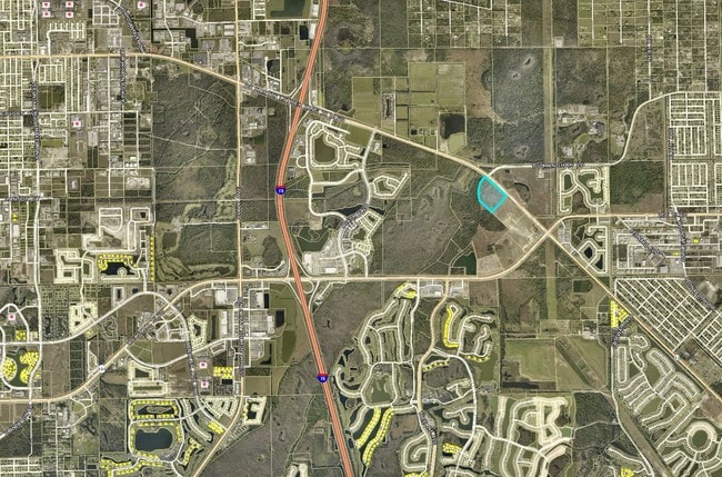
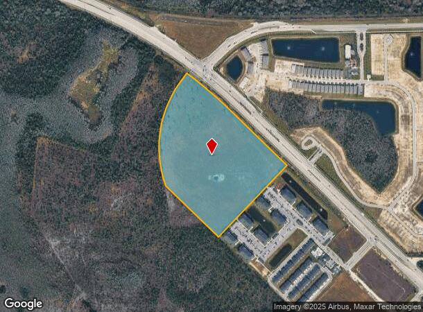
11200 State Road 82 Rd
Cape Coral-Fort Myers, FL
Colonial - Sr 82 E Of I-75
26-44-25-P2-00065.0000
PARL NE 1/4 SEC 26 + PT NW 1/4 SEC 25 S OF SR 82 DESC OR 2077/ PG 3285
Pasture
Lee
AE
Florida
12071C0432F
27.07 AC
2024
City of Ft Myers
2025
Southwest Florida
040110
DEMOGRAPHICS near 11200 State Road 82 Rd
1 Mile
3 Mile
5 Mile
2024 Total Population
1,658
37,326
125,420
2029 Population
1,965
44,565
149,405
Pop Growth 2024-2029
+ 18.52%
+ 19.39%
+ 19.12%
Average Age
37
43
40
2024 Total Households
547
14,093
46,418
HH Growth 2024-2029
+ 18.28%
+ 19.92%
+ 19.18%
Median Household Inc
$78,354
$71,958
$63,890
Avg Household Size
2.80
2.40
2.50
2024 Avg HH Vehicles
2.00
2.00
2.00
Median Home Value
$262,944
$291,902
$281,475
Median Year Built
2006
2007
2004
Nearby Places
Map Layers
Map Styles
 Street
 Aerial
- Restaurants
- Banks
- Shops
- Fitness
- Groceries
PUBLIC TRANSPORTATION
AIRPORT
Southwest Florida International
DRIVE
WALK
Distance
Southwest Florida International
13 min
7.2 mi
Punta Gorda
DRIVE
WALK
Distance
Punta Gorda
33 min
27.3 mi
Freight Ports
Port Manatee
DRIVE
WALK
Distance
Port Manatee
113 min
98.9 mi
SALE & LEASE HISTORY
LISTING DATE
SALE/LEASE

Sep 24, 2016
For Sale
Nearby Properties
Address
Land Use
TOTAL SIZE
Lot Size
Zoning
Address
Land Use
TOTAL SIZE
Lot Size
Zoning
77.79 AC
PUD
Address
Land Use
TOTAL SIZE
Lot Size
Zoning
608,522 SF
38.57 AC
CG
Address
Land Use
TOTAL SIZE
Lot Size
Zoning
438,839 SF
66.95 AC
MU
Address
Land Use
TOTAL SIZE
Lot Size
Zoning
463,722 SF
23.85 AC
C-1
Address
Land Use
TOTAL SIZE
Lot Size
Zoning
362,391 SF
12.80 AC
SDA
Address
Land Use
TOTAL SIZE
Lot Size
Zoning
475,045 SF
30.22 AC
PUD
Address
Land Use
TOTAL SIZE
Lot Size
Zoning
24.69 AC
C-1
Address
Land Use
TOTAL SIZE
Lot Size
Zoning
432,890 SF
18.88 AC
SDA
Address
Land Use
TOTAL SIZE
Lot Size
Zoning
422,099 SF
1.10 AC
CG
Address
Land Use
TOTAL SIZE
Lot Size
Zoning
286,629 SF
13.01 AC
SDA
Address
Land Use
TOTAL SIZE
Lot Size
Zoning
111.70 AC
C1
Address
Land Use
TOTAL SIZE
Lot Size
Zoning
580,121 SF
61.83 AC
IL
Address
Land Use
TOTAL SIZE
Lot Size
Zoning
324,346 SF
20 AC
C1
Address
Land Use
TOTAL SIZE
Lot Size
Zoning
9.07 AC
SDA
Address
Land Use
TOTAL SIZE
Lot Size
Zoning
17.50 AC
C1
Address
Land Use
TOTAL SIZE
Lot Size
Zoning
260,320 SF
8.81 AC
SDA
Address
Land Use
TOTAL SIZE
Lot Size
Zoning
333,614 SF
294.30 AC
AG-2
Address
Land Use
TOTAL SIZE
Lot Size
Zoning
261,340 SF
9.07 AC
CG
Address
Land Use
TOTAL SIZE
Lot Size
Zoning
6.99 AC
C-1
Address
Land Use
TOTAL SIZE
Lot Size
Zoning
288,358 SF
23.15 AC
CG
Address
Land Use
TOTAL SIZE
Lot Size
Zoning
6.38 AC
SDA
Address
Land Use
TOTAL SIZE
Lot Size
Zoning
67.46 AC
C1
Address
Land Use
TOTAL SIZE
Lot Size
Zoning
154,653 SF
11.77 AC
SDA
Address
Land Use
TOTAL SIZE
Lot Size
Zoning
230,967 SF
8.31 AC
SDA
Address
Land Use
TOTAL SIZE
Lot Size
Zoning
482,282 SF
20 AC
CG
Address
Land Use
TOTAL SIZE
Lot Size
Zoning
2.33 AC
CG
Address
Land Use
TOTAL SIZE
Lot Size
Zoning
231,360 SF
17.08 AC
PUD
Address
Land Use
TOTAL SIZE
Lot Size
Zoning
395,421 SF
14.72 AC
CG
Address
Land Use
TOTAL SIZE
Lot Size
Zoning
45,040 SF
14.03 AC
CG
Address
Land Use
TOTAL SIZE
Lot Size
Zoning
174,647 SF
21.57 AC
CG
The World's #1 Commercial Real Estate Marketplace
Connect with us
© 2025 CoStar Group
The information above has been obtained from sources believed reliable. While we do not doubt its accuracy we have not verified it and make no guarantee, warranty or representation about it. It is your responsibility to independently confirm its accuracy and completeness. Any projections, opinions, assumptions, or estimates used are for example only and do not represent the current or future performance of the property. The value of this transaction to you depends on tax and other factors which should be evaluated by your tax, financial, and legal advisors. You and your advisors should conduct a careful, independent investigation of the property to determine to your satisfaction the suitability of the property for your needs.