Property Record
Sr16 Highway E, Gig Harbor, WA 98335
NEARBY LISTINGS FOR SALE OR LEASE
Property Detail
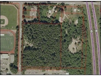
Sr16 Highway E
Seattle-Tacoma-Bellevue, WA
Pierce County Short Plat #78-584
012224-1044
SECTION 24 TOWNSHIP 22 RANGE 01 QUARTER 12 : THAT POR OF E 1/2 OF E 1/2 OF NW OF NE LY WLY OF SR 16 EXC S 330 FT THEREOF ALSO EXC CO RD SEG G 5621 HB
Vacantlandnec
Pierce
X
Washington
53033C0925G
4
2024
0.76 AC
2025
Gig Harbor/W Pierce Co
072505
Seattle/Puget Sound
DEMOGRAPHICS near Sr16 Highway E
1 mile
3 mile
5 mile
2024 Total Population
3,009
21,352
45,960
2029 Population
3,084
21,915
47,068
Pop Growth 2024-2029
+ 2.49%
+ 2.64%
+ 2.41%
Average Age
43
43
44
2024 Total Households
976
7,792
17,328
HH Growth 2024-2029
+ 2.66%
+ 2.68%
+ 2.49%
Median Household Inc
$121,439
$117,708
$114,005
Avg Household Size
2.60
2.60
2.60
2024 Avg HH Vehicles
2.00
2.00
2.00
Median Home Value
$714,354
$683,954
$651,872
Median Year Built
1993
1994
1991
Nearby Places
Map Layers
Map Styles
 Street
 Aerial
Transit
 Traffic
 Biking
Places
Listings with unknown addresses are not visible on the map
- Restaurants
- Banks
- Shops
- Fitness
- Groceries
PUBLIC TRANSPORTATION
AIRPORT
Seattle-Tacoma International
Drive
Walk
Distance
Seattle-Tacoma International
52 min
37.0 mi
Freight Ports
Port of Tacoma
Drive
Walk
Distance
Port of Tacoma
24 min
18.6 mi
Nearby Properties
Address
Land Use
TOTAL SIZE
Lot Size
Zoning
Address
Land Use
TOTAL SIZE
Lot Size
Zoning
308,000 SF
23.44 AC
PCD-BP
Address
Land Use
TOTAL SIZE
Lot Size
Zoning
427,880 SF
17.97 AC
GIGH
Address
Land Use
TOTAL SIZE
Lot Size
Zoning
192,969 SF
11.52 AC
PRD
Address
Land Use
TOTAL SIZE
Lot Size
Zoning
321,717 SF
75.30 AC
PI
Address
Land Use
TOTAL SIZE
Lot Size
Zoning
87,475 SF
11 AC
Address
Land Use
TOTAL SIZE
Lot Size
Zoning
71,494 SF
14.14 AC
Address
Land Use
TOTAL SIZE
Lot Size
Zoning
151,391 SF
17.49 AC
PCD-C
Address
Land Use
TOTAL SIZE
Lot Size
Zoning
92,797 SF
0.69 AC
PCD-BP
Address
Land Use
TOTAL SIZE
Lot Size
Zoning
295,242 SF
62 AC
PI
Address
Land Use
TOTAL SIZE
Lot Size
Zoning
122,520 SF
10.76 AC
PCD-C
Address
Land Use
TOTAL SIZE
Lot Size
Zoning
728 SF
60 AC
R5
Address
Land Use
TOTAL SIZE
Lot Size
Zoning
122,080 SF
16 AC
PCD-C
Address
Land Use
TOTAL SIZE
Lot Size
Zoning
57,560 SF
5.43 AC
PCD-C
Address
Land Use
TOTAL SIZE
Lot Size
Zoning
29,470 SF
3.46 AC
PCD-C
Address
Land Use
TOTAL SIZE
Lot Size
Zoning
56,504 SF
12.44 AC
Address
Land Use
TOTAL SIZE
Lot Size
Zoning
18.56 AC
PCD-BP
Address
Land Use
TOTAL SIZE
Lot Size
Zoning
14,039 SF
162.18 AC
MPC
Address
Land Use
TOTAL SIZE
Lot Size
Zoning
24,460 SF
19.80 AC
SF
Address
Land Use
TOTAL SIZE
Lot Size
Zoning
32,487 SF
2.70 AC
PCD-C
Address
Land Use
TOTAL SIZE
Lot Size
Zoning
55,904 SF
10.40 AC
CE
Address
Land Use
TOTAL SIZE
Lot Size
Zoning
1 SF
9.74 AC
R-1
Address
Land Use
TOTAL SIZE
Lot Size
Zoning
9,703 SF
2.92 AC
RSR
Address
Land Use
TOTAL SIZE
Lot Size
Zoning
40,090 SF
2.35 AC
ED
Address
Land Use
TOTAL SIZE
Lot Size
Zoning
24,354 SF
1.80 AC
MPC
Address
Land Use
TOTAL SIZE
Lot Size
Zoning
15,280 SF
1.42 AC
PCD-C
Address
Land Use
TOTAL SIZE
Lot Size
Zoning
16,104 SF
1.77 AC
PCD-C
Address
Land Use
TOTAL SIZE
Lot Size
Zoning
11,370 SF
10.09 AC
R10
Address
Land Use
TOTAL SIZE
Lot Size
Zoning
16,168 SF
1.66 AC
PCD-C
Address
Land Use
TOTAL SIZE
Lot Size
Zoning
34,304 SF
5.20 AC
RAC
Address
Land Use
TOTAL SIZE
Lot Size
Zoning
44,880 SF
3.01 AC
RB-2
The World's #1 Commercial Real Estate Marketplace
Connect with us
© 2026 CoStar Group
The information above has been obtained from sources believed reliable. While we do not doubt its accuracy we have not verified it and make no guarantee, warranty or representation about it. It is your responsibility to independently confirm its accuracy and completeness. Any projections, opinions, assumptions, or estimates used are for example only and do not represent the current or future performance of the property. The value of this transaction to you depends on tax and other factors which should be evaluated by your tax, financial, and legal advisors. You and your advisors should conduct a careful, independent investigation of the property to determine to your satisfaction the suitability of the property for your needs.