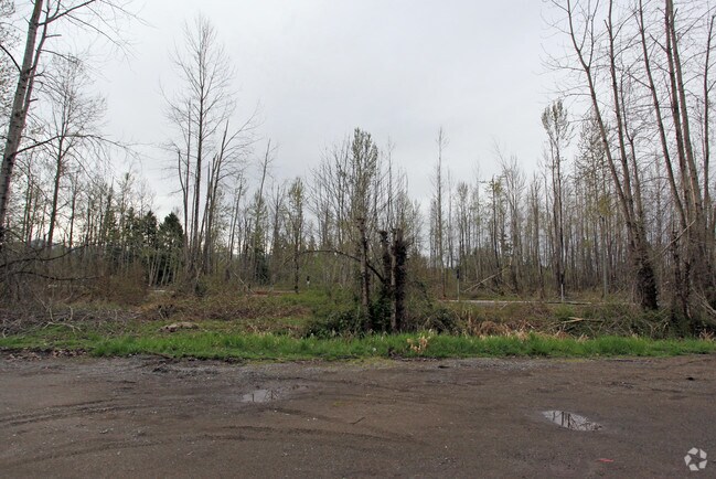
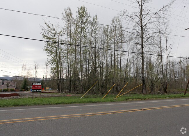
Property Record
Sr165 E Sr 165 E, Buckley, WA 98321


Property Detail
Sr165 E Sr 165 E
061910-2037
SECTION 10 TOWNSHIP 19 RANGE 06 QUARTER 22 TR A OF DBLA 2009-12-10-5008 DESC AS COM AT NE COR OF N 1/2 OF NW OF NW TH W 329.98 FT TH S 30 FT TO POB TH CONT S 330.76 FT TH W 77.81 FT TH S 47.26 FT TH W 141.91 FT TH S 254.31 FT TO EXIST FENCE LI PER BL
Commercialacreage
PIERCE
CC
Washington
B and X Area of moderate flood hazard, usually the area between the limits of the 100-year and 500-year floods.
13.38 AC
2024
E Pierce County
2025
Seattle/Puget Sound
070205
Seattle-Tacoma-Bellevue, WA
NEARBY LISTINGS FOR SALE OR LEASE
DEMOGRAPHICS near Sr165 E Sr 165 E
1 mile
3 mile
5 mile
2025 Total Population
3,693
10,849
36,222
2030 Population
3,760
11,037
37,291
Pop Growth 2025-2030
+ 1.81%
+ 1.73%
+ 2.95%
Average Age
40
40
41
2025 Total Households
1,356
3,919
13,415
HH Growth 2025-2030
+ 1.77%
+ 1.71%
+ 2.99%
Median Household Inc
$116,499
$127,053
$122,652
Avg Household Size
2.60
2.70
2.60
2025 Avg HH Vehicles
2.00
3.00
3.00
Median Home Value
$574,340
$649,556
$598,229
Median Year Built
1984
1989
1989
Nearby Places
Map Layers
Map Styles
 Street
 Aerial
Transit
 Traffic
 Biking
Places
Listings with unknown addresses are not visible on the map
- Restaurants
- Banks
- Shops
- Fitness
- Groceries
PUBLIC TRANSPORTATION
AIRPORT
Seattle-Tacoma International
Drive
Walk
Distance
Seattle-Tacoma International
51 min
32.6 mi
Freight Ports
Port of Tacoma
Drive
Walk
Distance
Port of Tacoma
35 min
21.8 mi
SALE & LEASE HISTORY
LISTING DATE
SALE/LEASE

Sep 24, 2016
For Sale
Nov 22, 2016
For Sale
Aug 16, 2018
For Sale
Nearby Properties
Address
Land Use
TOTAL SIZE
Lot Size
Zoning
Address
Land Use
TOTAL SIZE
Lot Size
Zoning
230,000 SF
54.30 AC
R10
Address
Land Use
TOTAL SIZE
Lot Size
Zoning
257,034 SF
39.18 AC
P
Address
Land Use
TOTAL SIZE
Lot Size
Zoning
240,262 SF
47.07 AC
P
Address
Land Use
TOTAL SIZE
Lot Size
Zoning
28,384 SF
6.15 AC
P
Address
Land Use
TOTAL SIZE
Lot Size
Zoning
44,380 SF
253.26 AC
P
Address
Land Use
TOTAL SIZE
Lot Size
Zoning
47,375 SF
40.51 AC
P
Address
Land Use
TOTAL SIZE
Lot Size
Zoning
151,202 SF
7.94 AC
CG
Address
Land Use
TOTAL SIZE
Lot Size
Zoning
2 SF
10.93 AC
NO DATA
Address
Land Use
TOTAL SIZE
Lot Size
Zoning
87,334 SF
33.88 AC
P
Address
Land Use
TOTAL SIZE
Lot Size
Zoning
45,102 SF
19.53 AC
R10
Address
Land Use
TOTAL SIZE
Lot Size
Zoning
47,992 SF
3.49 AC
NMU
Address
Land Use
TOTAL SIZE
Lot Size
Zoning
79,848 SF
5.99 AC
LI
Address
Land Use
TOTAL SIZE
Lot Size
Zoning
48,905 SF
12.26 AC
R10
Address
Land Use
TOTAL SIZE
Lot Size
Zoning
39,600 SF
2.66 AC
R-4
Address
Land Use
TOTAL SIZE
Lot Size
Zoning
44,013 SF
3.57 AC
CG
Address
Land Use
TOTAL SIZE
Lot Size
Zoning
27,727 SF
9.25 AC
NMU
Address
Land Use
TOTAL SIZE
Lot Size
Zoning
33,280 SF
2.79 AC
R-4
Address
Land Use
TOTAL SIZE
Lot Size
Zoning
38,000 SF
2.62 AC
LI
Address
Land Use
TOTAL SIZE
Lot Size
Zoning
38,000 SF
2.60 AC
LI
Address
Land Use
TOTAL SIZE
Lot Size
Zoning
30,692 SF
4.58 AC
P
Address
Land Use
TOTAL SIZE
Lot Size
Zoning
20,373 SF
3.65 AC
BUCK
Address
Land Use
TOTAL SIZE
Lot Size
Zoning
20,592 SF
2.41 AC
R-4
Address
Land Use
TOTAL SIZE
Lot Size
Zoning
16,060 SF
5.01 AC
R-6,000
Address
Land Use
TOTAL SIZE
Lot Size
Zoning
21,504 SF
1.40 AC
HDR
Address
Land Use
TOTAL SIZE
Lot Size
Zoning
40,000 SF
4.02 AC
LI
Address
Land Use
TOTAL SIZE
Lot Size
Zoning
24,142 SF
7.70 AC
CG
Address
Land Use
TOTAL SIZE
Lot Size
Zoning
1 SF
6.76 AC
R10
Address
Land Use
TOTAL SIZE
Lot Size
Zoning
17.62 AC
NO DATA
Address
Land Use
TOTAL SIZE
Lot Size
Zoning
1 SF
12 AC
P
Address
Land Use
TOTAL SIZE
Lot Size
Zoning
15,255 SF
1.68 AC
CG
The World's #1 Commercial Real Estate Marketplace
Connect with us
© 2026 CoStar Group
The information above has been obtained from sources believed reliable. While we do not doubt its accuracy we have not verified it and make no guarantee, warranty or representation about it. It is your responsibility to independently confirm its accuracy and completeness. Any projections, opinions, assumptions, or estimates used are for example only and do not represent the current or future performance of the property. The value of this transaction to you depends on tax and other factors which should be evaluated by your tax, financial, and legal advisors. You and your advisors should conduct a careful, independent investigation of the property to determine to your satisfaction the suitability of the property for your needs.