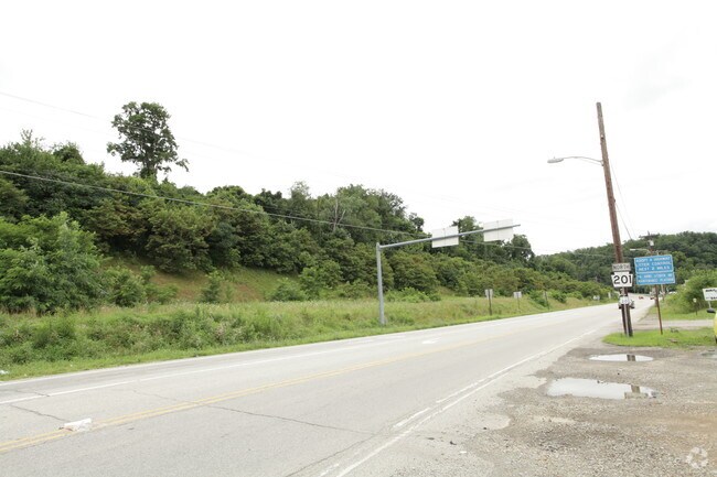
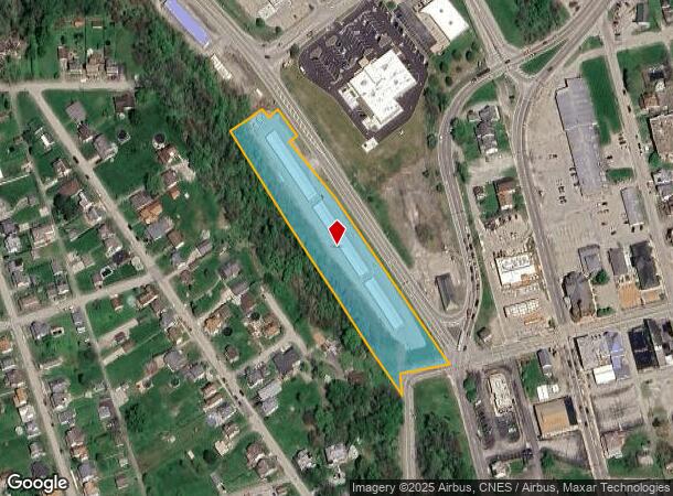
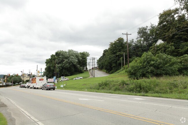
Property Record
Sr201, Connellsville, PA 15425
NEARBY LISTINGS FOR SALE OR LEASE
-
-
No Photo
-
-
View all Connellsville listings for sale on LoopNet.com
Property Detail
Sr201
Pittsburgh, PA
W F Soisson Plan
05-08-0116
2.78 ACC MINI-WAREHOUSE
Warehouse
Fayette
X
Pennsylvania
42051C0213E
2.78 AC
2025
Fayette County
2025
Pittsburgh
260800
DEMOGRAPHICS near Sr201
1 Mile
3 Mile
5 Mile
2024 Total Population
2,838
16,261
22,251
2029 Population
2,713
15,852
21,600
Pop Growth 2024-2029
(4.40%)
(2.52%)
(2.93%)
Average Age
44
44
44
2024 Total Households
1,260
7,131
9,633
HH Growth 2024-2029
(4.68%)
(2.71%)
(3.10%)
Median Household Inc
$43,296
$45,569
$47,566
Avg Household Size
2.20
2.20
2.30
2024 Avg HH Vehicles
2.00
2.00
2.00
Median Home Value
$127,898
$115,185
$118,480
Median Year Built
1950
1953
1955
Nearby Places
Map Layers
Map Styles
 Street
 Aerial
- Restaurants
- Banks
- Shops
- Fitness
- Groceries
PUBLIC TRANSPORTATION
COMMUTER RAIL
Connellsville Amtrak (Capitol Limited - Amtrak)
DRIVE
WALK
Distance
Connellsville Amtrak (Capitol Limited - Amtrak)
2 min
16 min
0.8 mi
AIRPORT
Arnold Palmer Regional
DRIVE
WALK
Distance
Arnold Palmer Regional
39 min
24.4 mi
Freight Ports
Port of Baltimore
DRIVE
WALK
Distance
Port of Baltimore
244 min
215.5 mi
Nearby Properties
Address
Land Use
TOTAL SIZE
Lot Size
Zoning
Address
Land Use
TOTAL SIZE
Lot Size
Zoning
103.19 AC
Address
Land Use
TOTAL SIZE
Lot Size
Zoning
24.40 AC
Address
Land Use
TOTAL SIZE
Lot Size
Zoning
25.95 AC
Address
Land Use
TOTAL SIZE
Lot Size
Zoning
23.88 AC
Address
Land Use
TOTAL SIZE
Lot Size
Zoning
Address
Land Use
TOTAL SIZE
Lot Size
Zoning
Address
Land Use
TOTAL SIZE
Lot Size
Zoning
5.81 AC
Address
Land Use
TOTAL SIZE
Lot Size
Zoning
Address
Land Use
TOTAL SIZE
Lot Size
Zoning
Address
Land Use
TOTAL SIZE
Lot Size
Zoning
Address
Land Use
TOTAL SIZE
Lot Size
Zoning
26,834 SF
17.17 AC
Address
Land Use
TOTAL SIZE
Lot Size
Zoning
69,630 SF
1 AC
Address
Land Use
TOTAL SIZE
Lot Size
Zoning
Address
Land Use
TOTAL SIZE
Lot Size
Zoning
9,558 SF
7.46 AC
Address
Land Use
TOTAL SIZE
Lot Size
Zoning
4,000 SF
5.04 AC
Address
Land Use
TOTAL SIZE
Lot Size
Zoning
85,784 SF
8.80 AC
Address
Land Use
TOTAL SIZE
Lot Size
Zoning
15.06 AC
Address
Land Use
TOTAL SIZE
Lot Size
Zoning
9,816 SF
0.93 AC
Address
Land Use
TOTAL SIZE
Lot Size
Zoning
34,647 SF
2.79 AC
Address
Land Use
TOTAL SIZE
Lot Size
Zoning
10,200 SF
7 AC
Address
Land Use
TOTAL SIZE
Lot Size
Zoning
15.02 AC
Address
Land Use
TOTAL SIZE
Lot Size
Zoning
4,160 SF
5.32 AC
Address
Land Use
TOTAL SIZE
Lot Size
Zoning
16.78 AC
Address
Land Use
TOTAL SIZE
Lot Size
Zoning
196,395 SF
14 AC
Address
Land Use
TOTAL SIZE
Lot Size
Zoning
Address
Land Use
TOTAL SIZE
Lot Size
Zoning
88,416 SF
2.65 AC
Address
Land Use
TOTAL SIZE
Lot Size
Zoning
50,518 SF
4.65 AC
Address
Land Use
TOTAL SIZE
Lot Size
Zoning
Address
Land Use
TOTAL SIZE
Lot Size
Zoning
0.42 AC
Address
Land Use
TOTAL SIZE
Lot Size
Zoning
The World's #1 Commercial Real Estate Marketplace
Connect with us
© 2025 CoStar Group
The information above has been obtained from sources believed reliable. While we do not doubt its accuracy we have not verified it and make no guarantee, warranty or representation about it. It is your responsibility to independently confirm its accuracy and completeness. Any projections, opinions, assumptions, or estimates used are for example only and do not represent the current or future performance of the property. The value of this transaction to you depends on tax and other factors which should be evaluated by your tax, financial, and legal advisors. You and your advisors should conduct a careful, independent investigation of the property to determine to your satisfaction the suitability of the property for your needs.