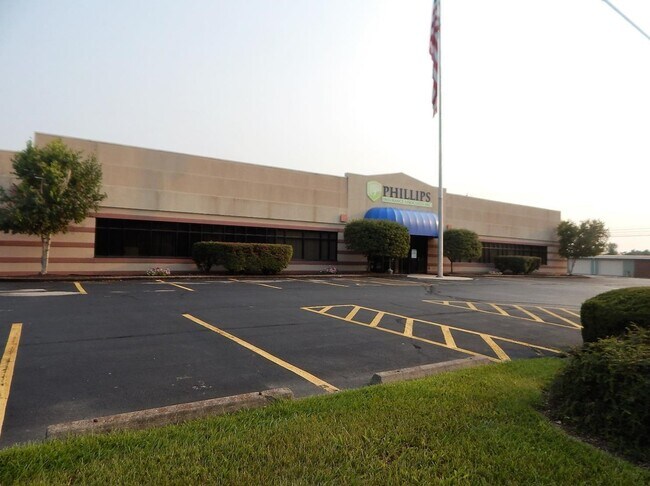
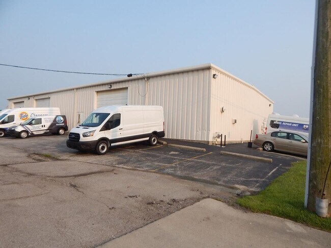
Property Record
Sr22 3, Wilmington, OH 45177

Property Detail
Sr22 3
290-25-09-19-0000-00
EXT MS 1556
Officebuilding
CLINTON
B and X Area of moderate flood hazard, usually the area between the limits of the 100-year and 500-year floods.
Ohio
2025
1.02 AC
2025
Ohio South Area
964501
Other Market Areas
21,560 SF
Wilmington, OH
NEARBY LISTINGS FOR SALE OR LEASE
DEMOGRAPHICS near Sr22 3
1 mile
3 mile
5 mile
2025 Total Population
3,187
15,164
18,808
2030 Population
3,205
15,195
18,839
Pop Growth 2025-2030
+ 0.56%
+ 0.20%
+ 0.16%
Average Age
43
40
41
2025 Total Households
1,335
6,198
7,553
HH Growth 2025-2030
+ 0.60%
+ 0.29%
+ 0.23%
Median Household Inc
$62,908
$59,109
$62,580
Avg Household Size
2.20
2.30
2.30
2025 Avg HH Vehicles
2.00
2.00
2.00
Median Home Value
$221,028
$191,567
$212,152
Median Year Built
1990
1978
1979
Nearby Places
Map Layers
Map Styles
 Street
 Aerial
Layers
 Traffic
 Biking
Places
Listings with unknown addresses are not visible on the map
- Restaurants
- Banks
- Shops
- Fitness
- Groceries
PUBLIC TRANSPORTATION
AIRPORT
James M Cox Dayton International
Drive
Walk
Distance
James M Cox Dayton International
74 min
48.0 mi
SALE & LEASE HISTORY
LISTING DATE
SALE/LEASE

Sep 01, 2021
For Sale
Nearby Properties
Address
Land Use
TOTAL SIZE
Lot Size
Zoning
Address
Land Use
TOTAL SIZE
Lot Size
Zoning
68,375 SF
0.01 AC
Address
Land Use
TOTAL SIZE
Lot Size
Zoning
42,621 SF
26.45 AC
Address
Land Use
TOTAL SIZE
Lot Size
Zoning
96,727 SF
26.63 AC
Address
Land Use
TOTAL SIZE
Lot Size
Zoning
12,200 SF
40.56 AC
I2
Address
Land Use
TOTAL SIZE
Lot Size
Zoning
404,416 SF
55.93 AC
Address
Land Use
TOTAL SIZE
Lot Size
Zoning
Address
Land Use
TOTAL SIZE
Lot Size
Zoning
417,229 SF
16.74 AC
Address
Land Use
TOTAL SIZE
Lot Size
Zoning
6,490 SF
24.63 AC
SR
Address
Land Use
TOTAL SIZE
Lot Size
Zoning
7,058 SF
80.46 AC
RR
Address
Land Use
TOTAL SIZE
Lot Size
Zoning
83,588 SF
23.10 AC
I2
Address
Land Use
TOTAL SIZE
Lot Size
Zoning
12,525 SF
3.41 AC
Address
Land Use
TOTAL SIZE
Lot Size
Zoning
11,840 SF
17.56 AC
SR
Address
Land Use
TOTAL SIZE
Lot Size
Zoning
78,732 SF
20.31 AC
Address
Land Use
TOTAL SIZE
Lot Size
Zoning
25,116 SF
17.39 AC
RR
Address
Land Use
TOTAL SIZE
Lot Size
Zoning
18,124 SF
10 AC
Address
Land Use
TOTAL SIZE
Lot Size
Zoning
40,955 SF
7.18 AC
Address
Land Use
TOTAL SIZE
Lot Size
Zoning
97,636 SF
19.77 AC
Address
Land Use
TOTAL SIZE
Lot Size
Zoning
8,707 SF
5.01 AC
Address
Land Use
TOTAL SIZE
Lot Size
Zoning
140,592 SF
20.05 AC
Address
Land Use
TOTAL SIZE
Lot Size
Zoning
49,914 SF
9.92 AC
SR
Address
Land Use
TOTAL SIZE
Lot Size
Zoning
4,400 SF
8.04 AC
Address
Land Use
TOTAL SIZE
Lot Size
Zoning
37,924 SF
25.78 AC
RR
Address
Land Use
TOTAL SIZE
Lot Size
Zoning
35,464 SF
2.50 AC
Address
Land Use
TOTAL SIZE
Lot Size
Zoning
19,264 SF
0.17 AC
Address
Land Use
TOTAL SIZE
Lot Size
Zoning
8,968 SF
2.14 AC
Address
Land Use
TOTAL SIZE
Lot Size
Zoning
281.31 AC
SR
Address
Land Use
TOTAL SIZE
Lot Size
Zoning
46,659 SF
4.64 AC
Address
Land Use
TOTAL SIZE
Lot Size
Zoning
19,528 SF
1.24 AC
Address
Land Use
TOTAL SIZE
Lot Size
Zoning
4,321 SF
298.61 AC
RR
Address
Land Use
TOTAL SIZE
Lot Size
Zoning
23,334 SF
0.38 AC
The World's #1 Commercial Real Estate Marketplace
Connect with us
© 2026 CoStar Group
The information above has been obtained from sources believed reliable. While we do not doubt its accuracy we have not verified it and make no guarantee, warranty or representation about it. It is your responsibility to independently confirm its accuracy and completeness. Any projections, opinions, assumptions, or estimates used are for example only and do not represent the current or future performance of the property. The value of this transaction to you depends on tax and other factors which should be evaluated by your tax, financial, and legal advisors. You and your advisors should conduct a careful, independent investigation of the property to determine to your satisfaction the suitability of the property for your needs.