Property Record
Sr228 S Sr 228 S, Macclenny, FL 32063

Property Detail
Sr228 S Sr 228 S
Jacksonville, FL
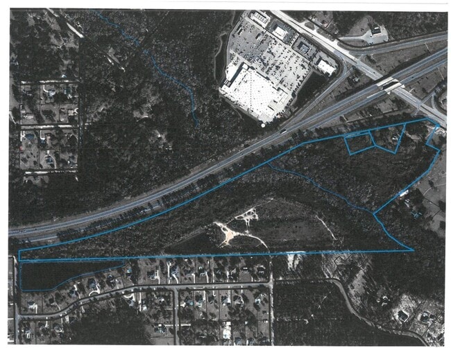
LEG 002227 ACRES PART OF S 1/2 OF SEC 04-3S-22E LYING SOUTH OF I-10 DESC IN OR 81 PGS 368-369 & OR 85 PGS 140-141 & OR 2002-6339 & OR 2004-6519 & LEASE AGREEMENT WITH
04-3S-22-0000-0000-0200
BAKER
Agriculturalland
Florida
A Areas with a 1% annual chance of flooding and a 26% chance of flooding over the life of a 30-year mortgage.
22.27 AC
2025
Baker County
2025
Jacksonville (Florida)
040102
NEARBY LISTINGS FOR SALE OR LEASE
DEMOGRAPHICS near Sr228 S Sr 228 S
1 mile
3 mile
5 mile
2025 Total Population
961
11,091
17,208
2030 Population
1,044
12,097
18,648
Pop Growth 2025-2030
+ 8.64%
+ 9.07%
+ 8.37%
Average Age
40
39
39
2025 Total Households
336
3,860
5,985
HH Growth 2025-2030
+ 8.63%
+ 9.48%
+ 8.72%
Median Household Inc
$81,451
$69,603
$72,525
Avg Household Size
2.80
2.70
2.80
2025 Avg HH Vehicles
2.00
2.00
2.00
Median Home Value
$251,829
$254,340
$261,747
Median Year Built
1989
1991
1991
Nearby Places
Map Layers
Map Styles
 Street
 Aerial
Layers
 Traffic
 Biking
Places
Listings with unknown addresses are not visible on the map
- Restaurants
- Banks
- Shops
- Fitness
- Groceries
PUBLIC TRANSPORTATION
AIRPORT
Jacksonville International
Drive
Walk
Distance
Jacksonville International
48 min
38.0 mi
Freight Ports
Jacksonville Port
Drive
Walk
Distance
Jacksonville Port
40 min
31.9 mi
SALE & LEASE HISTORY
LISTING DATE
SALE/LEASE

Dec 29, 2020
For Sale
Nearby Properties
Address
Land Use
TOTAL SIZE
Lot Size
Zoning
Address
Land Use
TOTAL SIZE
Lot Size
Zoning
866,822 SF
123.04 AC
Address
Land Use
TOTAL SIZE
Lot Size
Zoning
595,617 SF
208.81 AC
Address
Land Use
TOTAL SIZE
Lot Size
Zoning
123,102 SF
70.72 AC
Address
Land Use
TOTAL SIZE
Lot Size
Zoning
100,000 SF
27.17 AC
Address
Land Use
TOTAL SIZE
Lot Size
Zoning
160,877 SF
26.94 AC
Address
Land Use
TOTAL SIZE
Lot Size
Zoning
52,920 SF
9.51 AC
Address
Land Use
TOTAL SIZE
Lot Size
Zoning
65,821 SF
2.50 AC
Address
Land Use
TOTAL SIZE
Lot Size
Zoning
49,892 SF
2.58 AC
Address
Land Use
TOTAL SIZE
Lot Size
Zoning
72,243 SF
96.51 AC
Address
Land Use
TOTAL SIZE
Lot Size
Zoning
70,998 SF
6.89 AC
Address
Land Use
TOTAL SIZE
Lot Size
Zoning
43,429 SF
6.85 AC
Address
Land Use
TOTAL SIZE
Lot Size
Zoning
6,200 SF
25.96 AC
Address
Land Use
TOTAL SIZE
Lot Size
Zoning
59,035 SF
3.90 AC
Address
Land Use
TOTAL SIZE
Lot Size
Zoning
93,924 SF
26.81 AC
Address
Land Use
TOTAL SIZE
Lot Size
Zoning
29,512 SF
5.60 AC
Address
Land Use
TOTAL SIZE
Lot Size
Zoning
41,157 SF
7.60 AC
Address
Land Use
TOTAL SIZE
Lot Size
Zoning
38,674 SF
4.58 AC
Address
Land Use
TOTAL SIZE
Lot Size
Zoning
29,625 SF
12.63 AC
Address
Land Use
TOTAL SIZE
Lot Size
Zoning
23,400 SF
2.32 AC
Address
Land Use
TOTAL SIZE
Lot Size
Zoning
43,546 SF
16.62 AC
Address
Land Use
TOTAL SIZE
Lot Size
Zoning
3,360 SF
16.77 AC
Address
Land Use
TOTAL SIZE
Lot Size
Zoning
32,911 SF
3.60 AC
Address
Land Use
TOTAL SIZE
Lot Size
Zoning
13,387 SF
1.82 AC
Address
Land Use
TOTAL SIZE
Lot Size
Zoning
13,094 SF
1.85 AC
Address
Land Use
TOTAL SIZE
Lot Size
Zoning
3,872 SF
131.02 AC
Address
Land Use
TOTAL SIZE
Lot Size
Zoning
18.86 AC
Address
Land Use
TOTAL SIZE
Lot Size
Zoning
10,000 SF
11 AC
Address
Land Use
TOTAL SIZE
Lot Size
Zoning
11,799 SF
1.44 AC
Address
Land Use
TOTAL SIZE
Lot Size
Zoning
28,000 SF
4.07 AC
Address
Land Use
TOTAL SIZE
Lot Size
Zoning
144 SF
16.81 AC
The World's #1 Commercial Real Estate Marketplace
Connect with us
© 2026 CoStar Group
The information above has been obtained from sources believed reliable. While we do not doubt its accuracy we have not verified it and make no guarantee, warranty or representation about it. It is your responsibility to independently confirm its accuracy and completeness. Any projections, opinions, assumptions, or estimates used are for example only and do not represent the current or future performance of the property. The value of this transaction to you depends on tax and other factors which should be evaluated by your tax, financial, and legal advisors. You and your advisors should conduct a careful, independent investigation of the property to determine to your satisfaction the suitability of the property for your needs.