Property Record
St Andrews Dr, Cincinnati, OH 45245
Property Detail
St Andrews Dr
Cincinnati, OH-KY-IN
COMBO 282813G146.
28-28-08D-150
CLERMONT
Golfcourse
Ohio
B and X Area of moderate flood hazard, usually the area between the limits of the 100-year and 500-year floods.
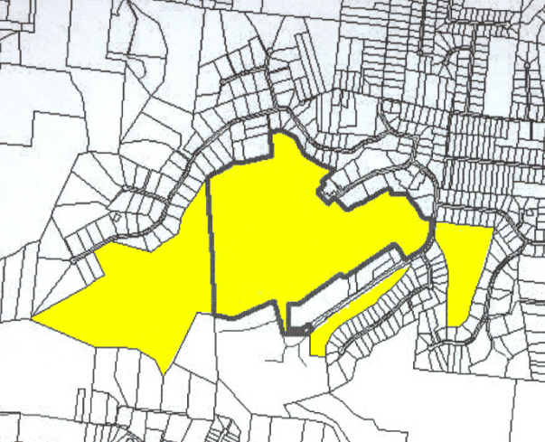
8.40 AC
2025
Eastgate/Anderson Twp
2025
Cincinnati/Dayton
041305
NEARBY LISTINGS FOR SALE OR LEASE
DEMOGRAPHICS near St Andrews Dr
1 mile
3 mile
5 mile
2025 Total Population
4,945
42,571
100,259
2030 Population
5,049
43,569
102,539
Pop Growth 2025-2030
+ 2.10%
+ 2.34%
+ 2.27%
Average Age
44
42
41
2025 Total Households
2,234
17,988
40,883
HH Growth 2025-2030
+ 2.42%
+ 2.51%
+ 2.46%
Median Household Inc
$73,264
$78,787
$81,150
Avg Household Size
2.10
2.30
2.40
2025 Avg HH Vehicles
2.00
2.00
2.00
Median Home Value
$269,807
$289,870
$284,950
Median Year Built
1977
1988
1985
Nearby Places
Map Layers
Map Styles
 Street
 Aerial
Layers
 Traffic
 Biking
Places
Listings with unknown addresses are not visible on the map
- Restaurants
- Banks
- Shops
- Fitness
- Groceries
PUBLIC TRANSPORTATION
AIRPORT
Cincinnati/Northern Kentucky International
Drive
Walk
Distance
Cincinnati/Northern Kentucky International
44 min
26.8 mi
Freight Ports
Port of Toledo
Drive
Walk
Distance
Port of Toledo
253 min
215.1 mi
Nearby Properties
Address
Land Use
TOTAL SIZE
Lot Size
Zoning
Address
Land Use
TOTAL SIZE
Lot Size
Zoning
7,560 SF
79.10 AC
Address
Land Use
TOTAL SIZE
Lot Size
Zoning
104,856 SF
46.13 AC
Address
Land Use
TOTAL SIZE
Lot Size
Zoning
8,914 SF
37.70 AC
Address
Land Use
TOTAL SIZE
Lot Size
Zoning
11,110 SF
5.74 AC
Address
Land Use
TOTAL SIZE
Lot Size
Zoning
Address
Land Use
TOTAL SIZE
Lot Size
Zoning
49.15 AC
Address
Land Use
TOTAL SIZE
Lot Size
Zoning
88,932 SF
11.21 AC
Address
Land Use
TOTAL SIZE
Lot Size
Zoning
16.02 AC
Address
Land Use
TOTAL SIZE
Lot Size
Zoning
12,000 SF
22.66 AC
Address
Land Use
TOTAL SIZE
Lot Size
Zoning
9,088 SF
42.09 AC
Address
Land Use
TOTAL SIZE
Lot Size
Zoning
980 SF
5.01 AC
Address
Land Use
TOTAL SIZE
Lot Size
Zoning
3,803 SF
21.34 AC
Address
Land Use
TOTAL SIZE
Lot Size
Zoning
79,064 SF
6.27 AC
Address
Land Use
TOTAL SIZE
Lot Size
Zoning
11,442 SF
9.70 AC
Address
Land Use
TOTAL SIZE
Lot Size
Zoning
96.71 AC
Address
Land Use
TOTAL SIZE
Lot Size
Zoning
168,266 SF
105.07 AC
Address
Land Use
TOTAL SIZE
Lot Size
Zoning
42,300 SF
10.72 AC
Address
Land Use
TOTAL SIZE
Lot Size
Zoning
70,489 SF
8.57 AC
Address
Land Use
TOTAL SIZE
Lot Size
Zoning
110,954 SF
9.61 AC
Address
Land Use
TOTAL SIZE
Lot Size
Zoning
65,720 SF
7.49 AC
Address
Land Use
TOTAL SIZE
Lot Size
Zoning
22,109 SF
7.98 AC
Address
Land Use
TOTAL SIZE
Lot Size
Zoning
108,532 SF
3.49 AC
Address
Land Use
TOTAL SIZE
Lot Size
Zoning
11,850 SF
24.64 AC
Address
Land Use
TOTAL SIZE
Lot Size
Zoning
13,296 SF
14.99 AC
Address
Land Use
TOTAL SIZE
Lot Size
Zoning
12,506 SF
10.70 AC
Address
Land Use
TOTAL SIZE
Lot Size
Zoning
275,706 SF
14.82 AC
Address
Land Use
TOTAL SIZE
Lot Size
Zoning
71,549 SF
9.90 AC
Address
Land Use
TOTAL SIZE
Lot Size
Zoning
6,900 SF
37.76 AC
Address
Land Use
TOTAL SIZE
Lot Size
Zoning
4,920 SF
2.50 AC
Address
Land Use
TOTAL SIZE
Lot Size
Zoning
7,822 SF
8.47 AC
The World's #1 Commercial Real Estate Marketplace
Connect with us
© 2026 CoStar Group
The information above has been obtained from sources believed reliable. While we do not doubt its accuracy we have not verified it and make no guarantee, warranty or representation about it. It is your responsibility to independently confirm its accuracy and completeness. Any projections, opinions, assumptions, or estimates used are for example only and do not represent the current or future performance of the property. The value of this transaction to you depends on tax and other factors which should be evaluated by your tax, financial, and legal advisors. You and your advisors should conduct a careful, independent investigation of the property to determine to your satisfaction the suitability of the property for your needs.