Property Record
St Joseph Rd, Robbins, NC 27325
Save to a Folder
{{folder.Name}}
{{folder.ListingIds.length}} Properties
{{folder.ListingIds.length}} Property
Create a New Folder
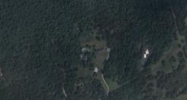
Property Detail
St Joseph Rd
Pinehurst-Southern Pines, NC
NIAGARA LOT 1 2 SOUTHERN PINES MUNI ST JOSEPH OFF
8582-00-88-2301
MOORE
Vacantlandnec
North Carolina
PD
1-2
B and X Area of moderate flood hazard, usually the area between the limits of the 100-year and 500-year floods.
5.35 AC
2025
North Carolina Southeast Area
2025
Other Market Areas
950601
NEARBY LISTINGS FOR SALE OR LEASE
DEMOGRAPHICS near St Joseph Rd
1 mile
3 mile
5 mile
2025 Total Population
798
16,832
42,378
2030 Population
849
17,927
45,039
Pop Growth 2025-2030
+ 6.39%
+ 6.51%
+ 6.28%
Average Age
50
45
44
2025 Total Households
410
8,035
18,847
HH Growth 2025-2030
+ 6.83%
+ 6.68%
+ 6.52%
Median Household Inc
$79,605
$79,249
$86,774
Avg Household Size
1.90
2.00
2.20
2025 Avg HH Vehicles
1.00
2.00
2.00
Median Home Value
$557,017
$446,431
$445,652
Median Year Built
1995
1994
1996
Nearby Places
Map Layers
Map Styles
 Street
 Aerial
Layers
 Traffic
 Biking
Places
Listings with unknown addresses are not visible on the map
- Restaurants
- Banks
- Shops
- Fitness
- Groceries
PUBLIC TRANSPORTATION
COMMUTER RAIL
Southern Pines Amtrak Station (Floridian - Amtrak)
Drive
Walk
Distance
Southern Pines Amtrak Station (Floridian - Amtrak)
5 min
2.7 mi
Freight Ports
Port of Wilmington
Drive
Walk
Distance
Port of Wilmington
172 min
136.6 mi
Nearby Properties
Address
Land Use
TOTAL SIZE
Lot Size
Zoning
Address
Land Use
TOTAL SIZE
Lot Size
Zoning
30,190 SF
181.04 AC
PPC
Address
Land Use
TOTAL SIZE
Lot Size
Zoning
18.49 AC
Address
Land Use
TOTAL SIZE
Lot Size
Zoning
2,264 SF
36 AC
PPC
Address
Land Use
TOTAL SIZE
Lot Size
Zoning
39.86 AC
Address
Land Use
TOTAL SIZE
Lot Size
Zoning
24,942 SF
39.99 AC
MULTI
Address
Land Use
TOTAL SIZE
Lot Size
Zoning
Address
Land Use
TOTAL SIZE
Lot Size
Zoning
15,900 SF
179.30 AC
MULTI
Address
Land Use
TOTAL SIZE
Lot Size
Zoning
12.78 AC
Address
Land Use
TOTAL SIZE
Lot Size
Zoning
39,490 SF
5.16 AC
GBCD
Address
Land Use
TOTAL SIZE
Lot Size
Zoning
Address
Land Use
TOTAL SIZE
Lot Size
Zoning
7.62 AC
Address
Land Use
TOTAL SIZE
Lot Size
Zoning
2,420.50 AC
MULTI
Address
Land Use
TOTAL SIZE
Lot Size
Zoning
11.17 AC
Address
Land Use
TOTAL SIZE
Lot Size
Zoning
8,118 SF
16.80 AC
PPC
Address
Land Use
TOTAL SIZE
Lot Size
Zoning
98,272 SF
25 AC
I
Address
Land Use
TOTAL SIZE
Lot Size
Zoning
53,926 SF
21.69 AC
GB
Address
Land Use
TOTAL SIZE
Lot Size
Zoning
24,520 SF
94.90 AC
PPCC
Address
Land Use
TOTAL SIZE
Lot Size
Zoning
Address
Land Use
TOTAL SIZE
Lot Size
Zoning
2,400 SF
0.46 AC
GB
Address
Land Use
TOTAL SIZE
Lot Size
Zoning
10,281 SF
0.52 AC
RM1
Address
Land Use
TOTAL SIZE
Lot Size
Zoning
5,962 SF
1.52 AC
RM1
Address
Land Use
TOTAL SIZE
Lot Size
Zoning
13,200 SF
2 AC
I
Address
Land Use
TOTAL SIZE
Lot Size
Zoning
572 SF
117 AC
MULTI
Address
Land Use
TOTAL SIZE
Lot Size
Zoning
3,612 SF
5.64 AC
MULTI
Address
Land Use
TOTAL SIZE
Lot Size
Zoning
3,807 SF
5 AC
PPC
Address
Land Use
TOTAL SIZE
Lot Size
Zoning
25,872 SF
4.40 AC
PPC
Address
Land Use
TOTAL SIZE
Lot Size
Zoning
12,045 SF
2 AC
RE
Address
Land Use
TOTAL SIZE
Lot Size
Zoning
24,118 SF
0.88 AC
CB
Address
Land Use
TOTAL SIZE
Lot Size
Zoning
1,344 SF
49.26 AC
RE
Address
Land Use
TOTAL SIZE
Lot Size
Zoning
2,540 SF
22.51 AC
PPC
The World's #1 Commercial Real Estate Marketplace
Connect with us
© 2026 CoStar Group
The information above has been obtained from sources believed reliable. While we do not doubt its accuracy we have not verified it and make no guarantee, warranty or representation about it. It is your responsibility to independently confirm its accuracy and completeness. Any projections, opinions, assumptions, or estimates used are for example only and do not represent the current or future performance of the property. The value of this transaction to you depends on tax and other factors which should be evaluated by your tax, financial, and legal advisors. You and your advisors should conduct a careful, independent investigation of the property to determine to your satisfaction the suitability of the property for your needs.