Property Record
St Paul Blvd, Rochester, NY 14617

NEARBY LISTINGS FOR SALE OR LEASE
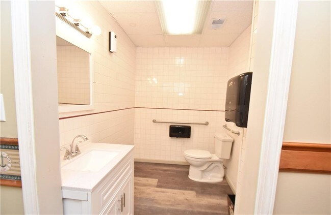
Property Detail
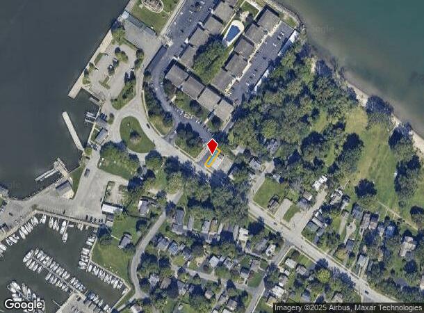
St Paul Blvd
Rochester, NY
Summerville Tract
263400-047-560-0001-051-000
L2 T14 R7 ABANDON PORTION OF 3RD ST
Residentialacreage
Monroe
X
New York
36055C0088H
97.000
2025
0.04 AC
2024
Northeast
010500
Rochester
2,357 SF
DEMOGRAPHICS near St Paul Blvd
1 Mile
3 Mile
5 Mile
2024 Total Population
6,798
41,781
136,168
2029 Population
6,711
41,167
134,459
Pop Growth 2024-2029
(1.28%)
(1.47%)
(1.26%)
Average Age
46
42
42
2024 Total Households
3,382
18,550
59,470
HH Growth 2024-2029
(1.33%)
(1.55%)
(1.31%)
Median Household Inc
$51,332
$60,448
$56,990
Avg Household Size
1.90
2.20
2.20
2024 Avg HH Vehicles
1.00
2.00
2.00
Median Home Value
$144,090
$143,083
$143,290
Median Year Built
1955
1954
1957
Nearby Places
- Restaurants
- Banks
- Shops
- Fitness
- Groceries
PUBLIC TRANSPORTATION
COMMUTER RAIL
DRIVE
WALK
Distance
15 min
8.6 mi
AIRPORT
Frederick Douglass/Greater Rochester International
DRIVE
WALK
Distance
Frederick Douglass/Greater Rochester International
21 min
12.4 mi
SALE & LEASE HISTORY
LISTING DATE
SALE/LEASE

Feb 01, 2021
For Sale
Aug 29, 2019
For Sale
Nearby Properties
Address
Land Use
TOTAL SIZE
Lot Size
Zoning
Address
Land Use
TOTAL SIZE
Lot Size
Zoning
270,150 SF
34.40 AC
02 - SINGL
Address
Land Use
TOTAL SIZE
Lot Size
Zoning
3,200 SF
36.50 AC
Address
Land Use
TOTAL SIZE
Lot Size
Zoning
211,954 SF
9.91 AC
15
Address
Land Use
TOTAL SIZE
Lot Size
Zoning
180,406 SF
28.80 AC
Address
Land Use
TOTAL SIZE
Lot Size
Zoning
65,000 SF
5.10 AC
Address
Land Use
TOTAL SIZE
Lot Size
Zoning
148,440 SF
4.18 AC
Address
Land Use
TOTAL SIZE
Lot Size
Zoning
145,943 SF
16.15 AC
05 - COMME
Address
Land Use
TOTAL SIZE
Lot Size
Zoning
3,348 SF
31.29 AC
07 - MIXED
Address
Land Use
TOTAL SIZE
Lot Size
Zoning
14,800 SF
14.91 AC
05 - COMME
Address
Land Use
TOTAL SIZE
Lot Size
Zoning
Address
Land Use
TOTAL SIZE
Lot Size
Zoning
Address
Land Use
TOTAL SIZE
Lot Size
Zoning
9,052 SF
18.98 AC
05 - COMME
Address
Land Use
TOTAL SIZE
Lot Size
Zoning
14,818 SF
23.87 AC
05 - COMME
Address
Land Use
TOTAL SIZE
Lot Size
Zoning
8,272 SF
15.90 AC
05 - COMME
Address
Land Use
TOTAL SIZE
Lot Size
Zoning
52,648 SF
13.59 AC
02 - SINGL
Address
Land Use
TOTAL SIZE
Lot Size
Zoning
200 SF
105.92 AC
Address
Land Use
TOTAL SIZE
Lot Size
Zoning
75,592 SF
3.59 AC
Address
Land Use
TOTAL SIZE
Lot Size
Zoning
47.50 AC
Address
Land Use
TOTAL SIZE
Lot Size
Zoning
6,138 SF
5.65 AC
Address
Land Use
TOTAL SIZE
Lot Size
Zoning
14,080 SF
15.20 AC
05 - COMME
Address
Land Use
TOTAL SIZE
Lot Size
Zoning
Address
Land Use
TOTAL SIZE
Lot Size
Zoning
29,282 SF
4.79 AC
05 - COMME
Address
Land Use
TOTAL SIZE
Lot Size
Zoning
3,472 SF
19.60 AC
05 - COMME
Address
Land Use
TOTAL SIZE
Lot Size
Zoning
4,575 SF
620.50 AC
Address
Land Use
TOTAL SIZE
Lot Size
Zoning
11,919 SF
5.68 AC
Address
Land Use
TOTAL SIZE
Lot Size
Zoning
56,320 SF
11.30 AC
Address
Land Use
TOTAL SIZE
Lot Size
Zoning
75,392 SF
8.50 AC
05 - COMME
Address
Land Use
TOTAL SIZE
Lot Size
Zoning
40,622 SF
6.20 AC
02 - SINGL
Address
Land Use
TOTAL SIZE
Lot Size
Zoning
14,048 SF
10.22 AC
Address
Land Use
TOTAL SIZE
Lot Size
Zoning
14.60 AC
The World's #1 Commercial Real Estate Marketplace
Connect with us
© 2025 CoStar Group
The information above has been obtained from sources believed reliable. While we do not doubt its accuracy we have not verified it and make no guarantee, warranty or representation about it. It is your responsibility to independently confirm its accuracy and completeness. Any projections, opinions, assumptions, or estimates used are for example only and do not represent the current or future performance of the property. The value of this transaction to you depends on tax and other factors which should be evaluated by your tax, financial, and legal advisors. You and your advisors should conduct a careful, independent investigation of the property to determine to your satisfaction the suitability of the property for your needs.